Category:1715 maps
Jump to navigation
Jump to search
| ← · 1710 · 1711 · 1712 · 1713 · 1714 · 1715 · 1716 · 1717 · 1718 · 1719 · → |
Deutsch: Karten mit Bezug zum Jahr 1715
English: Maps related to the year 1715
Español: Mapas relativos al año 1715
Français : Cartes concernant l’an 1715
Русский: Карты 1715 года
Subcategories
This category has the following 6 subcategories, out of 6 total.
Media in category "1715 maps"
The following 55 files are in this category, out of 55 total.
-
THE ILLIAD OF HOMER (translated by POPE) p1.312 GRAECIA HOMERICA.jpg 3,058 × 2,857; 5.4 MB
-
1715 Caraccos detail Map of the West-Indies by Herman Moll BPL 14251 2.png 1,063 × 750; 1.31 MB
-
1715 Sanctum Sepulchrum.jpg 4,032 × 3,024; 2.45 MB
-
Banduri and Lisle. Imperii Orientalis et Circumjacentium Regionum.I.jpg 1,828 × 360; 112 KB
-
Belagerung von Stralsund 1715.JPG 2,162 × 1,586; 920 KB
-
Bodenehr Mannheim c1715.jpg 4,791 × 2,998; 7.98 MB
-
Charles Inselin, L'Isle de Malthe (FL13730038 2564678).jpg 6,302 × 4,370; 35.66 MB
-
Dai-Nihonkoku no Chizu.jpg 1,771 × 1,235; 682 KB
-
De la grande rivière de Canada - appellée par les europeens de St. Laurens LOC 88696072.jpg 11,843 × 8,756; 12.85 MB
-
De la grande rivière de Canada - appellée par les europeens de St. Laurens LOC 88696072.tif 11,843 × 8,756; 296.68 MB
-
De la grande rivière de Canada - appellée par les europeens de St. Laurens LOC 88696073.jpg 12,078 × 7,680; 10.18 MB
-
De la grande rivière de Canada - appellée par les europeens de St. Laurens LOC 88696073.tif 12,078 × 7,680; 265.39 MB
-
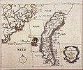
Die Insel Formosa Neu Abgemessen aus Besehl Kaysers Kamhi, 1715.jpg 1,821 × 1,538; 2.15 MB
-
Districtus Egranus, per J. C. Mullerum (page 1 crop).jpg 3,751 × 4,629; 9.27 MB
-
Districtus Egranus, per J. C. Mullerum.djvu 4,016 × 6,260, 2 pages; 6.15 MB
-
HalleyEclipse1715Path.jpg 2,894 × 4,777; 6.03 MB
-
Johann Baptist Homann, Generalis Totius Imperii Moscovitici Novissima Tabula (FL36378772 2594798).jpg 14,424 × 12,341; 268.89 MB
-
Johann Baptist Homann, Generalis Totius Imperii Russorum Novissima Tabula 01 (FL36379284 2606528).jpg 14,514 × 12,472; 279.15 MB
-
Johann Baptist Homann, Generalis Totius Imperii Russorum Novissima Tabula 02 (FL36379291 2606528).jpg 14,451 × 12,229; 269.95 MB
-
Johann Baptist Homann, Insula Creta hodie Candia (FL35072640 2533506).jpg 14,778 × 12,942; 259.65 MB
-
Johann Baptist Homann, Ukrania quae et Terra Cosaccorum (FL147394446 2607230).jpg 14,396 × 12,619; 214.05 MB
-
Johann Baptist Homann, Ægyptus Hodierna (FL25570168 2500429).jpg 12,606 × 14,663; 238.66 MB
-
Laurent Brémond, Nouvelle Carte de l'Archipel (FL35071974 2532628).jpg 17,189 × 11,931; 268.48 MB
-
Magnum Mare del Zur cum insula California.png 6,819 × 5,859; 69.88 MB
-
Map of Říčany ca 1715-1717 (SOkA Praha-venkov).jpg 3,000 × 2,952; 2.55 MB
-
Nathaniel Crouch, Ierusalem as it now is (FL6881366 2617426).jpg 1,196 × 1,792; 1.17 MB
-
New Zealand (1715).jpg 1,023 × 752; 146 KB
-
Nicolas de Fer, L' Empire des Turcs, en Europe, en Asie, et en Afrique (FL36009896 2715251).jpg 17,220 × 12,464; 273.81 MB
-
Plan et elevation de la ville de Quebec - vers 1715.jpg 4,608 × 3,456; 3.44 MB
-
Planol militar Ciutadella.jpg 1,079 × 1,567; 604 KB
-
Provence 1715.JPG 2,280 × 1,887; 2.68 MB
-
Romeyn de Hooghe, Temple de Jerusalem (FL6881547 2368091).jpg 2,750 × 2,222; 2.7 MB
-
Zofingen 1715.jpg 1,200 × 1,550; 294 KB
_p1.312_GRAECIA_HOMERICA.jpg/120px-THE_ILLIAD_OF_HOMER_(translated_by_POPE)_p1.312_GRAECIA_HOMERICA.jpg)


.jpg/120px-A_map_of_the_West-Indies_or_the_islands_of_America_in_the_North_Sea_(8342679246).jpg)
.jpg/120px-thumbnail.jpg)
_what_belongs_to_Spain%2C_England%2C_France%2C_Holland_etc._also_ye_trade_winds%2C_and_ye_LOC_gm71004474.jpg/120px-thumbnail.jpg)
_what_belongs_to_Spain%2C_England%2C_France%2C_Holland%2C_etc._also_ye_trade_winds%2C_and_ye_LOC_gm71005442.jpg/120px-thumbnail.jpg)
._L._Senex..._-_btv1b53070531z.jpg/120px-thumbnail.jpg)


.jpg/120px-Charles_Inselin%2C_L%27Isle_de_Malthe_(FL13730038_2564678).jpg)


.jpg/120px-De_Gelegenheyt_van_T%27Paradys_ende_T%27Landt_Canaan._Mitsgaders_de_eerst_bewoonde_Landen_der_Patriarchen_(FL36558762_3901578).jpg)


.jpg/97px-Districtus_Egranus%2C_per_J._C._Mullerum_(page_1_crop).jpg)

.jpg/120px-thumbnail.jpg)

.jpg/120px-Humphrey_Prideaux%2C_The_Ichnography_of_the_Temple_of_Jerusalem_with_a_description_of_the_same_(FL6878798_2368155).jpg)
.jpg/97px-Image_taken_from_page_17_of_%27The_History_of_South_Carolina_under_the_Proprietary_Government%2C_1670-1719%27_(16564311416).jpg)
.jpg/120px-Johann_Baptist_Homann%2C_Accurate_Vorstellung_der_Orientalisch-Kayserliehen_Haupt-und_Residenz_Stadt_Constantinopel_(FL36010579_2715966).jpg)
.jpg/120px-Johann_Baptist_Homann%2C_Generalis_Totius_Imperii_Moscovitici_Novissima_Tabula_(FL36378772_2594798).jpg)
.jpg/120px-Johann_Baptist_Homann%2C_Generalis_Totius_Imperii_Russorum_Novissima_Tabula_01_(FL36379284_2606528).jpg)
.jpg/120px-Johann_Baptist_Homann%2C_Generalis_Totius_Imperii_Russorum_Novissima_Tabula_02_(FL36379291_2606528).jpg)
.jpg/120px-Johann_Baptist_Homann%2C_Insula_Creta_hodie_Candia_(FL35072640_2533506).jpg)
.jpg/105px-Johann_Baptist_Homann%2C_Tabula_Geographica_qua_pars_Russiae_Magnae_Pontus_Euxinus_seu_Mare_Nigrum_et_Tartaria_Minor_(FL36378972_2605907).jpg)
.jpg/120px-Johann_Baptist_Homann%2C_Ukrania_quae_et_Terra_Cosaccorum_(FL147394446_2607230).jpg)
.jpg/103px-Johann_Baptist_Homann%2C_Ægyptus_Hodierna_(FL25570168_2500429).jpg)
.jpg/120px-Joseph_Moxon%2C_Paradise%2C_or_the_Garden_of_Eden._With_the_countries_circumjacent_inhabited_by_the_Patriarchs_(FL200067310_2368794).jpg)
.jpg/120px-thumbnail.jpg)
.jpg/120px-Laurent_Brémond%2C_Nouvelle_Carte_de_l%27Archipel_(FL35071974_2532628).jpg)

.jpg/120px-Map_of_Říčany_ca_1715-1717_(SOkA_Praha-venkov).jpg)
.jpg/80px-Nathaniel_Crouch%2C_Ierusalem_as_it_now_is_(FL6881366_2617426).jpg)
.jpg/120px-New_Zealand_(1715).jpg)
.jpg/120px-Nicolas_de_Fer%2C_L%27_Empire_des_Turcs%2C_en_Europe%2C_en_Asie%2C_et_en_Afrique_(FL36009896_2715251).jpg)
.jpg/120px-thumbnail.jpg)
.jpg/120px-Orbis_Romani_descriptio%2C_seu_divisio_per_themata_sub_Imperatoribus_Constantinopolitanis_post_Heraclii_tempora_facta_(5385393270).jpg)
.jpg/120px-thumbnail.jpg)


.jpg/120px-Romeyn_de_Hooghe%2C_De_Reysen_Christi_des_Heyland_en_Pauli_met_andere_syne_Bloedgetuygen_(FL199985480_2368617).jpg)
.jpg/120px-Romeyn_de_Hooghe%2C_Orbis_per_creationem_institutus_Adam_en_syne_Scheppinge_(FL6881804_2368616).jpg)
.jpg/120px-Romeyn_de_Hooghe%2C_Temple_de_Jerusalem_(FL6881547_2368091).jpg)
.jpg/120px-T_Beloofde_-_Landt_Canaan%2C_doorwandelt_van_onsen_Heere_ende_Salichmaecker_IESU_Christo_nessens_syne_Apostelen_(FL36560520_3901628).jpg)

