Category:21st-century maps of the world
Jump to navigation
Jump to search
Maps of the world by century: 6th century · 8th century · 10th century · 11th century · 12th century · 13th century · 14th century · 15th century · 16th century · 17th century · 18th century · 19th century · 20th century · 21st century ·
Wikimedia category | |||||
| Upload media | |||||
| Instance of | |||||
|---|---|---|---|---|---|
| |||||
Subcategories
This category has the following 5 subcategories, out of 5 total.
2
Media in category "21st-century maps of the world"
The following 200 files are in this category, out of 256 total.
(previous page) (next page)-
1-12 Africa Green-Grey.png 4,609 × 2,500; 2.3 MB
-
1-12 Antarctica Green-Grey.png 4,609 × 2,500; 2.27 MB
-
1-12 Central America Green-Grey.png 4,609 × 2,500; 2.26 MB
-
1-12 East Asia Green-Grey.png 4,609 × 2,500; 2.36 MB
-
1-12 Europe Green-Grey.png 4,609 × 2,500; 2.2 MB
-
1-12 Middle East Green-Grey.png 4,609 × 2,500; 2.31 MB
-
1-12 North America Green-Grey.png 4,609 × 2,500; 2.3 MB
-
1-12 South America Green-Grey.png 4,609 × 2,500; 2.28 MB
-
1-12 South Asia Green-Grey.png 4,609 × 2,500; 2.23 MB
-
The earth at night.jpg 13,500 × 6,750; 7.45 MB
-
ACTA 1.png 432 × 296; 48 KB
-
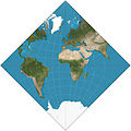
Adams hemisphere in a square.JPG 2,068 × 2,068; 711 KB
-
Airfrance destinations.svg 2,560 × 1,314; 1.14 MB
-
Aitoff-projection.jpg 2,048 × 1,025; 757 KB
-
Albers projection SW.jpg 2,058 × 1,208; 687 KB
-
Albers-equal-area-conic.png 673 × 346; 21 KB
-
Almaty International Airport.JPG 1,425 × 625; 101 KB
-
Ambassadors to Russia.svg 940 × 415; 1.53 MB
-
American Polyconic projection.jpg 2,058 × 1,580; 851 KB
-
Animax World Map.svg 4,500 × 2,234; 3.97 MB
-
Antarctic Circle.jpg 634 × 311; 275 KB
-
Anthropogene-Landschaften.png 4,779 × 2,594; 1.37 MB
-
ARCTIC CIRCLE 021106.jpg 634 × 311; 275 KB
-
Ardern travels.svg 2,560 × 1,314; 1.12 MB
-
Armadillo projection SW.JPG 2,068 × 1,184; 754 KB
-
AttaliEleven.PNG 1,425 × 628; 36 KB
-
Auslandseinsätze der Bundeswehr 2006.png 1,427 × 628; 40 KB
-
Auslandseinsätze der Bundeswehr 2011.svg 863 × 443; 1.25 MB
-
Außengebiete der Vereinigten Staaten.png 2,200 × 1,121; 366 KB
-
Axa group global locations.JPG 1,425 × 625; 79 KB
-
AXA Group Global Locations.svg 1,500 × 775; 244 KB
-
Axa worldmap.PNG 1,425 × 625; 48 KB
-
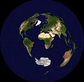
Azimuthal-equidistant.jpg 2,048 × 1,992; 984 KB
-
B3-Des.svg 940 × 477; 1.62 MB
-
Bb kart.png 1,174 × 694; 48 KB
-
Behrmann projection SW.jpg 2,058 × 880; 538 KB
-
BlackMarble20161km.jpg 43,200 × 21,600; 266.4 MB
-
Blank map world gmt (more simplified).svg 2,395 × 1,772; 3.3 MB
-
Blocos Economicos 2010.png 1,425 × 625; 66 KB
-
Blue Marble Next Generation + topography + bathymetry.jpg 3,600 × 1,800; 1.93 MB
-
Bluemarble-Kavrayskiy-June.jpg 1,210 × 610; 429 KB
-
BMI-30-Worldmap-2014.svg 1,620 × 774; 470 KB
-
Boggs eumorphic projection SW.JPG 2,070 × 1,042; 583 KB
-
Bonne projection SW.jpg 2,058 × 1,955; 1.02 MB
-
Bonne-projection.jpg 2,048 × 1,944; 1.14 MB
-
Bottomley projection SW.JPG 2,058 × 1,200; 945 KB
-
BSEC Central Asia + Japan Map.png 1,357 × 628; 53 KB
-
Cahill butterfly conformal projection SW.jpg 2,058 × 1,194; 544 KB
-
CallingCodesWorld-Labeled.svg 2,560 × 1,314; 1.06 MB
-
Canters Polyconic Map.png 894 × 525; 523 KB
-
Cassini projection squashed SW.JPG 1,040 × 2,068; 749 KB
-
Cassini projection SW.jpg 1,036 × 2,058; 668 KB
-
Cassini-projection.jpg 1,027 × 2,048; 882 KB
-
Cbre implantations monde.jpg 850 × 508; 112 KB
-
Chronologie Francophonie.gif 1,425 × 625; 458 KB
-
Circulacion termohalina.jpg 800 × 400; 75 KB
-
Collignon projection SW.jpg 2,060 × 530; 295 KB
-
Compassion world map.jpg 2,646 × 1,883; 457 KB
-
Connections between sister cities visualised on a world map (hotlog).svg 1,052 × 744; 29.84 MB
-
Connections between sister cities visualised on a world map (jetlog).svg 1,052 × 744; 29.87 MB
-
Continents colour.svg 863 × 443; 1.67 MB
-
Countries by highest point map(U.S. Standard Measurements).png 1,352 × 638; 67 KB
-
Countries by highest point map.PNG 1,352 × 638; 36 KB
-
Craig projection SW.jpg 2,059 × 1,169; 575 KB
-
Craig-retroazimuthal.jpg 2,048 × 1,353; 942 KB
-
Craster parabolic projection SW.jpg 2,068 × 1,040; 576 KB
-
Cylindrical equal-area projection SW.jpg 2,058 × 1,122; 636 KB
-
Digital humanities chart.jpg 792 × 4,263; 1.87 MB
-
Dist2con.png 3,600 × 1,800; 398 KB
-
Distribution of Geyser Pump.jpg 750 × 320; 288 KB
-
Dünya.svg 673 × 425; 344 KB
-
Earth seen from the sun.ogv 29 s, 640 × 480; 879 KB
-
Ecker IV projection SW.jpg 2,058 × 1,036; 630 KB
-
Ecker VI projection SW.jpg 2,058 × 1,036; 615 KB
-
Eckert II projection SW.JPG 2,058 × 1,036; 789 KB
-
Ellipsoidal transverse Mercator projection SW.jpg 2,072 × 2,684; 1.05 MB
-
Equal Earth Map 150E-ja.jpg 19,250 × 10,150; 22.79 MB
-
Equal Earth projection SW.jpg 2,060 × 1,008; 611 KB
-
Equidistante cilinder projectie 60NB ZB.PNG 517 × 517; 30 KB
-
Equirectangular projection with grid only.svg 501 × 251; 65 KB
-
Equirectangular-projection+terminator.jpg 2,048 × 1,025; 817 KB
-
Equirectangular-projection.jpg 2,048 × 1,025; 937 KB
-
ErdebeiNacht2Hölzel.png 1,878 × 940; 1.1 MB
-
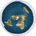
Flat earth.jpg 498 × 498; 31 KB
-
Flat earth.png 543 × 543; 396 KB
-
Flat Earth.png 1,550 × 1,550; 263 KB
-
Frankreich-Niederlande-Ueberseegebiete.png 1,427 × 628; 540 KB
-
Frankreich-Niederlande-Ueberseegebiete.svg 853 × 433; 2.28 MB
-
Gall isographic projection SW.jpg 2,068 × 1,466; 1.77 MB
-
Gall-peters.png 1,616 × 1,024; 1.34 MB
-
Gall–Peters projection SW.jpg 2,058 × 1,314; 723 KB
-
GaWC World Cities.png 1,500 × 775; 56 KB
-
Geografiaj subregionoj laŭ Unuiĝintaj Nacioj eo.svg 940 × 477; 1.67 MB
-
Geografiaj subregionoj laŭ Unuiĝintaj Nacioj hr.svg 940 × 477; 1.67 MB
-
Geografiaj subregionoj laŭ Unuiĝintaj Nacioj malplene.svg 940 × 477; 1.66 MB
-
Geoid height red blue.png 1,686 × 1,166; 940 KB
-
Geoida.png 1,686 × 1,166; 1.43 MB
-
Global Forest Area-ar.png 792 × 612; 168 KB
-
Gnomonische projectie Schiphol.PNG 597 × 599; 42 KB
-
GOPAC Members.png 691 × 442; 89 KB
-
Gravity anomalies on Earth.jpg 540 × 334; 84 KB
-
Hammer projection SW.jpg 2,058 × 1,036; 622 KB
-
Hammer retroazimuthal projection back SW.JPG 2,060 × 2,060; 638 KB
-
Hammer retroazimuthal projection full SW.JPG 2,060 × 2,060; 664 KB
-
Hammer-Aitov Projection.jpg 4,096 × 2,048; 1.79 MB
-
HavannaWorldMap.png 2,022 × 948; 181 KB
-
Hobo–Dyer projection SW.jpg 2,058 × 1,048; 603 KB
-
Hoelzel10ost.jpg 10,800 × 6,123; 5.84 MB
-
Hoelzelbluemarble.png 2,058 × 1,034; 1.56 MB
-
Hoelzelnaturalearth.png 3,038 × 1,944; 6.66 MB
-
Hotine Mercator projection SW.jpg 2,068 × 2,060; 1.29 MB
-
Hufnagel 10 projection SW.JPG 2,070 × 1,042; 604 KB
-
Hufnagel 11 projection SW.JPG 2,070 × 1,042; 598 KB
-
Hufnagel 12 projection SW.JPG 2,070 × 856; 526 KB
-
Hufnagel 2 projection SW.JPG 2,068 × 1,040; 592 KB
-
Hufnagel 3 projection SW.JPG 2,070 × 1,042; 587 KB
-
Hufnagel 4 projection SW.JPG 2,070 × 1,042; 590 KB
-
Hufnagel 7 projection SW.JPG 2,070 × 1,042; 597 KB
-
Hufnagel 9 projection SW.JPG 2,070 × 1,042; 603 KB
-
IALA world distribution.PNG 947 × 505; 94 KB
-
Import-Worldmap-2016.svg 1,620 × 774; 470 KB
-
International Hydrographic Organization countries.PNG 1,350 × 625; 37 KB
-
Lambert azimuthal equal-area projection SW.jpg 2,058 × 2,058; 1.14 MB
-
Lambert cylindrical equal-area projection SW.jpg 2,058 × 664; 429 KB
-
Lezgi WP countries.png 1,425 × 625; 56 KB
-
Loximuthal projection SW.JPG 2,068 × 1,078; 634 KB
-
M47 Patton users.png 1,425 × 625; 30 KB
-
Magnetic Field Earth.png 568 × 291; 308 KB
-
Map of Australia night sky 2016.jpg 5,717 × 4,250; 7.41 MB
-
Map of Transcontiental nations.png 1,425 × 625; 40 KB
-
Map-Europe-Outermost-regions-ar.PNG 1,427 × 628; 567 KB
-
Map-Europe-Outermost-regions-de.png 1,427 × 628; 565 KB
-
Map-Europe-Outermost-regions-fr.png 1,427 × 628; 592 KB
-
Map-of-human-migrations.svg 889 × 635; 649 KB
-
Mapamundi, Fundacion Niñez y Vida.JPG 1,632 × 1,224; 901 KB
-
Attaques-terroristes-meurtrières-au-21eme-siecle.png 1,425 × 625; 27 KB
-
Mariana and her husband 3.jpg 640 × 480; 107 KB
-
McBryde-Thomas flat-pole quartic projection SW.jpg 2,068 × 938; 571 KB
-
Mercator Projection.svg 1,652 × 1,221; 276 KB
-
Mercator-projection.jpg 2,048 × 1,588; 1.33 MB
-
MercNormSph enhanced.png 800 × 797; 660 KB
-
MercNormSph.png 800 × 797; 806 KB
-
MercTranEll.png 800 × 618; 493 KB
-
MercTranSph enhanced.png 1,068 × 1,073; 940 KB
-
MercTranSph.png 597 × 600; 329 KB
-
Migraciones humanas.png 2,001 × 1,429; 2.22 MB
-
Miller cylindrical projection of world with grid.png 295 × 225; 22 KB
-
Miller projection SW.jpg 2,058 × 1,512; 831 KB
-
Miss Grand International 2016 May 2017.png 1,425 × 625; 37 KB
-
Mobildekning.JPG 800 × 369; 77 KB
-
MODIS Map.jpg 5,400 × 2,700; 11.84 MB
-
Mollweide projection SW.jpg 2,058 × 1,036; 596 KB
-
Mollweide Projection.jpg 4,096 × 2,048; 1.76 MB
-
Mollweide-projection.jpg 2,048 × 1,025; 766 KB
-
Mollweide.jpg 10,800 × 5,400; 4.52 MB
-
Mollweide10ost.jpg 10,800 × 5,401; 4.52 MB
-
Mosaic of global land cover images taken by MERIS ESA210531.jpg 3,307 × 1,654; 2.97 MB
-
Nicolosi globular projection east SW.jpg 2,060 × 2,060; 1.03 MB
-
Nicolosi globular projection west SW.jpg 2,060 × 2,060; 828 KB
-
Nicolosi globular projections SW.jpg 4,111 × 2,060; 1.83 MB
-
Normal Mercator map 85deg.jpg 2,400 × 2,400; 915 KB
-
Obama international agreements and air strikes.png 1,427 × 628; 20 KB
-
OCEANOGENIC POWER Page 14.png 2,550 × 3,300; 3.04 MB
-
Oceans base map.svg 2,362 × 752; 4.06 MB
-
OIC members.png 1,425 × 625; 38 KB
-
Ortelius oval projection SW.JPG 2,070 × 1,042; 667 KB
-
PDOP current values.gif 880 × 550; 64 KB
-
Peirce-quincuncial-projection.jpg 2,048 × 2,048; 1.19 MB
-
Perlshaper orthographic example1.svg 550 × 550; 247 KB
-
Polar stereographic projections.jpg 4,096 × 2,048; 2.26 MB
-
Polyconic-projection.jpg 2,048 × 1,569; 928 KB
-
Quartic authalic projection SW.jpg 2,068 × 938; 541 KB
-
Quiznos locations (update 2012).jpg 1,357 × 628; 136 KB
-
R4WO cartowhite itineraryLD.jpg 300 × 160; 717 KB
-
Rectangular polyconic projection SW.jpg 2,068 × 1,256; 765 KB
-
Relief World Map by maps-for-free.jpg 16,384 × 12,544; 39.4 MB
-
Robinson world.png 7,510 × 3,760; 18.9 MB
-
Robinson-5400.jpg 5,400 × 2,739; 3.49 MB
-
Robinson-projection.jpg 2,048 × 1,039; 849 KB
-
RobinsonWeltkarte (without background).png 10,800 × 5,478; 26.14 MB
-
RobinsonWeltkarte.jpg 10,800 × 5,478; 4.83 MB
-
Simpol-Map-World-Merged.png 2,000 × 882; 368 KB
-
Sinusoidal projection SW.jpg 2,058 × 1,034; 551 KB
-
Sinusoïdale projectie.PNG 953 × 477; 46 KB
-
Sinu–Mollweide (Philbrick) projection.jpg 2,078 × 1,122; 692 KB
-
Srtm ramp2.world.21600x10800.jpg 21,600 × 10,800; 5.89 MB
-
Strebe 1995 11E SW.jpg 2,060 × 1,302; 750 KB
-
Strebe 1995 SW.JPG 2,068 × 1,306; 749 KB
-
Strebe asymmetric 2011 SW.JPG 2,068 × 1,246; 727 KB
-
Stylized World Topo 5400x2700.JPG 5,400 × 2,700; 2.59 MB
-
SunglassHutWorldMap.png 2,034 × 936; 187 KB
-
Tectonic plates(Empty).png 3,340 × 2,120; 661 KB
-
The Times projection SW.jpg 2,068 × 1,512; 843 KB
-
Thermohaline circulation.png 1,600 × 800; 1,001 KB
-
Tissot indicatrix world map Lambert cyl equal-area proj.svg 3,000 × 953; 1.44 MB
-
Tobler hyperelliptical projection SW.jpg 2,058 × 1,035; 606 KB
-
Transcontinental nations.svg 863 × 443; 1.6 MB
-
Transverse Mercator meridian stripes 10deg.jpg 4,101 × 2,048; 1.29 MB
-
Transverse Mercator meridian stripes 120deg.jpg 5,151 × 2,048; 1.59 MB
-
Transverse Mercator meridian stripes 20deg.jpg 4,117 × 2,048; 1.2 MB






.svg/120px-Blank_map_world_gmt_(more_simplified).svg.png)


.svg/120px-Connections_between_sister_cities_visualised_on_a_world_map_(hotlog).svg.png)
.svg/120px-Connections_between_sister_cities_visualised_on_a_world_map_(jetlog).svg.png)

.png/120px-Countries_by_highest_point_map(U.S._Standard_Measurements).png)








.jpg/120px-Quiznos_locations_(update_2012).jpg)


.png/120px-RobinsonWeltkarte_(without_background).png)


_projection.jpg/120px-Sinu–Mollweide_(Philbrick)_projection.jpg)


.png/120px-Tectonic_plates(Empty).png)


