Category:Blue Marble Next Generation images
Jump to navigation
Jump to search
See also categories: The Blue Marble and Blue Marble 2002 images.
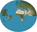
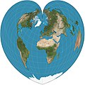
English: Images from NASA's Blue Marble: Next Generation series made with the MODIS instrument, named after the famous Blue Marble photograph taken during the Apollo 17 mission in 1972.[1] Observations in this release were taken during each month of 2004.
Media in category "Blue Marble Next Generation images"
The following 177 files are in this category, out of 177 total.
-
Adams hemisphere in a square.JPG 2,068 × 2,068; 711 KB
-
Afghanistan Blue Marble.png 1,995 × 1,581; 4.27 MB
-
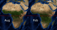
Africa FebAug.gif 1,020 × 1,082; 1.24 MB
-
Albers projection SW.jpg 2,058 × 1,208; 687 KB
-
Algeria Blue Marble.png 2,928 × 2,863; 7.7 MB
-
Alpenbogen.jpg 13,666 × 6,117; 15.47 MB
-
Alps from space.png 1,280 × 1,024; 1.77 MB
-
American Polyconic projection.jpg 2,058 × 1,580; 851 KB
-
Angola Blue Marble.png 1,883 × 1,913; 3.6 MB
-
Antarktyda i Antarktyka.jpg 8,400 × 6,300; 4.42 MB
-
Argentina Blue Marble.png 1,584 × 2,903; 6.55 MB
-
Armadillo projection SW.JPG 2,068 × 1,184; 754 KB
-
Atlantic November hurricanes BMNG.png 4,000 × 2,472; 6.25 MB
-
Azawagh Niger BMNG.png 600 × 780; 511 KB
-
Balthasart equal-area projection SW.jpg 2,058 × 1,588; 768 KB
-
Behrmann projection SW.jpg 2,058 × 880; 538 KB
-
Big Blue Marble.jpg 4,096 × 4,096; 546 KB
-
Bioko BMNG.png 1,731 × 1,927; 4.19 MB
-
Blue Marble - 2005 (animation still) (8245591938).jpg 800 × 600; 50 KB
-
Blue Marble - 2005 (Blue Marble- Next Generation) (8245544980).jpg 4,096 × 4,096; 608 KB
-
Blue Marble Eastern Hemisphere.jpg 3,718 × 3,718; 2.79 MB
-
Blue Marble map peloponnes section.jpg 641 × 547; 102 KB
-
Blue Marble Next Generation + topography + bathymetry.jpg 3,600 × 1,800; 1.93 MB
-
Blue Marble Western Hemisphere.jpg 3,718 × 3,718; 2.65 MB
-
BlueMarble 2005 east.png 500 × 500; 96 KB
-
BlueMarble monthlies animation.gif 864 × 432; 975 KB
-
BlueMarble monthlies SMIL.svg 512 × 256; 1.99 MB
-
Bm adria.jpg 1,109 × 853; 391 KB
-
Boggs eumorphic projection SW.JPG 2,070 × 1,042; 583 KB
-
Bonne projection SW.jpg 2,058 × 1,955; 1.02 MB
-
Bottomley projection SW.JPG 2,058 × 1,200; 945 KB
-
Brazil Blue Marble.png 1,776 × 1,788; 3.59 MB
-
Cahill butterfly conformal projection SW.jpg 2,058 × 1,194; 544 KB
-
Cameroon BMNG.png 1,296 × 1,933; 2.52 MB
-
Canada BMNG.png 2,185 × 1,931; 6.28 MB
-
Cassini projection squashed SW.JPG 1,040 × 2,068; 749 KB
-
Cassini projection SW.jpg 1,036 × 2,058; 668 KB
-
Chamberlin trimetric projection SW.jpg 2,060 × 2,284; 1.07 MB
-
Charley 2004 track BMNG.png 1,024 × 753; 431 KB
-
Chile Blue Marble.png 582 × 2,869; 2.74 MB
-
China BMNG.jpg 3,328 × 2,881; 6.76 MB
-
Circulacion termohalina.jpg 800 × 400; 75 KB
-
Collignon projection SW.jpg 2,060 × 530; 295 KB
-
Colombia SatPic BMNG.png 1,442 × 1,935; 3.27 MB
-
Costa Rica Blue Marble.png 1,280 × 974; 814 KB
-
Craig projection SW.jpg 2,059 × 1,169; 575 KB
-
Craster parabolic projection SW.jpg 2,068 × 1,040; 576 KB
-
Cw2.jpg 401 × 373; 47 KB
-
Cylindrical equal-area projection SW.jpg 2,058 × 1,122; 636 KB
-
Côte d'Ivoire BMNG.png 1,835 × 1,917; 3.83 MB
-
Democratic Republic of the Congo BMNG.png 1,994 × 1,929; 4.8 MB
-
Dominican Republic Blue Marble.png 1,270 × 899; 1.19 MB
-
Earth-satellite-seasons.gif 540 × 270; 1.73 MB
-
East Sea BMNG Jan.png 1,278 × 952; 1.33 MB
-
East Sea BMNG Jul.png 1,278 × 952; 1.08 MB
-
Ecker IV projection SW.jpg 2,058 × 1,036; 630 KB
-
Ecker VI projection SW.jpg 2,058 × 1,036; 615 KB
-
Eckert II projection SW.JPG 2,058 × 1,036; 789 KB
-
Ecuador Blue Marble.png 1,045 × 1,164; 1.24 MB
-
Ellipsoidal transverse Mercator projection SW.jpg 2,072 × 2,684; 1.05 MB
-
Equal Earth projection SW.jpg 2,060 × 1,008; 611 KB
-
Equinox-NO.jpg 800 × 525; 62 KB
-
Europe bluemarble laea location map.jpg 1,400 × 1,197; 926 KB
-
Gabon BMNG.png 1,329 × 1,409; 2.32 MB
-
Gall isographic projection SW.jpg 2,068 × 1,466; 1.77 MB
-
Gall–Peters projection SW.jpg 2,058 × 1,314; 723 KB
-
Germany Blue Marble May 2004.png 1,446 × 1,942; 4.25 MB
-
Ghana BMNG.png 869 × 1,245; 1.42 MB
-
Global View of the Arctic and Antarctic.jpg 8,400 × 8,400; 5.41 MB
-
Golfo de Guayaquil Blue Marble 2.jpg 395 × 395; 94 KB
-
Golfo de Guayaquil Blue Marble.JPG 395 × 395; 17 KB
-
Goode homolosine projection SW.jpg 2,058 × 900; 519 KB
-
Guayaquil Satelite Blue Marble (retocada).jpg 306 × 515; 244 KB
-
Guayaquil Satelite Blue Marble.jpg 306 × 515; 22 KB
-
Guyana BMNG.png 1,294 × 1,910; 4.44 MB
-
Hammer projection SW.jpg 2,058 × 1,036; 622 KB
-
Hammer retroazimuthal projection back SW.JPG 2,060 × 2,060; 638 KB
-
Hammer retroazimuthal projection combined1.jpg 2,376 × 2,200; 1.33 MB
-
Hammer retroazimuthal projection combined2.jpg 4,188 × 2,118; 1.75 MB
-
Hammer retroazimuthal projection front SW.JPG 2,060 × 2,060; 349 KB
-
Hammer retroazimuthal projection full SW.JPG 2,060 × 2,060; 664 KB
-
Hamoun.jpg 359 × 420; 139 KB
-
Hobo–Dyer projection SW.jpg 2,058 × 1,048; 603 KB
-
Hotine Mercator projection SW.jpg 2,068 × 2,060; 1.29 MB
-
Hufnagel 10 projection SW.JPG 2,070 × 1,042; 604 KB
-
Hufnagel 11 projection SW.JPG 2,070 × 1,042; 598 KB
-
Hufnagel 12 projection SW.JPG 2,070 × 856; 526 KB
-
Hufnagel 2 projection SW.JPG 2,068 × 1,040; 592 KB
-
Hufnagel 3 projection SW.JPG 2,070 × 1,042; 587 KB
-
Hufnagel 4 projection SW.JPG 2,070 × 1,042; 590 KB
-
Hufnagel 7 projection SW.JPG 2,070 × 1,042; 597 KB
-
Hufnagel 9 projection SW.JPG 2,070 × 1,042; 603 KB
-
India BMNG.jpg 2,791 × 2,897; 4.97 MB
-
Indonesia BMNG.png 3,803 × 1,703; 5.3 MB
-
Iran BMNG.png 2,104 × 1,935; 5.6 MB
-
Irish Sea 4.82844W 53.54821N.png 992 × 653; 912 KB
-
Kazakhstan BMNG.jpg 3,803 × 2,179; 6.23 MB
-
Kenya BMNG.png 1,347 × 1,612; 2.13 MB
-
Korea Blue Marble.png 1,278 × 952; 1.04 MB
-
La Terre au solstice d'hiver.png 1,560 × 1,024; 453 KB
-
Lambert azimuthal equal-area projection SW.jpg 2,058 × 2,058; 1.14 MB
-
Lambert cylindrical equal-area projection SW.jpg 2,058 × 664; 429 KB
-
Libya BMNG.png 2,031 × 1,929; 3.81 MB
-
Littrow projection SW.JPG 2,058 × 1,782; 1.06 MB
-
Location-london.png 926 × 795; 1.17 MB
-
Loximuthal projection SW.JPG 2,068 × 1,078; 634 KB
-
Malesia BMNG.png 2,552 × 944; 2.01 MB
-
Mali BMNG.png 2,046 × 1,925; 4.05 MB
-
Maracaibo Basin.png 652 × 555; 545 KB
-
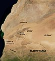
Mauritania BMNG.jpg 1,756 × 1,931; 2.7 MB
-
Mauritania BMNG.png 1,756 × 1,931; 3 MB
-
McBryde-Thomas flat-pole quartic projection SW.jpg 2,068 × 938; 571 KB
-
MCD43B4.A2009153.mosaic.png 2,160 × 1,080; 2.27 MB
-
Mexico BMNG.png 2,550 × 1,819; 4.83 MB
-
Mollweide projection SW.jpg 2,058 × 1,036; 596 KB
-
Myanmar BMNG.png 484 × 1,024; 958 KB
-
Namibia BMNG.png 2,058 × 1,917; 4.13 MB
-
NASA Blue Marble Sandy Island.PNG 605 × 615; 146 KB
-
Nicolosi globular projection east SW.jpg 2,060 × 2,060; 1.03 MB
-
Nicolosi globular projection west SW.jpg 2,060 × 2,060; 828 KB
-
Nicolosi globular projections SW.jpg 4,111 × 2,060; 1.83 MB
-
Niger BMNG.png 2,427 × 1,919; 3.72 MB
-
Nigeria BMNG.png 2,302 × 1,923; 5.91 MB
-
Nightfall europe-and-afrika 20050507-184500.jpg 1,024 × 1,024; 143 KB
-
Ortelius oval projection SW.JPG 2,070 × 1,042; 667 KB
-
Pakistan BMNG.png 1,973 × 1,938; 5.64 MB
-
Pakistan Mountain Ranges BMNG.jpg 1,973 × 1,938; 1.32 MB
-
Pakistan Pothohar BMNG.jpg 1,973 × 1,938; 1.29 MB
-
Papua New Guinea BMNG.png 2,560 × 1,823; 2.47 MB
-
Peru Blue Marble.png 1,966 × 2,834; 5.22 MB
-
Poledníky.png 450 × 366; 151 KB
-
Quartic authalic projection SW.jpg 2,068 × 938; 541 KB
-
Rectangular polyconic projection SW.jpg 2,068 × 1,256; 765 KB
-
Republic of Congo BMNG.png 1,654 × 1,925; 4.3 MB
-
Sinusoidal projection SW.jpg 2,058 × 1,034; 551 KB
-
Sinu–Mollweide (Philbrick) projection.jpg 2,078 × 1,122; 692 KB
-
Smyth-Craster equal-area projection SW.jpg 2,058 × 1,034; 511 KB
-
Somalia BMNG.png 1,479 × 1,923; 2.43 MB
-
SouthShetlandIslands BlueMarble 200411.jpg 1,227 × 780; 87 KB
-
Srtm ramp2.world.21600x10800.jpg 21,600 × 10,800; 5.89 MB
-
Strebe 1995 11E SW.jpg 2,060 × 1,302; 750 KB
-
Strebe 1995 SW.JPG 2,068 × 1,306; 749 KB
-
Strebe asymmetric 2011 SW.JPG 2,068 × 1,246; 727 KB
-
Stylized World Topo 5400x2700.JPG 5,400 × 2,700; 2.59 MB
-
São Tomé e Príncipe Blue Marble.jpg 501 × 668; 105 KB
-
Tanzania BMNG.png 2,048 × 1,935; 5.29 MB
-
Thailand BMNG.png 1,950 × 2,884; 6.6 MB
-
The Times projection SW.jpg 2,068 × 1,512; 843 KB
-
Tobler equal-area projection SW.jpg 2,058 × 2,058; 768 KB
-
Tobler hyperelliptical projection SW.jpg 2,058 × 1,035; 606 KB
-
Trystan Edwards equal-area projection SW.jpg 2,058 × 1,043; 511 KB
-
Two-point equidistant projection SW.jpg 2,044 × 1,601; 1.07 MB
-
U234 map clean.png 1,024 × 704; 451 KB
-
U234 map de.png 1,024 × 704; 465 KB
-
Van der Grinten projection SW.jpg 2,058 × 2,058; 1.05 MB
-
Venezuela BMNG.png 2,169 × 1,896; 4.36 MB
-
Vertical perspective SW.jpg 2,058 × 2,058; 989 KB
-
Vietnam BMNG.png 1,375 × 2,841; 5.39 MB
-
Wagner VIII Batwing projection SW.JPG 2,070 × 1,392; 756 KB
-
Wagner VIII Eurasian projection SW.JPG 2,070 × 1,558; 822 KB
-
Wagner VIII projection SW.JPG 2,070 × 1,128; 666 KB
-
Wagner VIII–Canters projection SW.JPG 2,070 × 768; 478 KB
-
Wagner VIII–meta-Canters projection SW.JPG 2,070 × 1,214; 703 KB
-
Wagner VIII–meta-TsNIGAiK projection SW.JPG 2,070 × 1,216; 725 KB
-
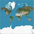
Web maps Mercator projection SW.jpg 2,068 × 2,060; 1.1 MB
-
Werner projection SW.jpg 2,058 × 2,065; 1.11 MB
-
Wfm ellesmere island crop.jpg 762 × 886; 310 KB
-
Wfm ellesmere island with Peary Channel highlighted.png 2,400 × 1,778; 3.58 MB
-
Wfm ellesmere island.jpg 1,280 × 948; 193 KB
-
Whole world - time-lapse from 2004-01 to 2004-12.gif 1,000 × 500; 1.45 MB
-
World Elevation Map 8 bit (World Height map) (alterative version).png 21,600 × 10,800; 32.28 MB
-
World elevation map.png 21,600 × 10,800; 71.79 MB
-
Worldwind.png 1,024 × 768; 602 KB
-
Zambia BMNG.png 2,246 × 1,938; 5.88 MB
-
Океани Землі.png 2,058 × 2,058; 4.67 MB



_(8245591938).jpg/120px-Blue_Marble_-_2005_(animation_still)_(8245591938).jpg)
_(8245544980).jpg/120px-Blue_Marble_-_2005_(Blue_Marble-_Next_Generation)_(8245544980).jpg)








.jpg/71px-Guayaquil_Satelite_Blue_Marble_(retocada).jpg)











_projection.jpg/120px-Sinu–Mollweide_(Philbrick)_projection.jpg)




_(alterative_version).png/120px-World_Elevation_Map_8_bit_(World_Height_map)_(alterative_version).png)


