Category:Language-neutral maps
Jump to navigation
Jump to search
English: Language-neutral maps. Maps without any annotation should be put in Category:Blank maps. Those having some annotation with a language-neutral legend (labels using numbers and symbols for example) should also be categorized here, or in a subcategory.
Subcategories
This category has the following 11 subcategories, out of 11 total.
- Language-neutral map legends (33 F)
- Language-neutral maps of the world (123 F)
*
G
L
N
P
- Map placeholders (36 F)
Media in category "Language-neutral maps"
The following 200 files are in this category, out of 687 total.
(previous page) (next page)-
15animation.gif 640 × 480; 8.51 MB
-
2004 Indonesia Tsunami.gif 300 × 311; 100 KB
-
Africa ChamberlinTrimetric.png 800 × 872; 125 KB
-
AfsharidGreatestextentIranica.png 2,000 × 2,000; 733 KB
-
Al-Mukharram blank subdistricts 2013.png 538 × 380; 7 KB
-
Albers projection SW.jpg 2,058 × 1,208; 687 KB
-
Albers-equal-area-conic.png 673 × 346; 21 KB
-
Alpenbogen.jpg 13,666 × 6,117; 15.47 MB
-
Amasya map.png 714 × 511; 92 KB
-
Antarctica interglacial hg.png 1,117 × 764; 402 KB
-
Area Metropolitana Cali.png 1,942 × 2,002; 472 KB
-
ArrondissementP-O.JPG 619 × 322; 40 KB
-
Azimutalprojektion-polar kl.jpg 277 × 277; 18 KB
-
Azimutalprojektion-transversal kl.jpg 277 × 277; 17 KB
-
Azimuthal-equidistant.jpg 2,048 × 1,992; 984 KB
-
Bashúrí Kurdistan.png 1,080 × 1,125; 63 KB
-
Batimetria.jpg 889 × 984; 315 KB
-
Battle of Dara-battleplan-langneutral.png 745 × 571; 8 KB
-
Berbers.png 592 × 465; 62 KB
-
Bertilbeentomap.png 600 × 300; 10 KB
-
Bezirke Austria-B.png 696 × 363; 47 KB
-
BlackMarble20161km.jpg 43,200 × 21,600; 266.4 MB
-
Blue Marble Next Generation + topography + bathymetry.jpg 3,600 × 1,800; 1.93 MB
-
Bolonga zone.png 479 × 456; 97 KB
-
Bonne projection 118.png 118 × 110; 16 KB
-
Borneo Topography.png 1,725 × 1,824; 2.52 MB
-
Brazil Köppen Climate Map.png 1,199 × 995; 201 KB
-
Burgdorf Lage Beinhorn.png 700 × 833; 128 KB
-
Burgdorf Lage Dachtmissen.png 700 × 833; 128 KB
-
Burgdorf Lage Hauptort.png 700 × 833; 129 KB
-
Burgdorf Lage Heeßel.png 700 × 833; 128 KB
-
Burgdorf Lage Hülptingsen.png 700 × 833; 128 KB
-
Burgdorf Lage Otze.png 700 × 833; 128 KB
-
Burgdorf Lage Ramlingen-Ehlershausen.png 700 × 833; 128 KB
-
Burgdorf Lage Schillerslage.png 700 × 833; 128 KB
-
Burgdorf Lage Sorgensen.png 700 × 833; 128 KB
-
Burgdorf Lage Weferlingsen.png 700 × 833; 128 KB
-
Burgdorf Ortsteile.png 700 × 833; 128 KB
-
Burma ethnolinguistic map.jpg 209 × 430; 22 KB
-
Buthraupis montana distribution map.png 320 × 350; 19 KB
-
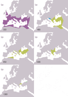
Byzantine Empire map.gif 800 × 760; 66 KB
-
Cahill butterfly conformal projection SW.jpg 2,058 × 1,194; 544 KB
-
Canters Polyconic Map.png 894 × 525; 523 KB
-
Cassini projection squashed SW.JPG 1,040 × 2,068; 749 KB
-
Cassini projection SW.jpg 1,036 × 2,058; 668 KB
-
Cassini-projection.jpg 1,027 × 2,048; 882 KB
-
Cbre implantations monde.jpg 850 × 508; 112 KB
-
Chamberlin trimetric projection SW.jpg 2,060 × 2,284; 1.07 MB
-
China Sex Museum map.png 320 × 287; 11 KB
-
Chwe Chenedl Geltaidd syml gyda Baneri.svg 360 × 711; 210 KB
-
Chwe Chenedl Geltaidd syml.png 360 × 711; 12 KB
-
Chwe Chenedl Geltaidd.png 430 × 711; 12 KB
-
Circulacion termohalina.jpg 800 × 400; 75 KB
-
City Lights of the United States 2012.jpg 6,646 × 4,430; 5.46 MB
-
Columbia drainage basin blank map.png 808 × 790; 712 KB
-
Columbina cyanopis distribution map.png 320 × 380; 19 KB
-
Columbina passerina distribution map.png 655 × 940; 79 KB
-
Continents geographycal hires.jpg 4,000 × 4,000; 956 KB
-
Corfú. Plano mudo.jpg 1,955 × 2,431; 831 KB
-
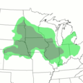
Corn.png 960 × 960; 254 KB
-
CornBelt.jpg 960 × 960; 188 KB
-
Cornbelt.png 960 × 960; 98 KB
-
Craig projection SW.jpg 2,059 × 1,169; 575 KB
-
Craig-retroazimuthal-for-mecca.png 541 × 317; 23 KB
-
Craig-retroazimuthal.jpg 2,048 × 1,353; 942 KB
-
Craster parabolic projection SW.jpg 2,068 × 1,040; 576 KB
-
Croatia minority languages 2011.jpg 2,201 × 2,151; 687 KB
-
Cryptophaps poecilorrhoa range map.png 960 × 600; 17 KB
-
CT-1 map.png 613 × 445; 17 KB
-
CT-190 map.png 589 × 433; 16 KB
-
CT-34 map.png 339 × 245; 8 KB
-
CT-5 map.png 600 × 430; 17 KB
-
CT-6 map.png 608 × 436; 17 KB
-
CT-67 map.png 640 × 475; 19 KB
-
Cyanocorax chrysops map.png 420 × 530; 29 KB
-
Cyanocorax morio map.jpg 700 × 382; 97 KB
-
Cyanocorax yncas map.png 550 × 550; 34 KB
-
Cyanocorax yncas2 map.jpg 700 × 382; 171 KB
-
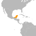
Cyanocorax yucatanicus map.png 400 × 400; 25 KB
-
Cylindrical equal-area projection SW.jpg 2,058 × 1,122; 636 KB
-
Cyprus administrative.gif 8,610 × 5,270; 971 KB
-
Cyprus administrative.jpg 8,576 × 5,232; 4.11 MB
-
Czech Republic districts.png 1,300 × 878; 42 KB
-
Czech Republic species distribution map grid blank.png 1,744 × 1,020; 136 KB
-
Czechia - merged map.png 2,684 × 1,568; 2.05 MB
-
DamierCentralités.png 593 × 373; 20 KB
-
DamierThéorique.png 504 × 271; 5 KB
-
Death rate world map.PNG 1,455 × 630; 44 KB
-
Dilma Rousseff foreign trips.png 1,024 × 529; 136 KB
-
Dist2con.png 3,600 × 1,800; 398 KB
-
Distribution map of Niumbaha superba - ZooKeys-285-089-g007.jpeg 1,062 × 1,503; 697 KB
-
Distribution of Celts in Europe.png 360 × 287; 9 KB
-
Distributions of Berber people-map.png 1,885 × 1,326; 1.27 MB
-
EAC Zonenprotokoll 1.png 2,362 × 2,006; 379 KB
-
Earth surface NGDC 2000.jpg 8,548 × 6,118; 19.12 MB
-
Earth upside-down.jpg 2,696 × 2,234; 412 KB
-
Ecker VI projection SW.jpg 2,058 × 1,036; 615 KB
-
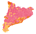
Election Map Catalonia 2017.svg 907 × 853; 608 KB
-
Ellipsoidal transverse Mercator projection SW.jpg 2,072 × 2,684; 1.05 MB
-
Embrunlocation.PNG 369 × 321; 6 KB
-
Enclave-ABC.png 150 × 135; 1 KB
-
Enclave.png 256 × 200; 2 KB
-
Equal Earth projection SW.jpg 2,060 × 1,008; 611 KB
-
Equidistante cilinder projectie 60NB ZB.PNG 517 × 517; 30 KB
-
Equirectangular-projection+terminator.jpg 2,048 × 1,025; 817 KB
-
Equirectangular-projection-topographic-world.jpg 4,424 × 2,214; 1.66 MB
-
Equirectangular-projection.jpg 2,048 × 1,025; 937 KB
-
ErdebeiNacht2Hölzel.png 1,878 × 940; 1.1 MB
-
Esxpel.PNG 239 × 289; 4 KB
-
Europe antarctica size.png 545 × 437; 134 KB
-
Europe midpoint.jpg 800 × 704; 146 KB
-
Europe mobile phone penetration map v3.png 450 × 360; 86 KB
-
Europe religion map (1950).png 1,473 × 1,198; 878 KB
-
European Otter area.png 728 × 536; 35 KB
-
Exclave.png 256 × 200; 2 KB
-
Feidi ABC.png 256 × 201; 8 KB
-
Fintopo blank.jpg 1,188 × 2,426; 1.24 MB
-
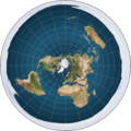
Flat earth.jpg 498 × 498; 31 KB
-
Flat earth.png 543 × 543; 396 KB
-
Flat Earth.png 1,550 × 1,550; 263 KB
-
LocationFloridaStraits.png 250 × 115; 2 KB
-
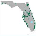
Florida Urbanized Areas.jpg 5,950 × 5,950; 2.19 MB
-
FM Tree Raster Figure 1.jpeg 782 × 752; 199 KB
-
Foie gras ilegal Mapa.PNG 2,664 × 1,224; 108 KB
-
Four Asian Tigers with flags.svg 410 × 651; 294 KB
-
France location in the EEC 1972 and the planned EEC enlargement.svg 748 × 688; 330 KB
-
French Empire evolution.gif 1,425 × 625; 146 KB
-
French regional elections 2015 1st Round-Front National.svg 542 × 584; 48 KB
-
Gall–Peters projection SW.jpg 2,058 × 1,314; 723 KB
-
General Map - Parc del Laberint d’Horta - Barcelona.svg 595 × 907; 463 KB
-
Global air pollution map.png 2,753 × 1,400; 212 KB
-
Global patterns of terrestrial vertebrate diversity - journal.pbio.1001294.g001.png 2,049 × 880; 1.25 MB
-
Gnomonic Projection Japan.jpg 2,048 × 2,048; 1.06 MB
-
Gnomonic Projection Polar.jpg 2,048 × 2,048; 1.06 MB
-
Gnomonic Projection Transversal.jpg 2,048 × 2,048; 984 KB
-
Gnomonische projectie Schiphol.PNG 597 × 599; 42 KB
-
Goldcoastct.png 472 × 341; 12 KB
-
Golden Horde 1389 Untifler.svg 962 × 684; 147 KB
-
Goode homolosine projection SW.jpg 2,058 × 900; 519 KB
-
Goode-homolosine-projection.jpg 2,048 × 888; 663 KB
-
GOPAC Members.png 691 × 442; 89 KB
-
Great Moravia-no labels.png 1,323 × 1,122; 403 KB
-
Grlakes lawrence map-blank.svg 592 × 477; 250 KB
-
Hammer projection SW.jpg 2,058 × 1,036; 622 KB
-
Hammer retroazimuthal projection back SW.JPG 2,060 × 2,060; 638 KB
-
Hammer retroazimuthal projection combined1.jpg 2,376 × 2,200; 1.33 MB
-
Hammer retroazimuthal projection combined2.jpg 4,188 × 2,118; 1.75 MB
-
Hammer retroazimuthal projection front SW.JPG 2,060 × 2,060; 349 KB
-
Hammer retroazimuthal projection full SW.JPG 2,060 × 2,060; 664 KB
-
Hauptstadtbeschluss 1991 Abgeordnetenvoten.svg 1,130 × 1,366; 1.04 MB
-
Hengchun villages3.svg 777 × 778; 13 KB
-
Hotine Mercator projection SW.jpg 2,068 × 2,060; 1.29 MB
-
Höhenprofil Pinneberg.jpg 413 × 556; 51 KB
-
IGRF 2000 magnetic declination.gif 1,010 × 804; 66 KB
-
Infant-under-five-mortality-worldmap-2016.svg 1,620 × 774; 468 KB
-
Israel at night.jpg 425 × 934; 174 KB
-
Israeli-Palestinian Railways.svg 1,660 × 2,748; 592 KB
-
JedediahSmithLanguageIndependentVersion.png 950 × 594; 916 KB
-
Jerusalem Old City blank map.svg 392 × 370; 358 KB
-
Johannesburg 2006 regions with legend.PNG 653 × 831; 23 KB
-
July mean flow at 18000 feet.png 625 × 445; 9 KB
-
Karte-fuehrerbunker.jpg 955 × 807; 513 KB
-
Karte-reichskanzlei.jpg 953 × 806; 404 KB
-
Kavrayskiy-vii-projection.jpg 2,048 × 1,182; 940 KB
-
Kegelprojektion laengentreu kl.jpg 277 × 277; 20 KB
-
Koninginnedag 2009 Incident 2.svg 1,542 × 888; 71 KB
-
Koninginnedag 2009 Incident.svg 1,544 × 940; 52 KB
-
Korea map white.png 260 × 460; 6 KB
-
Koter.jpg 2,480 × 3,509; 676 KB
-
Koter.png 2,480 × 3,509; 192 KB
-
Kurdish languages map.svg 950 × 560; 4.44 MB
-
Kurilen und Sachalin 1875-1945.svg 868 × 478; 64 KB
-
Kvarken Archipelago Finland.png 445 × 540; 323 KB
-
Kyrgyzstan Topography.png 1,705 × 1,015; 1.54 MB
-
KyrgyzstanNumbered.png 750 × 423; 49 KB
-
LA2-Bering-Sea-UTM-zones.png 960 × 516; 103 KB
-
LA2-Helsinki-water-2.png 764 × 777; 170 KB
-
LA2-Helsinki-water.png 1,001 × 807; 178 KB
-
LA2-India-UTM-zones.png 1,070 × 936; 222 KB
-
Lambert 1.jpg 1,024 × 1,024; 247 KB
-
Lambert 2.jpg 1,024 × 1,024; 262 KB
-
Lambert Azimutal 3.jpg 1,024 × 1,024; 265 KB
-
Lambert azimuthal equal-area projection SW.jpg 2,058 × 2,058; 1.14 MB
-
Lambert cylindrical equal-area projection SW.jpg 2,058 × 664; 429 KB
-
Lambert-azimuthal-equal-area.jpg 2,048 × 2,047; 1.26 MB
-
Lamberts Projection Transversal.jpg 2,048 × 2,048; 951 KB
-
Landoj kie estas naciaj asocioj ligitaj al UEA.PNG 1,425 × 625; 41 KB
-
Landoj kie estas naciaj asocioj ligitaj al UEA.svg 2,754 × 1,398; 1.05 MB
-
Languetransfrontaliere.png 427 × 216; 10 KB
-
Legality of primate use in scientific research.png 1,400 × 625; 31 KB
-
Lezgi WP countries.png 1,425 × 625; 56 KB
-
Lezgi WP Russian regions.png 3,463 × 1,970; 176 KB
-
Libya Topography.png 1,180 × 1,071; 1.56 MB
-
Lines of equal latitude and longitude FROM (World borders parallel).png 2,000 × 1,999; 509 KB




















.png/120px-Europe_religion_map_(1950).png)
_participation_map.svg/120px-European_Convention_for_the_Protection_of_Animals_during_International_Transport_(2003_revision)_participation_map.svg.png)
















.png/120px-Lines_of_equal_latitude_and_longitude_FROM_(World_borders_parallel).png)
.png/120px-Lines_of_equal_latitude_and_longitude_FROM_(World_map_Winkel_Tripel_proj-0deg_centered).png)