Category:Maps by Abraham Ortelius
Jump to navigation
Jump to search
Subcategories
This category has the following 20 subcategories, out of 20 total.
1
- Typus Orbis Terrarum (32 F)
A
- Africae Tabula Nova (14 F)
C
- Cartouches by Abraham Ortelius (33 F)
H
I
M
- Maps of Asia by Abraham Ortelius (29 F)
- Maps of Ischia by Mario Cartaro (20 F)
T
Media in category "Maps by Abraham Ortelius"
The following 200 files are in this category, out of 332 total.
(previous page) (next page)-
 "Theatrum orbis terrarum Abrahami Orteli". Anversa, Ioannem Moretum, 1601.png 1,145 × 807; 1.58 MB
-
 1570 1584 Palestinae 6391.jpg 2,881 × 2,223; 4.65 MB
-
 1570 Geldria Theatrvm orbis terrarvm.jpg 701 × 538; 94 KB
-
_and_Surrounding_Countries_by_Flemish_佛萊明人(今比利時北部)所繪福爾摩沙臺灣.jpeg/120px-1570_Map_of_Formosa_(Taiwan)_and_Surrounding_Countries_by_Flemish_佛萊明人(今比利時北部)所繪福爾摩沙臺灣.jpeg)
-
_-_Geographicus_-_AsiaeNovaDescriptio-ortelius.jpg/120px-1570_Ortelius_Map_of_Asia_(first_edition)_-_Geographicus_-_AsiaeNovaDescriptio-ortelius.jpg) 1570 Ortelius Map of Asia (first edition) - Geographicus - AsiaeNovaDescriptio-ortelius.jpg 5,000 × 3,791; 8.16 MB
1570 Ortelius Map of Asia (first edition) - Geographicus - AsiaeNovaDescriptio-ortelius.jpg 5,000 × 3,791; 8.16 MB
-
 1570 Palestinae Hondius.jpg 1,719 × 1,310; 1.04 MB
-
_and_Surrounding_Countries_by_Dutch_Flemish_荷屬佛萊明人(今比利時北部)所繪福爾摩沙臺灣.jpg/103px-1570-1612_Map_of_Formosa_(Taiwan)_and_Surrounding_Countries_by_Dutch_Flemish_荷屬佛萊明人(今比利時北部)所繪福爾摩沙臺灣.jpg)
-
.jpg/120px-1572_Europa_Ortelius_(cropped).jpg) 1572 Europa Ortelius (cropped).jpg 5,491 × 4,064; 22.89 MB
1572 Europa Ortelius (cropped).jpg 5,491 × 4,064; 22.89 MB
-
 1572 Europa Ortelius.A.jpg 5,294 × 3,872; 20.61 MB
-
 1572 Europa Ortelius.B.jpg 673 × 441; 328 KB
-
 1572 Europa Ortelius.C.jpg 2,235 × 2,460; 5.24 MB
-
 1572 Europa Ortelius.D.jpg 1,383 × 1,022; 1.5 MB
-
 1572 Europa Ortelius.E.jpg 771 × 964; 748 KB
-
 1572 Europa Ortelius.F.jpg 499 × 766; 415 KB
-
 1572 Europa Ortelius.G.jpg 848 × 407; 363 KB
-
 1572 Europa Ortelius.H.jpg 853 × 577; 513 KB
-
 1572 Europa Ortelius.I.jpg 1,149 × 795; 875 KB
-
 1572 Europa Ortelius.jpg 6,768 × 5,160; 32.01 MB
-
 1573 map of Palestine by Abraham Ortelius.jpg 12,225 × 9,267; 25.35 MB
-
 1574 map of the Western Balkan by Abraham Ortelius verso.jpg 12,472 × 9,473; 11.62 MB
-
 1574 map of the Western Balkan by Abraham Ortelius.jpg 11,839 × 8,866; 16.77 MB
-
 1574 Ortelius Royon detail.jpg 1,920 × 1,337; 1.59 MB
-
 Postland.jpg 820 × 610; 492 KB
-
 1576 Ortellius ARTOIS.jpg 960 × 1,323; 1.07 MB
-
_Hispaniolae%2C_Cubae%2C_aliarumque_insularum_circumiacientium%2C_delineatio_1579_(1581)_UTA.jpg/120px-Ortelius_Culiacanae%2C_Americae_regionis%2C_descriptio_(and)_Hispaniolae%2C_Cubae%2C_aliarumque_insularum_circumiacientium%2C_delineatio_1579_(1581)_UTA.jpg)
-

-
_-_Geographicus_-_Portugalliae-ortelius-1587.jpg/120px-1579_Ortelius_Map_of_Portugal_(_Porvgalliae_)_-_Geographicus_-_Portugalliae-ortelius-1587.jpg)
-
 1580 Zelandicarum v Deventer.jpg 2,666 × 1,971; 1.71 MB
-

-
 1584 map of Aegean Islands and Cyprus by Abraham Ortelius.jpg 13,147 × 10,367; 30.76 MB
-
 1584 map of Greece and the Aegean Sea by Abraham Ortelius.jpg 12,895 × 9,347; 29.09 MB
-
 1584 map of Greece and Western Turkey by Abraham Ortelius.jpg 12,525 × 9,061; 26.74 MB
-
 1584 map of Greece by Abraham Ortelius.jpg 12,729 × 9,188; 32.66 MB
-
_and_10_Greek_Islands_-_Geographicus_-_CandiaInsula-ortelius-1584_(cropped).jpg/120px-1584_Ortelius_Map_of_Crete_(Candia)_and_10_Greek_Islands_-_Geographicus_-_CandiaInsula-ortelius-1584_(cropped).jpg)
-
_and_10_Greek_Islands_-_Geographicus_-_CandiaInsula-ortelius-1584.jpg/120px-1584_Ortelius_Map_of_Crete_(Candia)_and_10_Greek_Islands_-_Geographicus_-_CandiaInsula-ortelius-1584.jpg)
-
 1587 Frisia occidentalis.jpg 6,572 × 5,141; 6.24 MB
-
 Ortelius Maris Pacifici 1589 UTA.jpg 1,388 × 950; 619 KB
-
 1590 map of the Black Sea by Abraham Ortelius.jpg 14,445 × 11,998; 31.19 MB
-
 1590 map of Thrace by Abraham Ortelius.jpg 13,292 × 10,391; 26.57 MB
-
 Orteliusstraat Japan.jpg 3,368 × 2,490; 11.28 MB
-
 Marchetti-Ortelius Africae Tabula Nova1598 UTA.jpg 2,616 × 2,037; 1.45 MB
-
 1598 Zelandia Ort.jpg 2,554 × 2,016; 1.65 MB
-
 Ortelius America.jpg 7,581 × 5,532; 6.67 MB
-
 1624 detail map of the Holy Land by Abraham Ortelius.jpg 2,013 × 3,994; 2.38 MB
-
 1624 imaginary view of Daphne in Antioch by Abraham Ortelius.jpg 12,119 × 9,167; 31.46 MB
-
 1624 map of the Ancient World based upon the Bible by Abraham Ortelius.jpg 13,020 × 8,862; 22.85 MB
-
 1624 map of the Exodus route by Abraham Ortelius.jpg 1,436 × 1,090; 477 KB
-
 1624 ORTELIUS Map BLACK SEA Roman Era Pontus Euxinus.jpg 1,042 × 800; 190 KB
-
.jpg/120px-thumbnail.jpg)
-
-
 A. Ortelius - Oswiec. et Zatorien Ducatus - 1655.jpg 742 × 586; 137 KB
-
 Abisynia 1584.jpg 586 × 509; 119 KB
-
 Abraham Ortelius - Agnano.jpg 800 × 582; 101 KB
-
.jpg/120px-Abraham_Ortelius_-_Chinae_(1584).jpg) Abraham Ortelius - Chinae (1584).jpg 6,332 × 4,877; 16.21 MB
Abraham Ortelius - Chinae (1584).jpg 6,332 × 4,877; 16.21 MB
-
 Abraham Ortelius - Image of the Pilgrimage of St Paul - WGA16706.jpg 1,173 × 900; 195 KB
-
.jpg/120px-Abraham_Ortelius_-_Maris_Pacifici_(c_1589).jpg) Abraham Ortelius - Maris Pacifici (c 1589).jpg 6,717 × 5,310; 16.3 MB
Abraham Ortelius - Maris Pacifici (c 1589).jpg 6,717 × 5,310; 16.3 MB
-
 Abraham Ortelius - Neapolis.jpg 800 × 668; 116 KB
-
 Abraham Ortelius - Pianta di Napoli, dettaglio.jpg 800 × 651; 130 KB
-
 Abraham Ortelius - Pontvs Evxinus.jpg 640 × 467; 112 KB
-
 Abraham Ortelius - ROMANI IMPERII IMAGO.jpg 1,945 × 1,400; 3.61 MB
-
 Abraham Ortelius - Romania, Bvlgaria, Walachia et Syrfia.jpg 640 × 499; 115 KB
-
 Abraham Ortelius - Solfatara.jpg 800 × 604; 120 KB
-
 Abraham Ortelius - Theatrum orbis terrarum.jpg 1,002 × 797; 419 KB
-
_vicinarvmqe_regionum%2C_vti_Bvlgariae%2C_Walachiae%2C_Syrfiae%2C_etc._descriptio.jpg/120px-Abraham_Ortelius_after_Jacobo_Castaldi_-_Romaniae%2C_(quae_olim_Thracia_dicta)_vicinarvmqe_regionum%2C_vti_Bvlgariae%2C_Walachiae%2C_Syrfiae%2C_etc._descriptio.jpg)
-
 Abraham Ortelius Amerika 1579 ubs G 0638 III.jpg 1,500 × 1,032; 952 KB
-
 Abraham Ortelius and Jan van Keerbergen. Persia. 1603.jpg 10,621 × 7,673; 5.74 MB
-

-
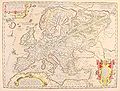
 Abraham Ortelius Map of Europe.jpg 2,691 × 1,965; 5.92 MB
-
.jpg/120px-Abraham_Ortelius_nordenkart%2C_1601_(12285056056).jpg) Abraham Ortelius nordenkart, 1601 (12285056056).jpg 4,963 × 3,998; 5.74 MB
Abraham Ortelius nordenkart, 1601 (12285056056).jpg 4,963 × 3,998; 5.74 MB
-
 Abraham Ortelius Nordmeer Theat orb terr 1573.png 1,024 × 768; 1.74 MB
-
%2C_incisione_acquarellata%2C_1584_ca._01.jpg/120px-Abraham_ortelius%2C_carta_d%27egitto_(due_fogli)%2C_incisione_acquarellata%2C_1584_ca._01.jpg) Abraham ortelius, carta d'egitto (due fogli), incisione acquarellata, 1584 ca. 01.jpg 2,288 × 1,944; 4.1 MB
Abraham ortelius, carta d'egitto (due fogli), incisione acquarellata, 1584 ca. 01.jpg 2,288 × 1,944; 4.1 MB
-
%2C_incisione_acquarellata%2C_1584_ca._02.jpg/120px-Abraham_ortelius%2C_carta_d%27egitto_(due_fogli)%2C_incisione_acquarellata%2C_1584_ca._02.jpg) Abraham ortelius, carta d'egitto (due fogli), incisione acquarellata, 1584 ca. 02.jpg 2,184 × 1,872; 3.78 MB
Abraham ortelius, carta d'egitto (due fogli), incisione acquarellata, 1584 ca. 02.jpg 2,184 × 1,872; 3.78 MB
-
 Abraham Ortelius-Septentrionalium Regionum Descrip.jpg 1,000 × 742; 418 KB
-

-
 Abraham Ortelius. Percici sive Sophorvm Regni Tipvs. 1667.jpg 10,471 × 7,948; 6.86 MB
-
.jpg/120px-Abrahami_Ortelii._Pontvs_Euxinvs_(17th_century).jpg) Abrahami Ortelii. Pontvs Euxinvs (17th century).jpg 6,200 × 4,864; 5.95 MB
Abrahami Ortelii. Pontvs Euxinvs (17th century).jpg 6,200 × 4,864; 5.95 MB
-
 Abrahami Patriarchae Peregrinatio Et Vita.jpg 12,254 × 9,845; 29.73 MB
-
 Aegean Sea by Ortelius, detail of Kea, Suda, Mykonos, Delos, Kythnos.jpg 1,393 × 1,224; 482 KB
-
 Aegidius Tschschudi - Schweizerkarte - 1538.jpg 2,500 × 1,888; 3.74 MB
-
 Aegypti re centior de scriptio - DPLA - f87ced11a85536823229bd87acfaa560.jpg 1,000 × 778; 288 KB
-
_-_btv1b5964076p.jpg/86px-Aegyptus_-_(Abraham_Ortelius)_-_btv1b5964076p.jpg) Aegyptus - (Abraham Ortelius) - btv1b5964076p.jpg 5,624 × 7,816; 8.65 MB
Aegyptus - (Abraham Ortelius) - btv1b5964076p.jpg 5,624 × 7,816; 8.65 MB
-
 Aegyptvs Antiqva - DPLA - b39881153f5d05fe92271a645f34c894.jpg 1,000 × 839; 303 KB
-
_1595_-_btv1b531968814_(2_of_3).jpg/120px-Aegytus_antiqua_-_ex_conatibus_geographicis_Abrahami_Ortelii_(...)_1595_-_btv1b531968814_(2_of_3).jpg)
-
_1590_-_btv1b53196817x_(2_of_3).jpg/120px-Africae_propriae_tabula_-_ex_conatibus_geographicis_Abrahami_Ortelii_(...)_1590_-_btv1b53196817x_(2_of_3).jpg)
-
_1595_-_btv1b53211483k_(2_of_3).jpg/120px-Alexandri_magni_macedonis_expeditio_-_Ex_conatib._geographicis_Ab._Ortelii_(...)_1595_-_btv1b53211483k_(2_of_3).jpg)
-
.jpg/120px-Aprutii_ulterioris_descriptio_-_Natalis_Bonifacius_Sebenicensis_-_btv1b53043253n_(1_of_2).jpg)
-
 Arabia and the Red Sea.jpg 693 × 775; 150 KB
-
.jpg/120px-Asia_(1604).jpg) Asia (1604).jpg 800 × 600; 170 KB
Asia (1604).jpg 800 × 600; 170 KB
-
.jpg/120px-Asia1(1588).jpg) Asia1(1588).jpg 800 × 600; 172 KB
Asia1(1588).jpg 800 × 600; 172 KB
-
 B26055948F - Indiae orientalis insvlarvmqve adiacientivm typvs.jpg 6,058 × 4,266; 7.41 MB
-
 Barbarathermen Trier Ortelius Vivianus 1584.jpg 1,024 × 704; 595 KB
-
 Barbariae et Biledulgerid, Nova Descriptio.jpg 12,777 × 8,739; 16.31 MB
-
 Barbariae et Biledulgerid.jpg 600 × 399; 97 KB
-
 Barwald mapa 1590 ortelius.jpg 1,280 × 800; 1.07 MB
-
 Basic cartouche on the 1603 Tempe map by Ortelius.jpg 1,795 × 1,023; 574 KB
-

-

-
.jpg/120px-Belgii_veteris_typus_ex_conatibus_Geographicis_Abrahami_Ortelij..._-_btv1b8493369h_(1_of_2).jpg)
-
 Bijzondere Collecties UvA HB-KZL 33.18.40.jpg 1,517 × 1,194; 461 KB
-
 Braunsvicensis, et Luneburgensis ducatuum vera delineatio.jpg 2,657 × 3,478; 6.52 MB
-
 Brittenburg-Ortelius-1581.jpg 2,321 × 1,709; 3.25 MB
-
 Burgundia ortelius.jpg 804 × 641; 50 KB
-
.png/120px-BurzenlandOld1_(Ortelius_A.%2C_1598).png) BurzenlandOld1 (Ortelius A., 1598).png 497 × 305; 445 KB
BurzenlandOld1 (Ortelius A., 1598).png 497 × 305; 445 KB
-
 Ca. 1592 map of the Ottoman Empire by Abraham Ortelius.jpg 12,561 × 9,755; 23.93 MB
-
 Carlsbadt ort.jpg 420 × 300; 34 KB
-
.jpg/120px-Carte_de_la_Corsie_(1584).jpg) Carte de la Corsie (1584).jpg 1,600 × 1,200; 443 KB
Carte de la Corsie (1584).jpg 1,600 × 1,200; 443 KB
-
 Carte de la Flandre en 1590.png 1,754 × 1,396; 6.74 MB
-
 Carte de Utopia.jpg 2,560 × 1,920; 2.88 MB
-
 Carthaginis Celeberrimi Sinus Typus. NYPL1632234.tiff 7,230 × 5,428; 112.28 MB
-
 Caspian Sea. Persici Sive Sopho Rvm Regni Typvs.The Ortelius map of Persia, Antwerp, 1570.jpg 17,845 × 8,375; 11.13 MB
-
 CEM-09-Asiae-Nova-Descriptio-Central-Asia-2509.jpg 2,048 × 1,536; 1.57 MB
-
 CEM-09-Asiae-Nova-Descriptio-Kitaia-lacus-2511.jpg 1,600 × 1,200; 1.02 MB
-
 CEM-09-Asiae-Nova-Descriptio-SE-Asia-2505.jpg 2,560 × 1,920; 2.08 MB
-
 CEM-09-Asiae-Nova-Descriptio-Tartaria-2508 Caucasus.jpg 846 × 770; 429 KB
-
 CEM-09-Asiae-Nova-Descriptio-Tartaria-2508.jpg 2,048 × 1,536; 1.59 MB
-
 CEM-10-Tartariae-sive-Magni-Chami-Regni-2516.jpg 2,560 × 1,920; 2.08 MB
-
 CEM-10-Tartariae-sive-Magni-Chami-Regni-South-2518.jpg 2,560 × 1,920; 2.06 MB
-
 CEM-11-Chinae-nova-descriptio-2521.jpg 1,770 × 1,400; 3.3 MB
-
 Chiaha-chiaves-map-1584.jpg 313 × 251; 23 KB
-
 Chiaves-map-xuala-1584.jpg 442 × 257; 35 KB
-
.jpg/107px-Chinesische_Mauer_(Ortelius_1584).jpg) Chinesische Mauer (Ortelius 1584).jpg 1,530 × 1,710; 699 KB
Chinesische Mauer (Ortelius 1584).jpg 1,530 × 1,710; 699 KB
-
 Corfu-Ortelius-1595.jpg 500 × 379; 90 KB
-
 Cyprus Insula, Candia, Olim Creta.jpg 10,986 × 9,316; 16.11 MB
-
 Dacia and Moesia.jpg 640 × 494; 112 KB
-
 Dacia kaerius.jpg 640 × 499; 102 KB
-
.jpg/120px-Daciarum%2C_Moesiarumque%2C_vetus_descriptio_-_ex_conatibus_geographicis_Abrahami_Ortelii_1595_-_btv1b53194602t_(2_of_3).jpg)
-
 Denmark 1570.jpg 4,960 × 3,496; 5.99 MB
-
 Descriptio Germaniae inferioris Nederlanden 1573.png 1,778 × 1,352; 7.32 MB
-
 Descriptio Germaniae Inferioris Nederlanden Map by Abraham Ortelius 1573.jpg 6,817 × 5,153; 15.69 MB
-

-
 Detail from a map of Ortelius - Magellan's ship Victoria.png 2,522 × 1,538; 9.48 MB
-
 Detail of plate 11 showing Cambalu Wellcome L0071619.jpg 4,000 × 4,173; 3.8 MB
-
 Detail of plate 11 showing Magnus Chan Wellcome L0071618.jpg 4,680 × 4,044; 5.55 MB
-
 Detail of plate 9 showing Samarchand Wellcome L0071617.jpg 5,200 × 3,080; 3.24 MB
-
 Detail of plate showing Porlok and Minhed Wellcome L0071620.jpg 3,600 × 4,500; 4.32 MB
-
 Dokkumerdiep in 1587.jpg 1,737 × 1,019; 440 KB
-
 Dubrovytsia 1580 Map.jpg 3,738 × 3,096; 3.3 MB
-
 Ducato d'Urbino. A. Ortel, 1608.jpg 3,504 × 2,707; 2.54 MB
-
 Epitome theatri Ortelianii, Abraham Ortelio.jpg 3,162 × 2,372; 4.36 MB
-
.jpg/120px-Europae_-_btv1b8592191k_(1_of_2).jpg) Europae - btv1b8592191k (1 of 2).jpg 8,160 × 6,224; 9.5 MB
Europae - btv1b8592191k (1 of 2).jpg 8,160 × 6,224; 9.5 MB
-
 Europae - Europe.jpg 5,524 × 4,082; 9.6 MB
-
 Europam sive Celticam Veterem.jpg 12,044 × 8,672; 23.58 MB
-
 Europam, Sive Celticam Veterem 1595.jpg 920 × 698; 268 KB
-
 Faroe stamp 002 map of the nordic countries 10 oyru.jpg 303 × 234; 33 KB
-
 Faroe stamp 004 map of the nordic countries 60 oyru.jpg 303 × 233; 33 KB
-
 Faroe stamp 006 map of the nordic countries 80 oyru.jpg 301 × 233; 31 KB
-
 Faroe stamp 008 map of the nordic countries 120 oyru.jpg 302 × 233; 34 KB
-
 Fezzae et Marocchi regna Africae celeberrima describebat Abrah. Ortelius - CBT 6620211.jpg 5,772 × 4,485; 5.67 MB
-
 Figurative cartouche on a Graecia map by Ortelius.jpg 1,964 × 2,897; 1.81 MB
-
_1584_Map_by_Abraham_Ortelius.jpg/120px-Flandria_(Vlaanderen_Flanders)_1584_Map_by_Abraham_Ortelius.jpg) Flandria (Vlaanderen Flanders) 1584 Map by Abraham Ortelius.jpg 12,583 × 9,989; 44.7 MB
Flandria (Vlaanderen Flanders) 1584 Map by Abraham Ortelius.jpg 12,583 × 9,989; 44.7 MB
-
 Forum Iulii 1655.jpg 1,366 × 970; 476 KB
-
.jpg/120px-Frans_Hogenberg%2C_Typus_orbis_Terrarum_(FL13736273_2718391).jpg) Frans Hogenberg, Typus orbis Terrarum (FL13736273 2718391).jpg 8,959 × 6,837; 84.09 MB
Frans Hogenberg, Typus orbis Terrarum (FL13736273 2718391).jpg 8,959 × 6,837; 84.09 MB
-
 From a 1587 edition of this map the Deccan and the South.jpg 800 × 582; 118 KB
-
_north_India_and_Persia.jpg/120px-From_a_full-sized_map_of_Asia_by_Ortelius%2C_1595_(early_ed._1575)_north_India_and_Persia.jpg)
-

-
 Fülek megvétele 1593-ban.jpg 2,000 × 1,196; 1.29 MB
-
 Germaniae Typus.jpg 12,173 × 9,564; 32.49 MB
-
 Graecia Sophiani.jpg 12,325 × 8,913; 31.07 MB
-
 Groclant in 1572 Typus Orbis Terrarum Ortelius.jpeg 800 × 600; 473 KB
-
 H Zell kujawsko-pomorskie.jpg 525 × 473; 191 KB
-
 Hatvan megvétele 1596.jpg 800 × 488; 204 KB
-
 Hawiye Kingdom of the North East in 1570.png 1,028 × 354; 670 KB
-
_Detail_from_map_of_Iceland_1585.jpg/120px-Hekla_(A._Ortelius)_Detail_from_map_of_Iceland_1585.jpg) Hekla (A. Ortelius) Detail from map of Iceland 1585.jpg 1,434 × 1,137; 450 KB
Hekla (A. Ortelius) Detail from map of Iceland 1585.jpg 1,434 × 1,137; 450 KB
-
-
 Hollandiae 1570 Ortelius.jpg 6,712 × 5,062; 27.3 MB
-
 Illyricum. Slavoniae, Croatiae, Carniae, Istriae, Bosniae descr. 1589.jpg 1,411 × 1,086; 690 KB
-
-

-

-

-

-
 Iovis Ammonis Oraclum - as imagined 1595 by Ortelius.jpg 2,304 × 2,012; 1.43 MB
-
 Island19x1024.jpg 1,024 × 786; 130 KB
-

-
 Ivan IV Ortelius 1574.JPG 375 × 405; 28 KB
-

-
 Jacob van Deventer - deel van Noord-Beveland.jpg 421 × 291; 14 KB
-
 Japanmap Ortelius 1572.jpg 563 × 474; 220 KB
-
%2C_RP-P-2005-214-1.jpg/120px-Kaart_van_Griekenland_Graecia%2C_Sophiani_(titel_op_object)%2C_RP-P-2005-214-1.jpg) Kaart van Griekenland Graecia, Sophiani (titel op object), RP-P-2005-214-1.jpg 5,026 × 3,580; 4.3 MB
Kaart van Griekenland Graecia, Sophiani (titel op object), RP-P-2005-214-1.jpg 5,026 × 3,580; 4.3 MB
-
.jpg/120px-Kart425(0091).jpg) Kart425(0091).jpg 4,000 × 3,083; 1.57 MB
Kart425(0091).jpg 4,000 × 3,083; 1.57 MB
-
.jpg/120px-Kart425(0219).jpg) Kart425(0219).jpg 4,000 × 2,896; 1.96 MB
Kart425(0219).jpg 4,000 × 2,896; 1.96 MB
-
 Kiou1562.jpg 2,084 × 2,084; 1.28 MB
-
 Komarno1594.jpg 1,653 × 999; 1.17 MB
-
 Księstwo Cieszyńskie 1570.jpg 1,280 × 1,152; 879 KB
-
 Kyivstar vkraina 1580.jpg 2,500 × 1,890; 2.62 MB
-

-
 Livland 15jh.png 1,000 × 900; 2.23 MB
-
 Loediensis dioecesis typus - A. Ort. - btv1b53040632v.jpg 6,095 × 4,600; 5.45 MB
-
 Lotharingiae typus ortelius 1588.jpg 800 × 575; 68 KB
-
 Map - Special Collections University of Amsterdam - OTM - HB-KZL 31.01.04.tiff 6,824 × 5,426; 105.94 MB
-
 Map - Special Collections University of Amsterdam - OTM- HB-KZL 31-01-03.tif 7,240 × 5,666; 117.36 MB
-
 Map - Special Collections University of Amsterdam - OTM- HB-KZL 31-01-05.tif 6,536 × 5,082; 95.03 MB
-
 Map - Special Collections University of Amsterdam - OTM- HB-KZL 31-01-07.tif 6,264 × 4,596; 82.37 MB
-
 Map - Special Collections University of Amsterdam - OTM- HB-KZL 31-01-16.tif 6,480 × 5,084; 94.25 MB
-
 Map - Special Collections University of Amsterdam - OTM- HB-KZL 31-01-17.tif 6,984 × 5,464; 109.18 MB
-
 Map - Special Collections University of Amsterdam - OTM- HB-KZL 31-01-18.tif 6,776 × 5,507; 106.76 MB
-
 Map - Special Collections University of Amsterdam - OTM- HB-KZL 31-01-32.tif 7,224 × 6,035; 124.73 MB
-
 Map - Special Collections University of Amsterdam - OTM- HB-KZL 31-01-35.tif 7,256 × 6,016; 124.89 MB
-
 Map - Special Collections University of Amsterdam - OTM- HB-KZL 31-01-43.tif 7,272 × 5,624; 117.01 MB
-
 Map - Special Collections University of Amsterdam - OTM- HB-KZL 31-01-44.tif 6,856 × 5,440; 106.71 MB


_and_Surrounding_Countries_by_Flemish_佛萊明人(今比利時北部)所繪福爾摩沙臺灣.jpeg)
_-_Geographicus_-_AsiaeNovaDescriptio-ortelius.jpg)

_and_Surrounding_Countries_by_Dutch_Flemish_荷屬佛萊明人(今比利時北部)所繪福爾摩沙臺灣.jpg)
.jpg)


_Hispaniolae,_Cubae,_aliarumque_insularum_circumiacientium,_delineatio_1579_(1581)_UTA.jpg)

_-_Geographicus_-_Portugalliae-ortelius-1587.jpg)


_and_10_Greek_Islands_-_Geographicus_-_CandiaInsula-ortelius-1584.jpg)


.jpg)


.jpg)

.jpg)


_vicinarvmqe_regionum,_vti_Bvlgariae,_Walachiae,_Syrfiae,_etc._descriptio.jpg)


.jpg)

,_incisione_acquarellata,_1584_ca._01.jpg)
,_incisione_acquarellata,_1584_ca._02.jpg)


.jpg)


_-_btv1b5964076p.jpg)

_1595_-_btv1b531968814_(2_of_3).jpg)
_1590_-_btv1b53196817x_(2_of_3).jpg)
_1595_-_btv1b53211483k_(2_of_3).jpg)
.jpg)

.jpg)
.jpg)


.jpg)


.png)


.jpg)


.jpg)


.jpg)


.jpg)


_1584_Map_by_Abraham_Ortelius.jpg)

.jpg)

_north_India_and_Persia.jpg)


_Detail_from_map_of_Iceland_1585.jpg)


,_RP-P-2005-214-1.jpg)
.jpg)
.jpg)


_and_10_Greek_Islands_-_Geographicus_-_CandiaInsula-ortelius-1584_(cropped).jpg)