Category:Maps of the world showing history
Jump to navigation
Jump to search

Maps of the world made less than seventy (70) years ago that show history.
- For old maps of the world, see Category:Old maps of the world.
- For old maps in general, see Category:Old maps
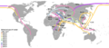
| Maps of world history | |
| BC | |
|
| |
| AD |
1 · 50 · 100 · 200 · 250 · 300 · 400 · 500 · 700 · 750 · 820 · 900 · 1200 · 1500 · 1556 · 1648 · 1700 · 1750 · 1815 · 1859 · 1871 · 1914 · 1935 · 1954 · 1989 · 2000 · |
|
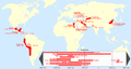
Maps of colonization history | |
|
see also: Eastern Hemisphere only maps template (1300BC-1500AD) | |
| (this template: · view · discuss ) | |
Subcategories
This category has the following 17 subcategories, out of 17 total.
Pages in category "Maps of the world showing history"
The following 9 pages are in this category, out of 9 total.
Media in category "Maps of the world showing history"
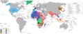
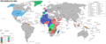
The following 164 files are in this category, out of 164 total.
-
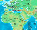
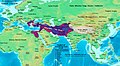 Alexander-Empire 323bc.jpg 2,321 × 1,288; 933 KB
-
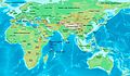
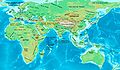
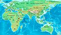
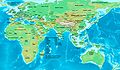
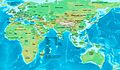
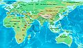
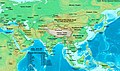 Asia 500ad.jpg 2,196 × 1,305; 435 KB
-
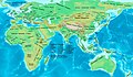
 East-Hem 001ad.jpg 3,240 × 1,903; 709 KB
-
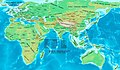
 East-Hem 050ad.jpg 3,240 × 1,903; 722 KB
-
 East-Hem 050bc.jpg 3,240 × 1,903; 722 KB
-
 East-Hem 1000bc.jpg 3,240 × 1,903; 1.43 MB
-
 East-Hem 100ad.jpg 3,240 × 1,903; 726 KB
-
 East-Hem 100bc.jpg 3,240 × 1,903; 737 KB
-
 East-Hem 1025ad.jpg 3,240 × 1,903; 3.16 MB
-
 East-Hem 1100ad.jpg 3,240 × 1,903; 3.16 MB
-
 East-Hem 1200ad.jpg 3,240 × 1,903; 2.01 MB
-
 East-Hem 1300bc.jpg 3,240 × 1,903; 1.42 MB
-
 East-Hem 200ad.jpg 3,240 × 1,903; 734 KB
-
 East-Hem 200bc.jpg 3,240 × 1,903; 2.23 MB
-
.jpg/120px-East-Hem_300ad_(cropped).jpg) East-Hem 300ad (cropped).jpg 968 × 602; 107 KB
East-Hem 300ad (cropped).jpg 968 × 602; 107 KB
-
 East-Hem 300ad.jpg 3,240 × 1,903; 739 KB
-
 East-Hem 323bc.jpg 3,240 × 1,903; 712 KB
-
.jpg/120px-East-Hem_400ad_(cropped).jpg) East-Hem 400ad (cropped).jpg 1,079 × 574; 117 KB
East-Hem 400ad (cropped).jpg 1,079 × 574; 117 KB
-
 East-Hem 400ad.jpg 3,240 × 1,903; 749 KB
-
 East-Hem 400bc.jpg 3,240 × 1,903; 725 KB
-
 East-Hem 475ad.jpg 3,240 × 1,903; 753 KB
-
.jpg/120px-East-Hem_476ad_(cropped).jpg) East-Hem 476ad (cropped).jpg 1,042 × 685; 167 KB
East-Hem 476ad (cropped).jpg 1,042 × 685; 167 KB
-
 East-Hem 476ad.jpg 3,240 × 1,903; 754 KB
-
 East-Hem 477ad.jpg 3,240 × 1,903; 760 KB
-
 East-Hem 500ad.jpg 3,240 × 1,903; 774 KB
-
 East-Hem 500bc.jpg 3,240 × 1,903; 1.41 MB
-
 East-Hem 565ad.jpg 3,240 × 1,903; 773 KB
-
 East-Hem 600ad.jpg 3,240 × 1,903; 3.8 MB
-
 East-Hem 600bc.jpg 3,240 × 1,903; 731 KB
-
 East-Hem 700ad.jpg 3,240 × 1,903; 924 KB
-
 East-Hem 800ad.jpg 3,240 × 1,903; 3.51 MB
-
 East-Hem 900ad.jpg 3,240 × 1,903; 1.71 MB
-
 Hittites 1300bc.jpg 1,285 × 1,008; 520 KB
-
 India in 477 CE.png 749 × 946; 1.03 MB
-
 Indo-Greeks 100bc.jpg 880 × 659; 696 KB
-
 Kushano-Hephthalites 600ad.jpg 758 × 670; 575 KB
-
 Kushanshas-Hepthalites 565ad.jpg 816 × 853; 131 KB
-
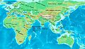
 NE 600ad.jpg 1,439 × 1,086; 502 KB
-
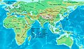
 NE 800ad.jpg 1,533 × 1,264; 552 KB
-
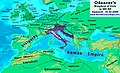 Odoacer 480ad.jpg 900 × 545; 701 KB
-
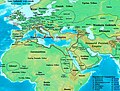
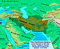 Parthia 001ad.jpg 793 × 652; 741 KB
-
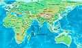
 Persia 600ad.jpg 1,098 × 623; 644 KB
-
 Ptolemaic-Empire 200bc.jpg 1,164 × 636; 1.02 MB
-
 Roman-Empire 200bc.jpg 1,164 × 636; 887 KB
-
 Roman-Empire 477ad.jpg 1,405 × 954; 372 KB
-
 Roman-Empire 565ad.jpg 1,287 × 875; 1.23 MB
-
 Rome-Seleucia-Parthia 200bc.jpg 1,205 × 567; 767 KB
-
 Saffarids 900ad.jpg 1,076 × 769; 1.04 MB
-
 Seleucid-Empire 200bc.jpg 1,244 × 716; 748 KB
-
 Sindh 700ad.jpg 720 × 473; 432 KB
-
 Map14century.png 1,438 × 712; 548 KB
-
 1555-56 CE World Map.PNG 4,500 × 2,234; 302 KB
-
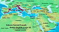
 Age of Ancient Empires.png 7,016 × 4,681; 846 KB
-
 Ancientcultures.gif 1,427 × 628; 76 KB
-
 British Empire 1897.jpg 1,116 × 849; 159 KB
-

-
 C.C.Fernberger.png 2,000 × 1,015; 202 KB
-
 Cavindasch.png 1,425 × 625; 48 KB
-
 Centres of origin and spread of agriculture v2.svg 940 × 415; 1.49 MB
-
 Colonisation 1492.png 3,600 × 1,578; 1.09 MB
-
 Colonisation 1600.png 8,550 × 3,750; 3.41 MB
-
Colonisation territorial changes from 15th to 20th century.ogv 1 min 34 s, 800 × 351; 3.32 MB
-
 Conceptions Colomb map-en.svg 1,022 × 635; 857 KB
-
 Conceptions Colomb map-fr.svg 1,022 × 635; 1.01 MB
-
 Connaissances geographiques.jpg 5,965 × 3,835; 3.53 MB
-
 Cook Three Voyages 59.png 800 × 401; 273 KB
-
 Descobrimentos e explorações portuguesesV2.png 1,357 × 628; 211 KB
-
 Early migrations mercator.svg 1,173 × 569; 392 KB
-
 Enrique melaka.png 1,425 × 625; 46 KB
-
 Europe in search of new routes to India and China, 1486-1616 A.D..jpg 4,667 × 2,708; 7.78 MB
-
 Formation-countries.png 1,425 × 744; 34 KB
-
 Francesco Carletti.png 1,425 × 625; 45 KB
-
 French Empire on World 1812.png 1,357 × 628; 15 KB
-
 French-British colonial twilight.png 3,056 × 1,730; 226 KB
-
 GDP of the world in 1800.png 1,202 × 571; 176 KB
-
 Geographie de l'antiquité.jpg 5,965 × 3,835; 4.08 MB
-
 Geopolitica guerra fria-Cold war geopolitics.png 3,057 × 1,784; 310 KB
-
 German campaign on world 1813.png 1,357 × 628; 33 KB
-
 German colonial.PNG 1,425 × 625; 41 KB
-
 Grass to meat.png 1,425 × 625; 50 KB
-
 Holocene-crop-domestication-de.svg 1,576 × 743; 252 KB
-
 Holocene-crop-domestication-en.svg 1,613 × 743; 252 KB
-
 Human spreading over history.png 1,425 × 625; 159 KB
-
 Karte Hochkulturen.png 1,871 × 991; 161 KB
-
 Karte Portugiesisch-Spanischer Verträge.png 1,500 × 775; 180 KB
-
 Las Indias.png 1,334 × 613; 46 KB
-
 Linie Inter Caetera und Tordesillas.jpg 1,200 × 1,254; 103 KB
-
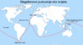 Magellan's Voyage HR.PNG 2,000 × 1,108; 391 KB
-
 Magellan-Harita-Tr.jpg 1,884 × 892; 193 KB
-
 Magellan-Map-En.png 1,357 × 643; 112 KB
-
 Magellan-Map-No.png 1,357 × 643; 74 KB
-
 Mongolempire.png 1,357 × 628; 49 KB
-
 Mundo post-Guerra Fria.png 3,050 × 1,938; 297 KB
-
 New Cold War Map 1980.png 1,405 × 703; 55 KB
-
 Old World 820.png 643 × 408; 31 KB
-
 Orbe China 1450.png 1,439 × 945; 81 KB
-
 Orbe Europa.png 1,250 × 769; 73 KB
-
 Orbe Islam 1500.png 1,442 × 962; 82 KB
-
 OrteliusWorldMap1570.jpg 5,816 × 3,961; 7.2 MB
-
 Osmanlı haritası 3.murad 1592.jpg 4,476 × 2,763; 7.57 MB
-
 Planche VI - Principales religions de l'ancien monde - liv3-ch09.png 4,224 × 2,848; 5.82 MB
-
 Portugal XVIII.png 1,427 × 628; 48 KB
-
 Portugal-1500.png 1,357 × 628; 72 KB
-
 Portuguese discoveries and explorationsV2en.png 1,357 × 628; 213 KB
-
 Post-Cold War World.png 3,048 × 1,937; 296 KB
-
 Praha, Nové Město, plakát z 21. srpna 1968.jpg 2,848 × 2,136; 1.44 MB
-
 Roman-Empire 477ad-es.svg 512 × 287; 36 KB
-
 Roman-Empire 477ad-pt.svg 512 × 287; 28 KB
-
 Rutas Jaime Duque.jpg 2,560 × 1,440; 885 KB
-
 Schouten,Spielbergen.png 1,425 × 625; 47 KB
-
 Second French Empire.png 1,425 × 625; 35 KB
-
 Spain and Portugal-ar.png 1,500 × 771; 225 KB
-
 Spain and Portugal-fr.png 1,500 × 771; 188 KB
-
 Spain and Portugal.png 1,500 × 771; 92 KB
-
 Spanish Empire - 1824.jpg 800 × 370; 25 KB
-
 Spread of Manicheanism.png 3,269 × 1,624; 4.33 MB
-
 Spread-of-printing.gif 1,400 × 725; 744 KB
-
 UK Surveying Activities Overseas 1961.jpg 4,836 × 3,936; 2.09 MB
-
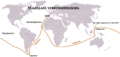
 Weltumsegelung von Ferdinand Magellan und Juan Sebastian Elcano.png 1,500 × 885; 350 KB
-
 Weltumsegelung von Magellan und Juan Sebastian Elcano.png 1,500 × 885; 297 KB
-
 World 2000 BC EL.svg 4,500 × 2,234; 824 KB
-
 World 2000 BC.png 4,500 × 2,234; 868 KB
-
 World 2000 BCE NearEast and Mediterranean.jpg 734 × 462; 73 KB
-
 World 2000 BCE.png 4,000 × 1,986; 1 MB
-
 World 2000BC.jpeg 319 × 158; 9 KB
-
 World History mid res v2.2.jpg 5,577 × 5,577; 4.14 MB
-
 World in 1 CE.png 4,000 × 2,036; 1.73 MB
-
 World in 100 BCE.PNG 4,000 × 2,036; 1.74 MB
-
 World in 100 CE.PNG 4,000 × 2,036; 1.67 MB
-
 World in 1000 BCE.png 4,500 × 2,234; 401 KB
-
 World in 200 CE.PNG 4,000 × 2,036; 1.71 MB
-
 World in 2000 BC.svg 4,500 × 2,234; 847 KB
-
 World in 250 CE.png 4,000 × 2,036; 1.7 MB
-
 World in 300 BCE.PNG 4,500 × 2,291; 1.92 MB
-
 World in 300 CE.PNG 4,000 × 2,036; 1.69 MB
-
 World in 323 BCE.png 4,500 × 2,234; 467 KB
-
 World in 400 BCE.png 4,700 × 2,392; 2.03 MB
-
 World in 400 CE.png 4,000 × 2,036; 1.71 MB
-
 World in 50 BCE.PNG 4,000 × 2,036; 1.73 MB
-
 World in 50 CE.PNG 4,000 × 2,036; 1.67 MB
-
 World in 500 BCE.png 4,000 × 1,986; 974 KB
-
 World in 500 CE.png 4,000 × 2,036; 1.72 MB
-
 World in 5000 BCE.png 4,700 × 2,392; 2.13 MB
-
 World in 700 CE.png 4,000 × 2,036; 1.74 MB
-
 World in 750 CE.png 4,000 × 2,036; 1.51 MB
-
 World in 800.png 1,357 × 617; 37 KB
-
 World in 820.png 1,200 × 600; 42 KB
-
 World in 900 CE.png 4,000 × 2,036; 1.76 MB
-
 World map 1200.jpg 5,000 × 2,605; 826 KB
-
 World map 1500.png 4,074 × 1,863; 269 KB
-
 World map 1648.png 2,476 × 1,391; 248 KB
-
 World map 1750.png 2,920 × 1,379; 266 KB
-
 World map 1871.jpg 5,000 × 2,605; 819 KB
-
 World map 1914.jpg 5,000 × 2,605; 829 KB
-
 World map 1935.png 3,058 × 1,245; 349 KB
-
 World map 1954.png 3,005 × 1,247; 331 KB
-
 World map at 2002.png 4,500 × 2,234; 204 KB
-
 World map at 2006.png 4,500 × 2,234; 204 KB
-
 World map at 2007.png 4,500 × 2,234; 204 KB
-
 World map between 2003 and 2005.png 4,500 × 2,234; 204 KB
-
 World War 1.gif 1,200 × 555; 456 KB
-
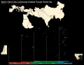 WorldsOldestCitiesContinuouslyInhabitedThroughPresentDay.svg 2,745 × 2,133; 1.68 MB
-
 Ww2 allied axis 1942 jun.png 1,480 × 628; 48 KB
-
 מפת חוזה סרגוסה.svg 1,219 × 627; 643 KB


.jpg)


.jpg)


.jpg)


.jpg)
._LOC_2001620596.jpg)