Category:Old maps of the history of France
Jump to navigation
Jump to search
Use the appropriate category for maps showing all or a large part of France. See subcategories for smaller areas:
| If the map shows | Category to use |
|---|---|
| France on a recently created map | Category:Maps of France or its subcategories |
| France on a map created more than 70 years ago | Category:Old maps of France or its subcategories |
| the history of France on a recently created map | Category:Maps of the history of France or its subcategories |
| the history of France on a map created more than 70 years ago | Category:Old maps of the history of France or its subcategories |

Subcategories
This category has the following 17 subcategories, out of 17 total.
Media in category "Old maps of the history of France"
The following 91 files are in this category, out of 91 total.
-
 'The Flight to France' by George Roux 26.jpg 394 × 273; 143 KB
-
 'The Flight to France' by George Roux 30.jpg 315 × 466; 193 KB
-
 Europe 526-600.jpg 907 × 1,427; 410 KB
-
 Europe 533-600.jpg 860 × 667; 352 KB
-
 Visigoti563.jpg 921 × 1,260; 1 MB
-
 Austrasie752.jpg 484 × 689; 78 KB
-
 Partage de l'Empire carolingien au Traité de Verdun en 843.JPG 3,597 × 3,308; 3.66 MB
-
 Zapadofranska rise.jpg 513 × 430; 182 KB
-
 Western empire verdun 843.png 1,013 × 800; 284 KB
-
.jpg/120px-Carte_du_royaume_de_France_pendant_la_mission_de_Jeanne_d%27Arc_1429-1430_(bar).jpg)
-
.jpg/116px-Carte_du_royaume_de_France_pendant_la_mission_de_Jeanne_d%27Arc_1429-1430_(rethel).jpg)
-
.jpg/120px-Carte_du_royaume_de_France_pendant_la_mission_de_Jeanne_d%27Arc_1429-1430_(vertus).jpg)
-
 Carte du royaume de France pendant la mission de Jeanne d'Arc 1429-1430.jpg 6,900 × 6,935; 19.52 MB
-
 1574 Ortelius Royon detail.jpg 1,920 × 1,337; 1.59 MB
-
 Sebastião Lopes 1575.jpg 2,232 × 3,100; 4.32 MB
-
 1576 Ortellius ARTOIS.jpg 960 × 1,323; 1.07 MB
-

-
 1747 La Feuille Map of France - Geographicus - France-ratelband-1747.jpg 2,500 × 1,691; 1.76 MB
-
 1762 Janvier Map of France - Geographicus - FranceMil-janvier-1762.jpg 3,500 × 2,462; 2.78 MB
-
 1775 Zannoni Two Panel Map of France - Geographicus - France-zannoni-1775.jpg 3,996 × 5,000; 6.5 MB
-
 1780 Raynal and Bonne Map of France - Geographicus - France-bonne-1780.jpg 2,500 × 1,686; 1.27 MB
-
 Carte de France 1789.jpg 1,789 × 1,240; 275 KB
-
-

-
_Map_of_FRANCE%2C_published_by_Gale%2C_Curtin_%26_Fenner.jpg/120px-(1814)_Map_of_FRANCE%2C_published_by_Gale%2C_Curtin_%26_Fenner.jpg) (1814) Map of FRANCE, published by Gale, Curtin & Fenner.jpg 2,777 × 2,274; 4.18 MB
(1814) Map of FRANCE, published by Gale, Curtin & Fenner.jpg 2,777 × 2,274; 4.18 MB
-
 1814 Thomson Map of France - Geographicus - France-t-1814.jpg 6,000 × 5,160; 9.18 MB
-
 1818 Pinkerton Map of France - Geographicus - France-pinkerton-1818.jpg 5,000 × 3,653; 4.95 MB
-
 Medieval Ecclesiastical Divisions of France.jpg 3,010 × 3,890; 3.55 MB
-
 France XVe siècle.jpg 900 × 970; 372 KB
-
 France ecc 1789 1802.jpg 1,114 × 943; 291 KB
-
.jpg/77px-373_of_%27Lectures_on_the_History_of_England%27_(11128791584).jpg) 373 of 'Lectures on the History of England' (11128791584).jpg 1,270 × 1,985; 566 KB
373 of 'Lectures on the History of England' (11128791584).jpg 1,270 × 1,985; 566 KB
-
.jpg/104px-400_of_%27La_France_Illustrée-_géographie_générale_..._Par_F._J%27_(11293770684).jpg) 400 of 'La France Illustrée- géographie générale ... Par F. J' (11293770684).jpg 1,267 × 1,457; 527 KB
400 of 'La France Illustrée- géographie générale ... Par F. J' (11293770684).jpg 1,267 × 1,457; 527 KB
-
.jpg/120px-thumbnail.jpg)
-

-
.jpg/120px-49_of_%27Clovis%2C_ou_la_France_au_Ve_siècle%27_(11300740196).jpg) 49 of 'Clovis, ou la France au Ve siècle' (11300740196).jpg 1,664 × 1,261; 520 KB
49 of 'Clovis, ou la France au Ve siècle' (11300740196).jpg 1,664 × 1,261; 520 KB
-
.jpg/83px-535_of_%27Histoire_de_la_révolution_de_1870-71_..._Illustrée%2C_etc%27_(11097465236).jpg) 535 of 'Histoire de la révolution de 1870-71 ... Illustrée, etc' (11097465236).jpg 2,060 × 2,973; 1.33 MB
535 of 'Histoire de la révolution de 1870-71 ... Illustrée, etc' (11097465236).jpg 2,060 × 2,973; 1.33 MB
-
.jpg/99px-79_of_%27Histoire_de_l%27unité_politique_et_territoriale_de_la_France%27_(11128300575).jpg) 79 of 'Histoire de l'unité politique et territoriale de la France' (11128300575).jpg 1,336 × 1,613; 602 KB
79 of 'Histoire de l'unité politique et territoriale de la France' (11128300575).jpg 1,336 × 1,613; 602 KB
-
.jpg/101px-91_of_%27La_France_et_les_Français_à_travers_les_siècles_..._Ouvrage_couronné_par_l%27Académie_francaise._Contenant_..._gravures%2C_etc%27_(11158085753).jpg)
-
_(14590972979).jpg/68px-A_history_of_all_nations_from_the_earliest_times%3B_being_a_universal_historical_library_(1905)_(14590972979).jpg)
-

-
.jpg/120px-A_Section_of_the_Map_of_the_British_Colonies_in_North_America_(John_Mitchell_1755).jpg) A Section of the Map of the British Colonies in North America (John Mitchell 1755).jpg 13,554 × 7,974; 8.82 MB
A Section of the Map of the British Colonies in North America (John Mitchell 1755).jpg 13,554 × 7,974; 8.82 MB
-
 Acta Eruditorum - III mappe Francia, 1703 – BEIC 13363829.jpg 1,961 × 1,606; 189 KB
-
 Ancient provinces, France and departments that replaced them. Wellcome M0016661.jpg 3,780 × 2,992; 2.26 MB
-
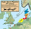 Anglo.Saxon.migration.5th.cen.jpg 1,800 × 1,703; 875 KB
-
_(14783970095).jpg/75px-Atlas_of_European_history_(1909)_(14783970095).jpg) Atlas of European history (1909) (14783970095).jpg 2,282 × 3,638; 1.57 MB
Atlas of European history (1909) (14783970095).jpg 2,282 × 3,638; 1.57 MB
-
 Atlas Ortelius KB PPN369376781-020av-020br.jpg 3,000 × 2,194; 4.26 MB
-
 Blagnac, sa baronnie en 1320.jpg 987 × 1,223; 262 KB
-
 Canada et Louisiane - par le Sr. le Rouge ingénieur géographe du Roy. NYPL434488.tiff 4,848 × 5,907; 81.94 MB
-
 Canada, Louisiane et terres angloises - par le Sr. d'Anville ... NYPL1261071.tiff 7,668 × 5,927; 130.05 MB
-
 Canada, Louisiane et terres angloises - par le Sr. d'Anville ... NYPL1261393.tiff 11,329 × 6,881; 223.06 MB
-

-

-

-

-

-
.jpg/105px-Carte_pour_l%27histoire_de_l%27Europe_-_par_Bémont_%3B_et_Monod%2C_-_btv1b8440548q_(5_of_5).jpg) Carte pour l'histoire de l'Europe - par Bémont ; et Monod, - btv1b8440548q (5 of 5).jpg 3,869 × 4,400; 2.27 MB
Carte pour l'histoire de l'Europe - par Bémont ; et Monod, - btv1b8440548q (5 of 5).jpg 3,869 × 4,400; 2.27 MB
-
 D161- N° 346. France de la Guerre de Cent ans. - liv3-ch08.png 1,436 × 1,580; 344 KB
-
 D339- N° 372. La France à la fin du XVe siècle. - liv3-ch11.png 1,436 × 1,784; 273 KB
-
 Diocèse de trèves Messincour.png 672 × 447; 325 KB
-
 Europe 526-600 japref.jpg 900 × 1,400; 325 KB
-
 EvansPownallMap1755.jpg 2,048 × 1,535; 1.77 MB
-
 France 12thC.jpg 968 × 1,541; 497 KB
-
 France 1800.jpg 2,000 × 1,865; 3.9 MB
-
.jpg/120px-France_1802_(102_Departments).jpg) France 1802 (102 Departments).jpg 7,260 × 7,024; 10.93 MB
France 1802 (102 Departments).jpg 7,260 × 7,024; 10.93 MB
-
.jpg/120px-France_1802-1804_(108_Departments).jpg) France 1802-1804 (108 Departments).jpg 9,867 × 8,982; 18.04 MB
France 1802-1804 (108 Departments).jpg 9,867 × 8,982; 18.04 MB
-
 France 1815.jpg 585 × 602; 114 KB
-
 France 1849 Political 2486023.jpg 10,700 × 7,835; 45.83 MB
-
 France 1900 map.jpg 1,064 × 1,447; 251 KB
-
.jpg/120px-France_divided_into_circles_and_departments_(3045238825).jpg) France divided into circles and departments (3045238825).jpg 2,000 × 1,621; 3.23 MB
France divided into circles and departments (3045238825).jpg 2,000 × 1,621; 3.23 MB
-
.jpg/120px-France_divided_into_circles_and_departments_(4587185888).jpg) France divided into circles and departments (4587185888).jpg 2,000 × 1,927; 4.41 MB
France divided into circles and departments (4587185888).jpg 2,000 × 1,927; 4.41 MB
-
 France during Franco-Prussian War December1870.jpg 1,981 × 1,719; 1.65 MB
-
 France frontiers 1601 1766.jpg 1,252 × 1,790; 477 KB
-
 France in 1792.jpg 1,033 × 637; 167 KB
-
 France XVe siècl2e.jpg 900 × 970; 839 KB
-
 France.1804.jpg 1,106 × 992; 461 KB
-
_on_8_May_1916_(cropped).jpg/120px-François_Georges-Picot_signature_from_the_Sykes_Picot_Agreement_Map_(signed)_on_8_May_1916_(cropped).jpg)
-
.jpg/97px-thumbnail.jpg)
-
.jpg/97px-thumbnail.jpg)
-
.jpg/98px-thumbnail.jpg)
-
.jpg/98px-thumbnail.jpg)
-
.jpg/120px-Image_taken_from_page_87_of_%27Overzicht_der_algemeene_en_vaderl._geschiedenis%2C_met_20_historische_Kaarten%2C_voor_de_lagere_Klassen%2C_etc%27_(11220901573).jpg)
-
.jpg/99px-Image_taken_from_page_87_of_%27Overzicht_der_algemeene_en_vaderl._geschiedenis%2C_met_20_historische_Kaarten%2C_voor_de_lagere_Klassen%2C_etc%27_(16589458992).jpg)
-
.jpg/101px-Image_taken_from_page_87_of_%27Overzicht_der_algemeene_en_vaderl._geschiedenis%2C_met_20_historische_Kaarten%2C_voor_de_lagere_Klassen%2C_etc%27_(16590117835).jpg)
-
 Kriegstheater oder Graenzkarte Zwischen Frankreich und Italien.jpg 7,304 × 6,474; 16.3 MB
-
 Louis Napoleon Bonaparte - Histoire de Cesar - Atlas 2 - Planche 01.jpg 1,877 × 1,311; 1.18 MB
-
 Louis Napoleon Bonaparte - Histoire de Cesar - Atlas 2 - Planche 02.jpg 1,625 × 1,003; 731 KB
-
 Louis Napoleon Bonaparte - Histoire de Cesar - Atlas 2 - Planche 03.jpg 1,248 × 988; 458 KB
-
 Mappe der Schlacht in Frankreich-Juni 1940.jpg 2,476 × 2,284; 1.49 MB
-
_on_8_May_1916_-_(cropped).jpg/120px-Mark_Sykes_signature_from_the_bottom_of_the_Sykes_Picot_Agreement_Map_(signed)_on_8_May_1916_-_(cropped).jpg)
-
 MPK1-426 Sykes Picot Agreement Map signed 8 May 1916.jpg 3,322 × 3,225; 5.7 MB
-
 Nice - Ville capitale du Comté de meme nom, Située sur les Frontiers d'Italie.jpg 9,210 × 6,670; 12.29 MB


.jpg)
.jpg)
.jpg)


_Map_of_FRANCE,_published_by_Gale,_Curtin_%26_Fenner.jpg)


.jpg)
.jpg)
.jpg)

.jpg)
.jpg)
.jpg)
.jpg)
_(14590972979).jpg)
.jpg)


_(14783970095).jpg)


.jpg)


.jpg)
.jpg)


.jpg)
.jpg)


.jpg)
.jpg)
.jpg)
.jpg)
.jpg)
.jpg)
.jpg)


_on_8_May_1916_-_(cropped).jpg)


_on_8_May_1916_(cropped).jpg)