Facebook’s Disaster Maps

Facebook

Today Facebook announced disaster maps for use by relief organizations. Based on aggregated and anonymized user data, the maps of users’ location, movement and check-ins can, Facebook says, provide relief organizations with valuable information about where the need is greatest. At launch only the Red Cross, UNICEF and the World Food Programme will have access to the data; a process will be established to determine how it will be shared with others. [Engadget]

Patents and Cartographic Inventions

Published late last month, Mark Monmonier’s new book, Patents and Cartographic Inventions: A New Perspective for Map History (Palgrave Macmillan) is on a somewhat more arcane and non-obvious subject than his usual fare. It’s an exploration of the U.S. patent system that focuses on map- and navigation-related inventions. The publisher’s description: “In probing evolving notions of novelty, non-obviousness, and cumulative innovation, Mark Monmonier examines rural address guides, folding schemes, world map projections, diverse improvements of the terrestrial globe, mechanical route-following machines that anticipated the GPS navigator, and the early electrical you-are-here mall map, which opened the way for digital cartography and provided fodder for patent trolls, who treat the patent largely as a license to litigate.” Actually sounds interesting as hell; the book is quite expensive, though. Amazon, iBooks.

The Earth at Night, Updated

NASA Earth Observatory images by Joshua Stevens, using Suomi NPP VIIRS data from Miguel Román, NASA’s Goddard Space Flight Center.

NASA has released updated global maps of the Earth at night. The so-called “black marble” maps show where human activity lights up the darkness. NASA’s page highlights some of the differences between the 2016 and 2012 versions of the map with before/after interactive sliders. John Nelson has tried something different: overlaying the 2016 map on the 2012 map with a clipping mask shows newly illuminated parts of the globe as dark patches.

John M. Nelson, “A Changing Earth at Night,” 2017.

National Geographic Infographics

ng-infographicsSpeaking of National Geographic. If the magazine is known for its cartography and its photography, one should not forget the illustrations, charts and infographics that accompany many of the articles and appear on the back of every folded map that comes several times a year with a magazine subscription. Now there’s a book of them: National Geographic Infographics. Edited by Julius Wiedemann and published by Taschen, the book “gather[s] the magazine’s best infographics of the past 128 years.” More at Atlas Obscura and Wired.

Missing Maps

Quartz takes a look at the Missing Maps project, which I suppose can best be described as a way to jumpstart mapping the unmapped developing regions of the world with OpenStreetMap. What’s interesting about Missing Maps is how it systematically deals out tasks to people best able to do them: remote volunteers trace imagery, community volunteers do the tagging and labelling. There’s even an app, MapSwipe, that gives its users “the ability to swipe through satellite images and indicate if they contain features like houses, roads or paths. These are then forwarded onto Missing Maps for precise marking of these features.” [WMS]

Mapping Online Gun Sales

npr-armslist
NPR

As part of an article looking at semi-automatic weapons being sold online, NPR produced the above map, which shows the locations of classified listings on Armslist (a website described as “the Craigslist of guns”) between 12 and 15 June 2016 (i.e., immediately after the Orlando nightclub shooting). About 90 percent of Armslist listings had location data; about one in four of these listings are for semi-automatic weapons. [Maps on the Web]

Previously: In the U.S., Toddlers Shoot People Often Enough That It Can Be Mapped.

The Princeton Braillists

princeton-braillists
Princeton Braillists’ map of Alaska: master master tooled in metal foil (left); thermoform copy made from metal master (right).

The Princeton Braillists publish tactile maps and atlases for a blind readership. Several books of maps are available: world and regional atlasesmaps of U.S. states, and others.

Maps and drawings are created by hand in an aluminum foil sheet. The metal is embossed with a variety of tools to produce raised lines and areas of varying height, texture and width. The maps are labelled with key letters that are identified on the pages preceding each map. The master drawing is duplicated by the Thermoform process to make clear, sharp copies. The 11×11½-inch plastic sheets are bound into volumes with cardboard covers and spiral plastic binders.

[cartogeek]

Burial Records Move from Window-Blind Maps to Digital Database

Nick Malawskey of Pennlive.com has the story of how the Newport Cemetery digitized its burial records, which had previously been recorded as hand-drawn maps on the back of window blinds.

It was, to say the least, an imperfect system. Caretakers essentially acted as the cemetery’s librarians, but without a Dewey Decimal system to guide them. Numbers were not necessarily sequential, or the system shifted over the years, making the maps essential to finding the older graves. And as time rolled on, the maps began to deteriorate, fraying at the edges or cracking apart.

[WMS]

Atlas of Canada

Book cover: Atlas of Canada I only just now found out about the new edition of Canadian Geographic‘s Atlas of Canada—via an item broadcast on CTV yesterday—or I would have included it in this year’s gift guide. It’s apparently the first new edition in a decade. (Incidentally this should not be confused with the Canadian government’s online Atlas of Canada, an entirely distinct beast.)

On the Map: A New Book from Simon Garfield

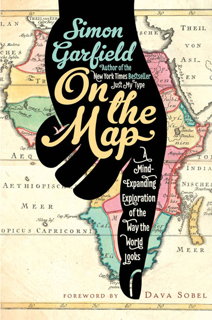
Book cover: On the MapVia a post by Mark Ovenden on Facebook, I learn about a new book by Simon Garfield, On the Map, which from the description sounds like a book in the vein of Mike Parker’s Map Addict and Ken Jennings’s Maphead.

From the British publisher’s description: “From the early sketches of philosophers and explorers through to Google Maps and beyond, Simon Garfield examines how maps both relate and realign our history. His compelling narratives range from the quest to create the perfect globe to the challenges of mapping Africa and Antarctica, from spellbinding treasure maps to the naming of America, from Ordnance Survey to the mapping of Monopoly and Skyrim, and from rare map dealers to cartographic frauds. En route, there are ‘pocket map’ tales on dragons and undergrounds, a nineteenth century murder map, the research conducted on the different ways that men and women approach a map, and an explanation of the curious long-term cartographic role played by animals.”

It’s out next month in Britain; the U.S. edition will be out at the end of December.

Buy at Amazon | author’s page | publisher (UK) | publisher (USA)