David Nuttall’s Maps of Fictional Places

An excerpt from David Nuttall's hand-drawn map of the fictional islands of Kjempsavor Ayars.
David Nuttall

Geofiction involves creating imaginary worlds through maps—maps of fictional places, but without the story attached—and David Nuttall has been at it since the age of five. He says he’s gotten better since then (his gallery, sorted by medium: see if he’s right). One of his maps is featured in the new (6th) volume of the NACIS Atlas of Design; Nat Case writes about it here:

David’s maps do wear the sorts of stylistic suits of clothes “regular” referential maps use. They studiously use stylesheets from particular eras and schools of cartography. And the “places” mapped, like most historical fiction, has strong roots in actual geographies. The patterns of settlement and transportation, the way landforms relate to one another: David knows his stuff. And so this map, “Kjempsavor Ayars,” looks like the Faeroes … and the Shetlands, the Outer Hebrides, or the islands of Norway. And the map artwork looks a lot like a kind of map-making from the early mid-20th century, where old schools of hand-lettering and drafting met an ever-more-engineered modern world. But, and this is such a puzzle to know what to do with: It’s not actually of anywhere. There’s no stories to back you up about this bridge or that ferry route, the Viking history of that settlement or the modern fishing industry at that port. It suggests there ought to be a history like that, but it unexpectedly leaves you with that job.

The Atlas of Design, vol. 6, costs $25 and can be bought here; David’s shop is here.

Sorol

Sorol world map

Another one for those of you who like geofiction as much as I do. The Sorolpedia is an online encyclopedia of the distant and fictional world of Sorol, containing articles about the planet and its inhabitants. The maps are something else: far better than you’d expect from such a project (there’s even a KML file to import it into Google Earth). Its creator has put it on indefinite hiatus since 2010, so we may not see any more updates, but it’s still fascinating stuff.

OpenGeofiction

Screenshot: OpenGeofiction

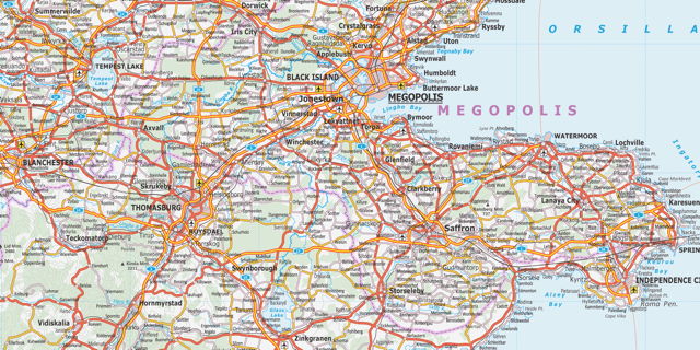
I love geofiction—creating imaginary worlds through maps—and OpenGeofiction is something I’ve wanted to see for a long time: a collaborative map of an imaginary world that is built with OpenStreetMap’s editing tools. The world is divided into territories, some of which any member can edit, others that are assigned to individual members (after a waiting period). More info here.

I’ve been playing with it and am already nervous about the amount of time I can see myself losing to this. (Though one wrinkle is having no real-world referents to determine scale: without GPS traces or aerial imagery, figuring out how big a house, or a cloverleaf loop, should be is going to be tricky.)

Previously: Ian Silva’s Koana Islands.

Ian Silva’s Koana Islands

Koana Islands (Ian Silva)

Wired Map Lab has the story of Ian Silva, who’s been posting astonishing road and transit maps of the imaginary Koana Islands to Reddit; the Islands now have their own section on the site, replete with a travel guide. It’s as serious an undertaking as William Sarjeant’s Rockall, Jerry Gretzinger’s Ukrainia, or Austin Tappan Wright’s Islandia.

I admit it: I love geofiction—creating imaginary worlds through maps—and I always get excited when I encounter a great new mapmaker. This is no exception.

Jerry’s Map

Jerry Gretzinger’s map began as a little doodle. Then it began to take on a life of its own. Jerry uses a deck of cards to determine how the map is revised, with near-mystical results. “Yes, it’s alive. It changes. My hand puts the paint on the paper and then I step back and say, ‘Wow, look at that,’ as though I was not the perpetrator. I’m just the observer.” I could see myself having this much fun. Via MetaFilter.