At about this time of the year I assemble a gift guide that lists some of the noteworthy books about maps that have been published this year. It’s by no means a comprehensive list, but if someone in your life is just a little bit obsessed about maps (and if you don’t have such a person, why don’t you?), and you’re looking for something to get them, this list might be of use.
Some of these books you’ve seen me blog about before; others I’m mentioning for the first time.
Historical Maps
Mappa Mundi: Hereford’s Curious Map by Sarah Arrowsmith (Logaston Press, April 2015). “The first chapter of the book tackles some of the questions asked by the many people who visit Hereford Cathedral today to see the Mappa Mundi. Who made the map? Did they think the world was flat? How was it made, and where? The book then shows us the map seen through the eyes of a medieval visitor to the cathedral.”
Great Escapes: The Story of MI9’s Second World War Escape and Evasion Maps by Barbara Bond (Times Books, October 2015). A history of the escape maps produced for prisoners of war. My blog post.

Revolution: Mapping the Road to American Independence, 1755-1783 by Richard H. Brown and Paul E. Cohen (W. W. Norton, October 2015). “When warfare erupted between Britain and her colonists in 1775, maps provided graphic news about military matters. A number of the best examples are reproduced here, including some from the personal collections of King George III, the Duke of Northumberland, and the Marquis de Lafayette. Other maps from institutional and private collections are being published for the first time. In all, sixty significant and beautiful cartographic works from 1755 to 1783 illustrate this intriguing era.”
Mapping the Second World War by Peter Chasseaud (Collins, October 2015). A collection of historical maps; a sequel to Chasseaud’s 2013 book Mapping the First World War. Appears to be available in Britain only. My blog post.
The History of Cartography, Volume Six: Cartography in the Twentieth Century edited by Mark Monmonier (University of Chicago Press, May 2015). The sixth installment of the massive History of Cartography Project takes two physical books and nearly two thousand pages to cover mapmaking in the twentieth century. (Volumes one through three can be downloaded as PDFs. Volumes four and five are still in preparation.) My blog post.
Map Collections
Map: Exploring the World (Phaidon Press, September 2015). A collection of “300 stunning maps from all periods and from all around the world,” assembled by “an international panel of cartographers, academics, map dealers and collectors.” My blog post.
Mind the Map: Creative Mapmaking and Cartography edited by Antonis Antoniou, Robert Klanten and Sven Ehmann (Gestalten, September 2015). “[A] showcase that reflects the broad range of work now being created by a new generation of mapmakers from around the world including classically legible maps, artistic experiments, editorial illustrations, city views, vacation guides, and global overviews.” My blog post.

The Curious Map Book by Ashley Baynton-Williams (British Library/University of Chicago Press, October 2015). “With The Curious Map Book, Ashley Baynton-Williams gathers an amazing, chronologically ordered variety of cartographic gems, mainly from the vast collection of the British Library.”
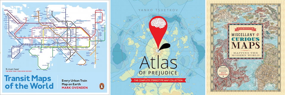
Transit Maps of the World by Mark Ovenden (Particular Books/Penguin USA, November 2015). A revised and expanded edition of Mark’s compilation of every urban transit map on the planet. (Here’s my review of the first edition.) My blog post.
The Art of Illustrated Maps: A Complete Guide to Creative Mapmaking’s History, Process and Inspiration by John Roman (HOW Design, November 2015). A rare look at “illustrated” or conceptual (rather than strictly geographic) maps. “This book maps the origins and history of creative cartography, analyzes why our brains so easily relate to conceptual maps, presents how professional artists create illustrated maps, and showcases the works of contemporary map illustrators from around the world.”

Atlas of Prejudice: The Complete Stereotype Map Collection by Yanko Tsvetkov (CreateSpace, July 2015). Yanko Tsvetkov’s maps of stereotypes and prejudices are a staple of the cartographic Web. The Atlas of Prejudice contains all the maps from his two previous self-published collections, plus 25 more. My blog post.
Vargic’s Miscellany of Curious Maps by Martin Vargic (Michael Joseph, October 2015/
Maps and Literature
Plotted: A Literary Atlas by Andrew DeGraff (Zest Books, October 2015). DeGraff’s distinct and idiosyncratic maps aren’t necessarily of books you’d expect maps for (e.g., A Christmas Carol); these are maps of the stories, not their setting, which means a completely different perspective that takes into account both time and distance travelled. My blog post.
The Art of The Lord of the Rings by Wayne G. Hammond and Christina Scull (HarperCollins/Houghton Mifflin Harcourt, October 2015). A collection of about 180 of the maps, sketches and drawings Tolkien created to help him visualize the world he was inventing. Sample images. My blog post.
