Vargic’s Miscellany of Curious Maps

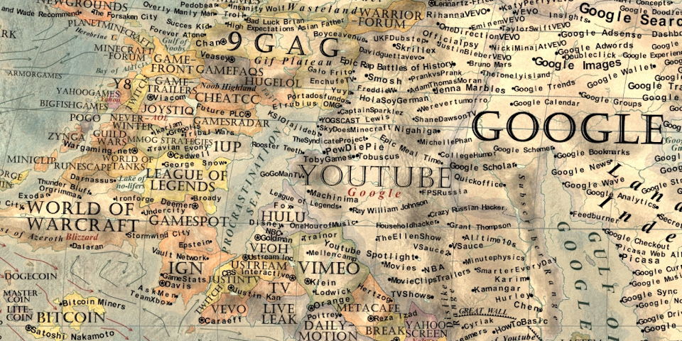
Vargic's Map of the Internet 2.0 (detail)

Vargic's Miscellany of Curious Maps (book cover)In January 2014 a teenage design student from Slovakia named Martin Vargic posted a map of the Internet—inspired, he told The Independent, by the xkcd classic—on his DeviantArt page. The map quickly went viral. Since then, he’s been producing maps of all sorts of things—a revised Internet map, a literature map, historical maps, maps of the world after global warming and an ice age, a stereotype map (see previous entry), plus other infographics—at a dizzying pace, most of which are available for sale on his website. Now his maps are being collected in a book, Vargic’s Miscellany of Curious Maps. It’s out now in the U.K. from Penguin imprint Michael Joseph; in North America it’ll be available in December from HarperCollins. Did I mention he’s a teenager?

Map of Middle-earth, Annotated by Tolkien Himself, Discovered

Detail of map of Middle-earth annotated by J. R. R. Tolkien

A map of Middle-earth annotated by J. R. R. Tolkien has been found. The map, found among the papers of illustrator Pauline Baynes, who died in 2008, was used by Baynes while she worked on a full-colour map of Middle-earth published in 1970. Tolkien’s annotations appear on the map in green ink and pencil; they not only correct some of the errors of the original map (executed by his son, Christopher); they also offer some geographical parallels to our own world (Hobbiton is at the same latitude as Oxford, Minas Tirith at Ravenna’s). Blackwell’s Rare Books is selling the map for £60,000; it’s the centrepiece of a forthcoming catalogue on the work of Pauline Baynes. [Tor.com]

Map: Exploring the World

Map: Exploring the World (inside)

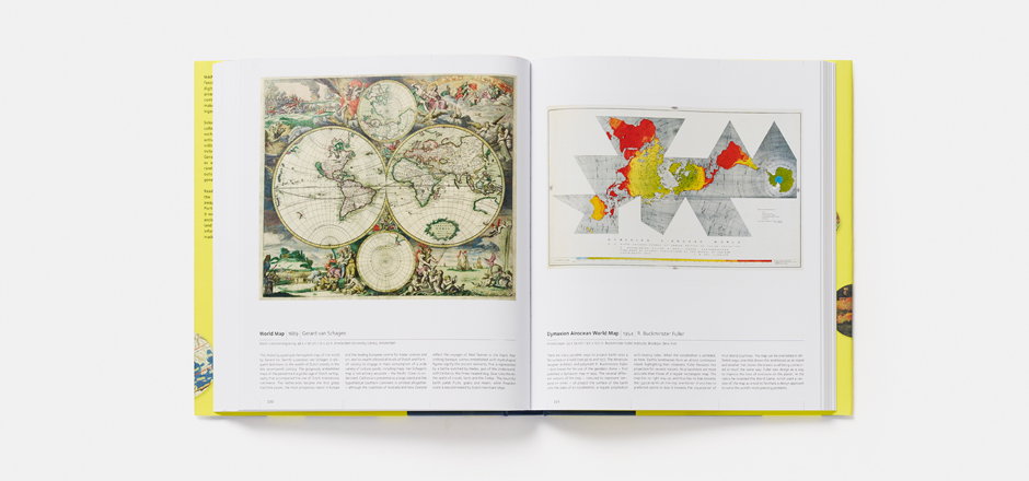
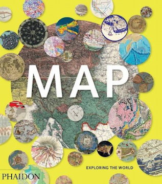
Map: Exploring the World (cover) The run-up to every holiday season produces a fresh batch of lavishly illustrated map books, and this year does not appear to be an exception. Map: Exploring the World, a collection of “300 stunning maps from all periods and from all around the world,” came out last month from Phaidon Press. The book was assembled by “an international panel of cartographers, academics, map dealers and collectors,” the publisher says; Forbes contributor Bruce Dorminey’s look at this book reveals that one of them was Library of Congress map curator John Hessler.

The Art of The Lord of the Rings

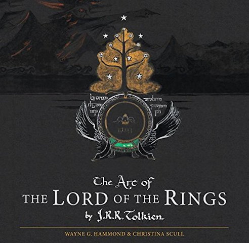
Book cover: The Art of The Lord of the Rings When J. R. R. Tolkien was writing The Lord of the Rings, the map was not an afterthought. (For one thing, with characters travelling many miles over many months, separately and together, distances and dates had to add up.) Tolkien didn’t just draft; he drew—maps, sketches, drawings, whatever he needed to help him visualize the world he was inventing. About 180 of those maps and drawings are now collected in a new book out today: The Art of The Lord of the Rings, edited by Wayne G. Hammond and Christina Scull (who previously authored The Lord of the Rings: A Reader’s Companion). Wired has some sample images. (From what I can tell, the British edition is slipcased.) [Boing Boing/MetaFilter]

Atlas of Cursed Places

Book cover: Atlas of Cursed Places The first thing to keep in mind about Olivier Le Carrer’s Atlas of Cursed Places (Black Dog & Leventhal, October 2015) is that it’s not an atlas. Rather, it’s a collection of brief essays about a series of unique places around the world. In that I suspect it’s much like Judith Schalansky’s Atlas of Remote Islands or Aude de Tocqueville’s Atlas of Lost Cities (English translation forthcoming next year). All of these books shared a publisher in France; all of them appear to have been conceived under the influence of Calvino.

The Atlas of Cursed Places’s essays are about places in the world that are, for one reason or another, particularly horrible, by dint of their history or geography. There are navigational hazards and environmental disasters, and sites of old horrors that were entirely human-made. Ghost towns, war zones, slums and mausoleums. Animal infestations. Each are engrossing, but the essays barely get started on their subjects: turn the page expecting more and you find yourself already on the next one. Each essay is an act of cruelty (very meta given the subject matter), whetting readers’ appetites but denying us the feast.

In the end this is an exercise in curation: the choices are fascinating, but the essays are affective rather than substantive. In that sense this book is an even lighter read than Alastair Bonnet’s Unruly Places (which seems to have much less Calvino in its book DNA).

(While not an atlas proper, this book does have a lot of maps illustrating each essay. But their effect is disorienting: each cursed place is indicated by a star on an old and out-of-date map, usually a plate from a century-old atlas.)

I received an electronic review copy of this book from the publisher via NetGalley.

Amazon | iBooks
A Fantasy Map Roundup

Map for The Fifth Season by Tim PaulN. K. Jemisin talks about the map that accompanies her new fantasy novel, The Fifth Season. Uncharacteristically for a fantasy map, but appropriately for the novel, it indicates tectonic plate boundaries. Also uncharacteristic is its use of shaded relief to indicate mountains. The map was executed by Tim Paul, whose portfolio is here.

Tor.com is giving away 10 copies of a fold-out poster map that accompanies the boxed set of Brandon Sanderson’s Mistborn trilogy. (Entry deadline is October 9 at noon EDT.)

Jake Hayes is collecting maps from children’s fiction on Pinterest.

At The Funambulist last January, Léopold Lambert discussed the use of cartography in François Schuiten and Benoit Peeters’s 2004 graphic novel The Invisible Frontier (Vol. 1, Vol. 2).

As Fabrice Leroy exposes in “The Representation of Politics and the Politics of Representation in Schuiten and Peeters’s La Frontière Invisible,” (History and Politics in French-Language Comics, Jackson: The University of Mississippi Press, 2008, 117-136), two cartographic paradigms oppose each other throughout Schuiten and Peeters’ novel. The first one is carried by an old man, Monsieur Paul, who is committed to make maps that reflects on the historic conditions of a place, both at an individual empirical level and at a collective (inter)national one. This interpretation of the map is particularly illustrated in the first part of the story with the delicate care of each body interacting empirically with the model/terrain. The second one is also embodied by a character, Ismail Djunov, who undertook to automatize the process of map-making through monumental machines aiming at an objective cartography.

Something else for me to track down. The Invisible Frontier seems to be out of print.

New Edition of Transit Maps of the World

Book cover: Transit Maps of the World A revised and expanded edition of Mark Ovenden‘s Transit Maps of the World is coming out in early November, presumably because the transit systems, and the maps thereof, have also been revised and expanded since the first edition was published in 2007. (My review of the first edition is here.) It’s being published by Penguin in the U.S. and Particular Books (a Penguin imprint) in the U.K. [Amazon]

Mercator Puzzle

Mercator Puzzle (screenshot)

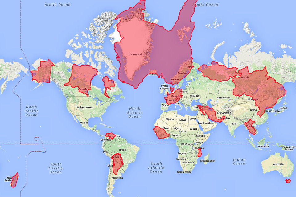
The Mercator Puzzle is an excellent way to visualize the distortions inherent in the Mercator projection, which conserves angles (useful for navigation) by exaggerating size at the poles (problematic in virtually every other use). Click and drag the countries in this in-browser app to see just how dramatically larger or smaller they become as you move them closer to and further away from the poles. [Boing Boing]

Previously: Review: Rhumb Lines and Map Wars; Reversing the Mercator Effect.