Cartographer Daniel Huffman, whose work I posted about a few times on The Map Room, has created a map of Lake Michigan in which the lake’s shoreline has been unfurled into a straight line. “I made this map because I wanted to show space referenced against a natural feature, rather than figuring locations based on the cardinal directions of north/south/etc.,” he says. “I think it’s a very human perspective, grounded in how we relate to the lake, rather than how it looks from space.” (With a 1:6 width/height ratio, it’s also insanely long, rather like a vertical Tabula Peutingeriana, and as such hard to display an excerpt of: you have to sacrifice detail or a sense of the whole. Which is to say: go and see the whole thing.) Via Kottke.
Month: September 2015
More Maps of Ceres

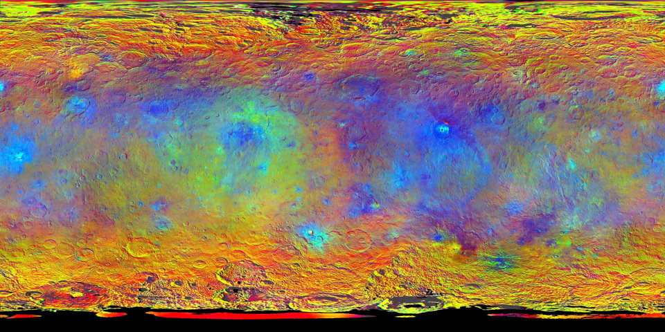
New maps of Ceres were released today at the European Planetary Science Conference in Nantes, France. One is a colour-coded topopgraphical map that resembles a map we saw earlier but adds newly approved names for topographical features. Another, the false-colour map seen above, combines imagery through infrared, red and blue filters and highlights compositional differences on Ceres’ surface (different materials reflect light at different frequencies).
Eleusinian Mysteries
Another fantasy story featuring maps, Charlotte Ashley’s “Eleusinian Mysteries,” appears in this month’s issue of Luna Station Quarterly. In it, a Javanese-Dutch mapmaker named Maghfira is punished for making maps of the moon that include a seemingly fanciful feature: a city named Eleusis. Naturally—this is an sf/fantasy story, after all—Eleusis turns out to be not so fanciful, and Maghfira gets herself into further trouble in its pursuit. The story says a little about maps and forbidden knowledge, rather more about about alienation and the urge to strike out into the unknown.
A Geographically Accurate Tube Map

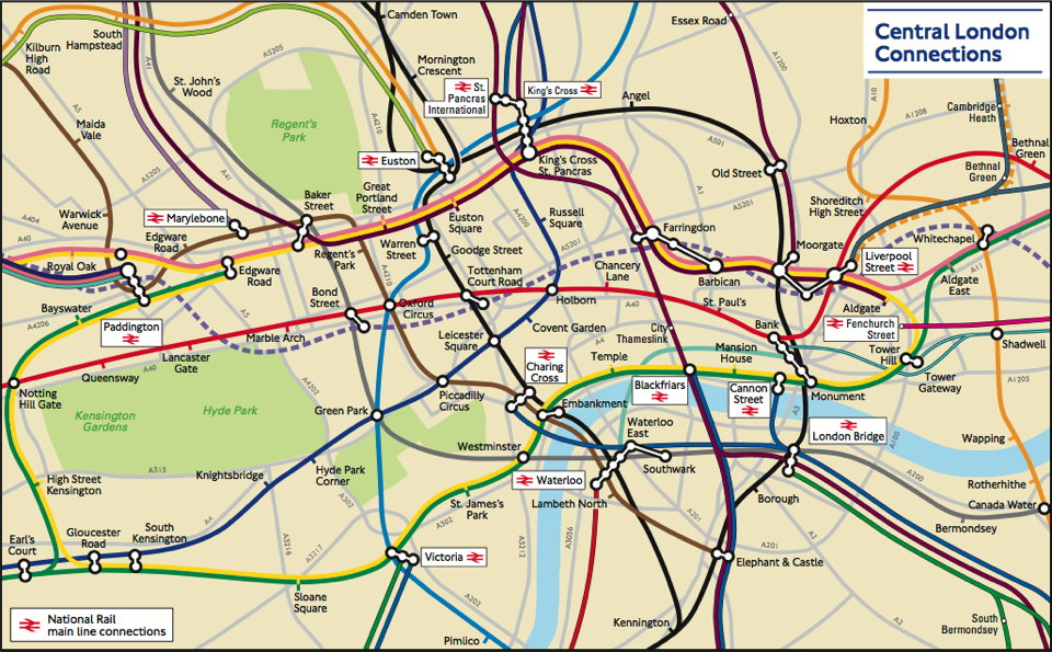
There is no transit map more iconic than the London Underground’s Tube map. First created by Harry Beck in the 1930s, the design has inspired countless other transit network maps that are schematic diagrams rather than geographically accurate maps. But Transport for London, which operates the Underground, also has a geographically accurate map of the network: it was strictly for internal use, but a freedom of information request has now brought it to light. It’s available here (PDF). The response has been so good that TfL now says it’ll be added to their website. CityMetric, Mapping London.
Real World vs. Fantasy Maps
In my study of fantasy maps, one thing I’m particularly interested in is the difference between fantasy maps and their real-world counterparts. Those differences can be substantial; at some point I hope to go into a bit more depth about them. Meanwhile, James Hinton’s guest post at The Worldbuilding School tries to address this subject by comparing a single real-world city map (London, 1653) with a non-canonical map of Osgiliath from a role-playing game. His point turns out to be that fantasy settings should make sense (Osgiliath, according to the map, doesn’t): it’s a question of geography rather than cartography. The territory rather than the map. But if you begin building your fantasy world by drawing the map … [MetaFilter]
Atlas of Stereotypes
Back when I was doing The Map Room, I followed along as Yanko Tsvetkov started producing map after map of European stereotypes. The project really took off. He’s kept at it since, while I wasn’t looking quite as closely; he’s also collected them into two self-published volumes called the Atlas of Prejudice, which appear to have sold rather well in several different languages. As of July, an all-in-one edition, Atlas of Prejudice: The Complete Stereotype Map Collection, containing all the maps from the previous volumes plus 25 more, is now available.
Previously: Yanko Tsvetkov’s Beloved Europe; Mapping European Stereotypes; Stereotype Maps of the World, Unite!
Mind the Map
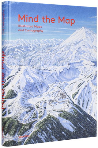
 A new book of map art is due out from Gestalten later this month. Mind the Map, edited by Antonis Antoniou, Robert Klanten and Sven Ehmann, seems very much in the same vein as their previous effort, A Map of the World. “Mind the Map is a showcase that reflects the broad range of work now being created by a new generation of mapmakers from around the world including classically legible maps, artistic experiments, editorial illustrations, city views, vacation guides, and global overviews.” The Guardian has some samples, as does the publisher’s catalog page.
Previously: The World According to Illustrators and Storytellers.


