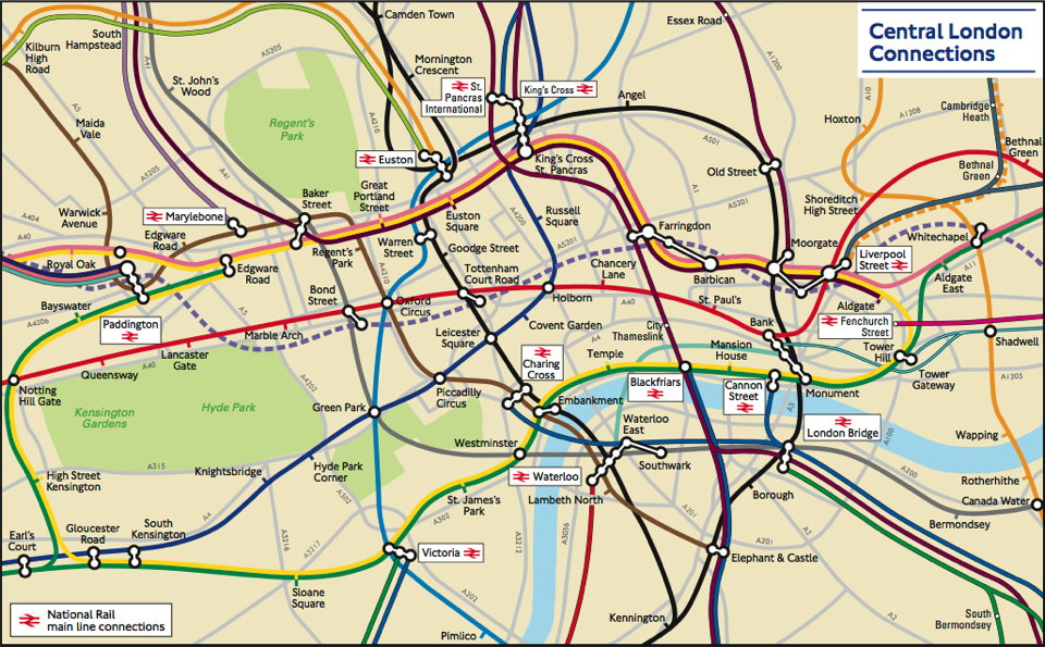
There is no transit map more iconic than the London Underground’s Tube map. First created by Harry Beck in the 1930s, the design has inspired countless other transit network maps that are schematic diagrams rather than geographically accurate maps. But Transport for London, which operates the Underground, also has a geographically accurate map of the network: it was strictly for internal use, but a freedom of information request has now brought it to light. It’s available here (PDF). The response has been so good that TfL now says it’ll be added to their website. CityMetric, Mapping London.
