A map-making competition asking participants to submit maps of their fictional worlds? That’s precisely the sort of thing I should bring to your attention, now that it’s been brought to mine. First announced in February; deadline May 21.
Month: April 2013
The KickMap Comes to London

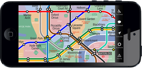
In 2007 Eddie Jabbour released the KickMap, a map of the New York subway system that tried to square the circle of various competing and controversial New York subway map designs. The KickMap later became an iOS app; I reviewed the iPad version in 2010. Now Eddie reports that he’s released a KickMap for the London Underground—not satisfied with updating Massimo Vignelli, he’s going after Harry Beck.
[W]hile the Tube Map’s updates over the decades have attempted to follow Beck’s design, a glance at the current iteration reveals that his design heirs have failed to retain his core credo of clarity and ease of use. Ongoing expansion of the Underground, the addition of the new Overground system, and essential disability access information have made most modern Tube Maps, both official and independent, overly complex and difficult to read. … [I]nstead of redesigning the entire map vocabulary as we did for KickMap NYC, we embarked on a fresh new effort to recapture Beck’s clarity and ease of use.
A regular Underground user would be able to evaluate whether the map succeeds in its goal to improve the Tube map’s clarity; I haven’t even so much as been to London, much less taken the Tube. But I’ve downloaded the app (disclosure: I received a promo code) and have played around with it a bit.
What I can say is that the map is gorgeous and scrolls fluidly (at least on an iPhone 5). In a nice touch, it adds detail like neighbourhoods and landmarks only when zoomed in, preserving a simpler, less cluttered map when zoomed out.
Those of you who’ve used the New York KickMap will find much that is familiar. While it can use your iPhone’s GPS to locate the nearest station—a nice touch on a non-geographic map—it does lack the New York app’s Directions function, which can route you between two stations on the network. Something to ask for, I think, in an update.
It costs only £0.69/$0.99 and is a universal iPhone/iPad app. iTunes link.
Mapping Manhattan
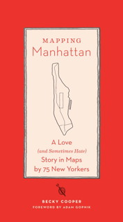
 A new book collects hand-drawn maps of Manhattan submitted by both anonymous and notable New Yorkers: Becky Cooper’s Mapping Manhattan: A Love (and Sometimes Hate) Story in Maps by 75 New Yorkers.
It started with Manhattan in the summer of 2009 when Becky was still an undergraduate at Harvard University. Inspired by Italo Calvino’s Invisible Cities, as well as her own experience creating a map of New York’s public art, Becky walked the length of Broadway, distributing over a thousand letterpress-printed outlines of the borough to the widest variety of New Yorkers she could find.
The maps she got back have been posted online, and now there’s a book. Fascinating project. Brain Pickings and The New York Times Magazine have profiles (with image galleries). Via io9.
