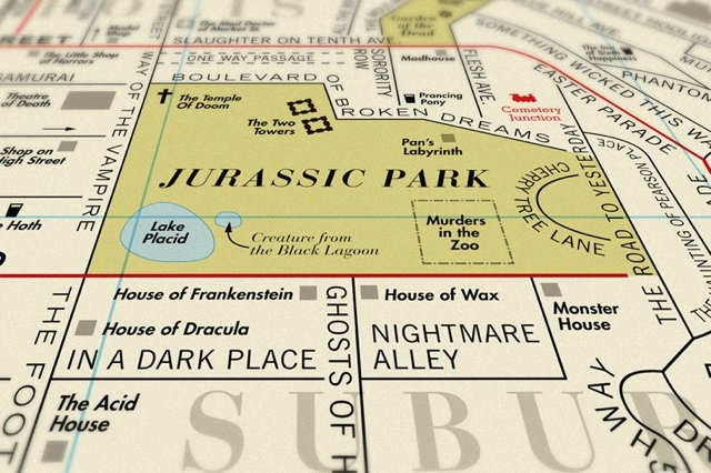
London design studio Dorothy has put out maps of imaginary places where the placenames all come from movies or songs. Prints are available for purchase. Via Kottke.
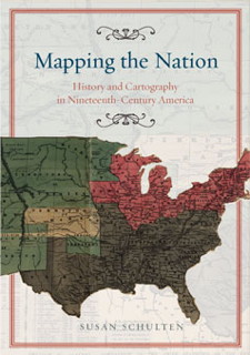
 Susan Schulten, a history professor at the University of Denver, writes to let me know about her new book, Mapping the Nation: History and Cartography in Nineteenth-Century America, out this month from University of Chicago Press.
From the publisher’s page: “Today, statistical and thematic maps are so ubiquitous that we take for granted that data will be arranged cartographically. Whether for urban planning, public health, marketing, or political strategy, maps have become everyday tools of social organization, governance, and economics. The world we inhabit—saturated with maps and graphic information—grew out of this sea change in spatial thought and representation in the nineteenth century, when Americans learned to see themselves and their nation in new dimensions.”
This sounds very interesting. Her previous book, The Geographical Imagination in America, 1880-1950, came out in 2001. I may have to pick up both: maps and the history of mentalities is too much to resist.
Fantasy and science fiction writer Kate Elliott talks about maps. An excerpt:
I know that some love maps, some are indifferent, and some dislike them. That’s as it should be.
I personally like maps, because I’m geeky that way but also because I process information both visually and kinesthetically, and thus maps make it easier for me to negotiate certain kinds of plots. Yet with other stories, I don’t even think of wanting a map. I wonder if there is a kind of story that seems more to benefit by a map while others just don’t have any call for them.
There are narratives in which there are things about the world you can’t learn from the story but which you can glimpse if the book includes a map, so in that sense a map can add a bit of extra dimension to a world. One of the challenges of writing the Spiritwalker books in first person is that there is a lot of information about the world that can never get into the narrative because it isn’t something a) the narrator would reflect on much less know &/or b) that is necessary to the plot.
Previously: How Readers Use Fantasy Maps.

During The Map Room’s existence I frequently reported on Martin Waldseemüller’s 1507 map of the world, notable because it was the first with the name “America” on it. Dubbed, as a result, “America’s birth certificate,” the last known copy of the large, 12-section map is now on display at the Library of Congress, which paid $10 million for it.
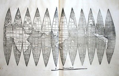
But Waldseemüller also produced small gores, which are used to construct globes; these ones would have been about four inches across. Four of these gores were known to exist, but yesterday Ludwig-Maximilians-Universität München announced that they had accidently turned up a fifth copy in their library collection. It differs from the other gores; they believe it to be from a later edition. It can be viewed online here. BBC News coverage. Thanks to Drew for the tip.
If you’re interested in the Waldseemüller map, you’ll want to read The Fourth Part of the World by Toby Lester. I reviewed it in December 2009.

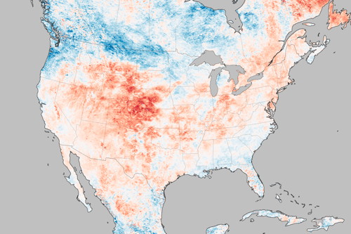
Hotter than usual? Yes. This map shows how much land surface temperatures during the week of June 17-24, 2012 have been above or below the average for 2000-2011. Now this map measures something very specific: land surface temperatures (LSTs) aren’t the same as air temperatures: “LSTs indicate how hot the surface of the Earth would feel to the touch. From a satellite vantage point, the ‘surface’ includes a number of materials that capture and retain heat, such as desert sand, the dark roof of a building, or the pavement of a road. As a result, daytime land surface temperatures are usually higher than air temperatures.” Via Bad Astronomy.