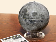
 Calling it “the first entirely new globe of the lunar surface in more than 40 years,” Sky and Telescope has announced a new Moon globe based on Lunar Reconnaissance Orbiter imagery. Replogle’s Moon globe has been the standard for decades, but it’s based on 1960s-era charts and, as I said in my review three years ago, doesn’t have a lot of contrast and doesn’t look much like the Moon. Mind you, the new globe costs almost twice as much.
Month: April 2012
El Viaje de Argos
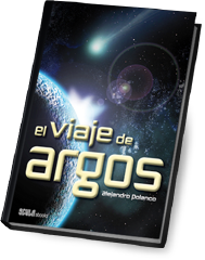 Alejandro Polanco Masa, whose map blog La Cartoteca is one of the finest on the subject in any language, has announced the availability of his speculative fiction novel El Viaje de Argos, in which maps play a prominent role. Here’s the description in Spanish:
Desde antiguo un enigmático astro llamado Argos siembra la atmósfera con una substancia muy especial. Sólo un pequeño grupo de sabios sabe cómo recolectar y emplear esa esencia de los cielos que permite la vida eterna. Pero en pleno auge de la Roma imperial, un desastre sacude a la hermandad de sabios. Desperdigados por el mundo y sin los conocimientos necesarios para mantener la inmortalidad, vagarán sin rumbo, condenados al olvido. Hasta que en el siglo XXI, una inquieta historiadora, Irene Abad, descubre un antiguo mapa que, sin saberlo, conduce hasta el peligroso secreto que los Hijos de Argos han perseguido durante dos milenios.
I wish I could say more about this, but I never studied Spanish and can barely navigate Spanish-language websites, much less read novels. El Viaje de Argos is available in ebook form via Amazon and iBooks.
The Lands of Ice and Fire: Westeros Atlas Coming in October
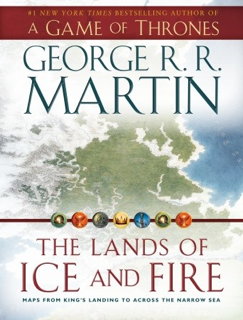 More information today on a book I’d heard was coming: The Lands of Ice and Fire, a definitive atlas of George R. R. Martin‘s fantasy world from A Song of Ice and Fire (A Game of Thrones, et cetera). The publisher: “The centerpiece of this gorgeous collection is guaranteed to be a must-have for any fan: the complete map of the known world, joining the lands of the Seven Kingdoms and the lands across the Narrow Sea for the first time in series history.” Fantasy and roleplaying game cartographer Jon Roberts is working on the project. It won’t be out until October, but you can already pre-order it at Amazon.
Previously: Maps of Martin’s “Song of Ice and Fire”; More Maps of Martin’s “Song of Ice and Fire”.
Wonderful Wind Map
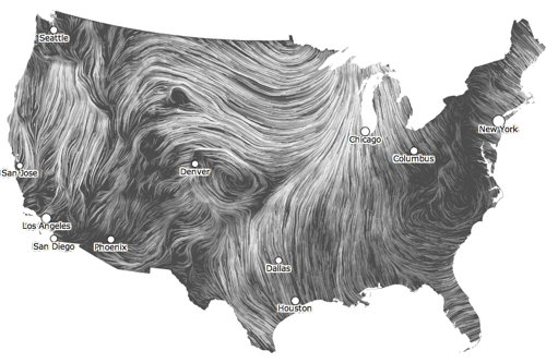
An amazing visualization of near-term wind forecasts by Fernanda Viégas and Martin Wattenberg, based on data from the National Weather Service’s National Weather Forecast Database. Looks gorgeous; slows my browser right down. Via Boing Boing, Kottke and O’Reilly Radar, among others.
OpenStreetMap in Watercolour
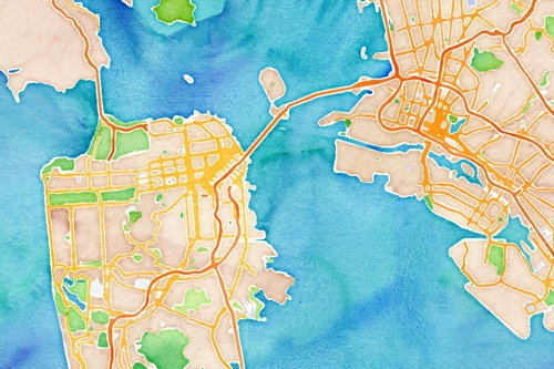
The ability to use other map styles with OpenStreetMap data is, I think, underexploited. I’m starting to hate the default Mapnik tiles. Stamen Design has released three different—vividly different—map styles for OpenStreetmap: watercolour tiles (above), high-contrast black-and-white, and shaded terrain. Via Daring Fireball.
Perpetual Ocean
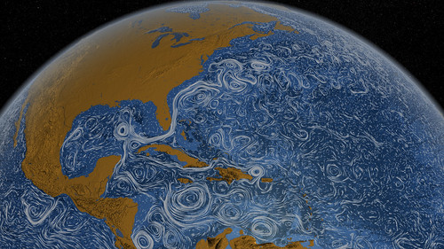
You may have seen this already: a beautiful, painting-like visualization of the world’s surface ocean currents between June 2005 and November 2007, which NASA posted last month. The visualization is based on model data from the ECCO2 project. See also this short video on Flickr (Flash required). Image credit: NASA/
19th-Century Children’s Maps
“In the 18th and 19th centuries, children were taught geography by making their own maps, usually copies of maps available to them in books and atlases at their schools or homes,” says a David Rumsey Collection post from January 2010 that is for some reason drawing attention right now. “These old maps made by children were hand drawn and colored, one-of-a-kind productions, and it is amazing that any have survived down to our time. That they have is due to luck and the efforts of families to preserve the history of their children.” Anyone interested in hand-drawn maps will like these; for my part I can’t get over the similarity in style between these maps and later fantasy maps. Via io9 and MetaFilter.

