Art designer James Shadrach Schoenke imagines a modern-day Westeros with a modern-style map that mimics the design of European road maps.
Tag: Westeros
Jonathan Roberts, Scientist and Fantasy Mapmaker
Fantasy cartographer Jonathan Roberts is profiled in a short, paywalled piece in Crain’s New York Business. (Winter Is Coming has a summary.) Roberts is, among other things, the artist behind The Lands of Ice and Fire, the boxed collection of 12 maps of George R. R. Martin’s Westeros. Things I did not know about him: he has a Ph.D. in physics, works as Dotdash’s chief innovation officer—and was given all of 12 weeks to complete the maps for The Lands of Ice and Fire. [Cartophilia]
Previously: A Q&A with Fantasy Cartographer Jonathan Roberts.
Applying Fantasy Maps to Globes
Map to Globe is an online tool that allows you to transfer a flat map onto a globe. Adam Whitehead has been trying it out with fantasy maps. Some work better than others. Westeros is not one of them, “because the maps of the North and the lands beyond the Wall need to be adjusted so they work on a globe.” Think of it as sort of a Mercator problem in reverse: imagining a flat map rather than a round world: the flat map’s lack of distortion is the issue.
As discussed before, in creating the maps of Westeros and Essos for A Song of Ice and Fire, George R. R. Martin has not really taken projection into account at all. On his maps of Westeros, the Wall is 300 miles long but the distance between Deepwood Motte and Winterfell (hundreds of miles to the south) is also said to be 300 miles long and the south coast of Westeros—3,000 miles south of the Wall!—is said to be 1,200 miles long. These are all in perfect scale to one another, which is not really possible when you look at the maps as a representation of what the planet actually looks like.
Trying to circle the square, so to speak, leads to complications, as Whitehead points out on his Atlas of Ice and Fire blog.
Of course, if your fantasy world is flat instead of round, you don’t have this problem.
Fantasy Maps: Middle-earth vs. Westeros
In the latest instalment of Hannah Stahl’s series of posts on fantasy maps at the Library of Congress’s map blog (see previous entry), she takes as a starting point my argument that Tolkien’s map of Middle-earth is the progenitor map from which the modern fantasy map design is descended, and compares that map to maps of Westeros from George R. R. Martin’s Song of Ice and Fire series.
Previously: The Library of Congress Looks at Fantasy Maps; Review: The Lands of Ice and Fire.
Game of Thrones Map Marker Set
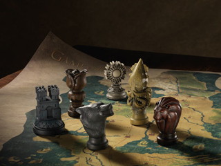
 Dark Horse has released a Game of Thrones map marker set, based on a map and markers briefly seen in the first season of the HBO TV series. What surprises me is how much more the map resembles a real-world medieval map, in its use of symbols and text, than do the usual fantasy maps, including those for Westeros (though, as I’ve argued before, real-world medieval maps were much more information-dense, and covered in text). At $200, it’s not cheap, but the markers are up to six inches in height, and the map is made of fabric and roughly four by three feet in size. It’s available for purchase at Amazon and ThinkGeek, among others.
The Geology of ‘Game of Thrones’

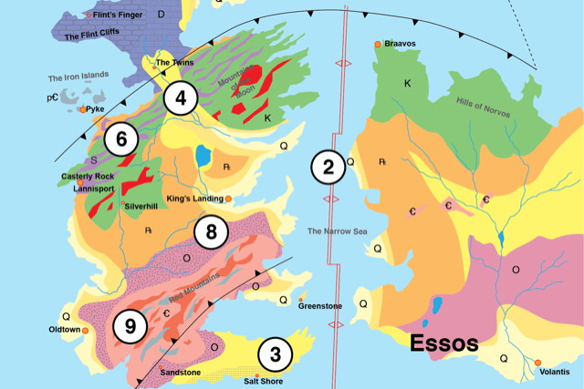
In The Geology of Game of Thrones, a group of geologists has created a geologic map of Westeros and Essos, as well as an invented geologic history of the planet on which George R. R. Martin’s epic takes place. Via io9.
This isn’t the first time a fantasy world has been looked at through a geologic lens. Karen Wynn Fonstad’s Atlas of Middle-earth took a reasonably rigorous look at the landforms of Middle-earth. And Antony Swithin—a geologist in real life under his real name, William Sarjeant—created a geologic map of his invented island of Rockall (see previous entry).
Previously: Review: The Lands of Ice and Fire.
My Own Private Westeros
Here’s someone building—by hand—a scale model of Westeros. Updated with photos at every step of construction. Madness! I approve. Via Boing Boing.
Review: The Lands of Ice and Fire
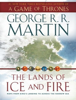
 The Lands of Ice and Fire, which came out last month, is a collection of maps of the lands of George R. R. Martin’s Song of Ice and Fire series, executed by the fantasy cartographer Jonathan Roberts.
You should know what you’re getting when you buy this. It’s not an atlas. It’s not even a book. George himself describes it as “a book-shaped box containing a whole bunch of gorgeous, glossy, fold-out maps of Westeros, Essos, and the lands and seas from A Song of Ice and Fire.” There is no text other than on a single-page introduction.
Open the box and you see two sleeves containing six maps apiece. Each map is 24 by 30 inches, single sided, in full colour, and on glossy paper, the kind you can see your fingerprints on. As fantasy maps go, this is a lavish production—a long way from the two-colour atlases we’ve seen for other imaginary worlds. (Some Amazon reviewers have expressed concern about wear and tear from folding and unfolding the maps; bear that in mind.)
Now Out: The Lands of Ice and Fire
 Today is the release date (in North America) for The Lands of Ice and Fire, a book (sort of) that contains maps of George R. R. Martin‘s Westeros, the setting for A Game of Thrones and its sequels.
George explains that this isn’t an atlas; in fact, it’s “not an actual book at all, but a book-shaped box containing a whole bunch of gorgeous, glossy, fold-out maps of Westeros, Essos, and the lands and seas from A Song of Ice and Fire.” (I hadn’t been sure.) Among the maps is an eagerly anticipated world map. George clarifies that “it’s not a complete world map, no. The idea was to do something representing the lands and seas of which, say, a maester of the Citadel might be aware … and while the maesters know more about Asshai and the lands beyond than a medieval monk knew about Cathay, distance remains a factor, and past a certain point legends and myths will creep here.”
The maps are the work of fantasy cartographer Jonathan Roberts. Sample images at io9 and Tor.com.
Buy at Amazon | publisher’s page
Previously: The Lands of Ice and Fire: Westeros Atlas Coming in October.
The Lands of Ice and Fire: Westeros Atlas Coming in October
 More information today on a book I’d heard was coming: The Lands of Ice and Fire, a definitive atlas of George R. R. Martin‘s fantasy world from A Song of Ice and Fire (A Game of Thrones, et cetera). The publisher: “The centerpiece of this gorgeous collection is guaranteed to be a must-have for any fan: the complete map of the known world, joining the lands of the Seven Kingdoms and the lands across the Narrow Sea for the first time in series history.” Fantasy and roleplaying game cartographer Jon Roberts is working on the project. It won’t be out until October, but you can already pre-order it at Amazon.
Previously: Maps of Martin’s “Song of Ice and Fire”; More Maps of Martin’s “Song of Ice and Fire”.


