
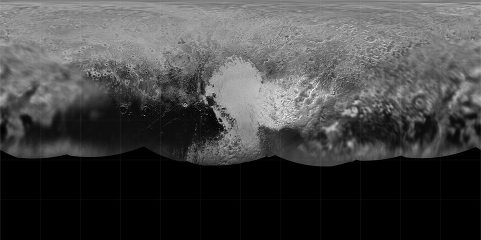
As I predicted, a new global map of Pluto has been released that incorporates the imagery that has been downlinked so far from the New Horizons flyby: with gridlines, without gridlines. If nothing else, the equatorial projection demonstrates how much of Pluto’s surface was not seen during the very brief encounter. From what I understand, imagery downlinks will resume in September and carry on for another year, so this map will almost certainly see many more updates.
Meanwhile, Ceres also has some new maps.
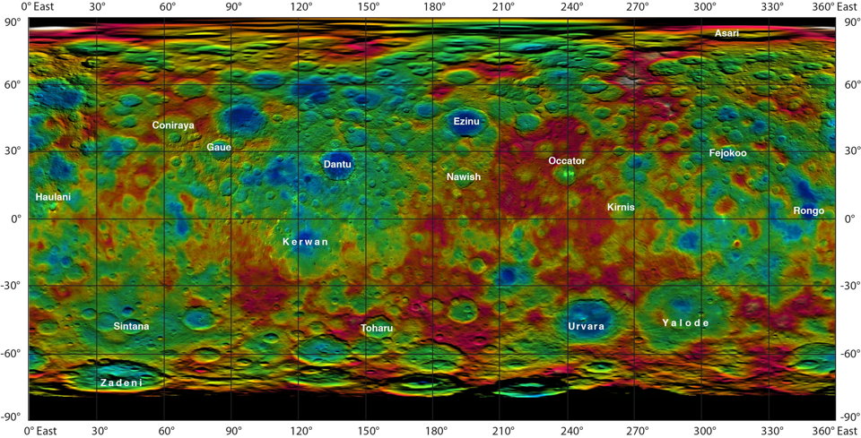
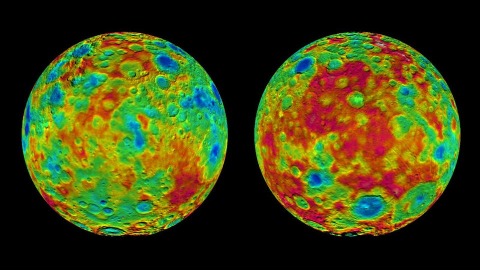
Elevation data for these colour-coded topographical maps “was constructed from analyzing images from Dawn’s framing camera taken from varying sun and viewing angles”; these data were then applied to image mosaics and mapped to cylindrical and orthographic projections. The cylindrical map also includes crater names recently approved by the IAU.
Image credits: NASA/JPL-Caltech/UCLA/MPS/DLR/IDA (Ceres); NASA/