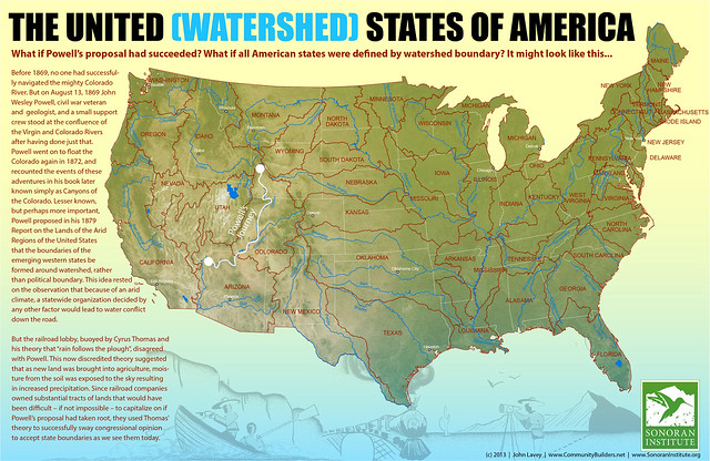
In 1879, surveyor (and future USGS director) John Wesley Powell proposed that the boundaries of future western states be determined by watersheds, in order to avoid water use conflicts. John Lavey takes this proposal to its logical conclusion, imagining a U.S. in which all 50 states follow watershed boundaries. Via io9.
Previously: Fifty Equal States Redux.

