A Digital Cartographer Tries Drawing by Hand

John M. Nelson

Fresh from trying to replicate hand-drawn effects (or even papercut effects) digitally, John M. Nelson has crossed over and begun attempting actual hand-drawn maps. Here he documents how he created a hand-drawn map as a Christmas present; here he gives hillshading by hand a try.

Previously: Five Years of DroughtCartographers’ StoriesThe Earth at Night, Updated.

Londonist Mapped

Londonist Mapped: Hand Drawn Maps for the Curious Explorer came out last month from AA Publishing. (It’ll be out in North America next February.) Londonist describes their book thusly: “The book presents dozens of beautiful maps of the capital, from historic plans to specially commissioned art. Here you’ll find maps of lost Victorian buildings, little-known musical history, subterranean London and many more. The book also includes a reprint of our popular Anglo-Saxon London map.” I wonder if it includes “Bridges of London.” [WMS]

Fuller Update

Fuller, London Town, 2005–2015. Black ink on archival cotton board, 91 cm × 116 cm.

The Bristol Post reports on artist Gareth Wood (aka Fuller), whose iconic London Town—now acquired (as an archival print) by the British Library—was preceded by a similar map of Bristol. An exhibition of his work, called Get Lost, will run from 5 to 26 May at the Palm Tree Gallery, 291 Portobello Road, London, W10 5TD. [WMS]

Previously: Fuller: London Town.

Update: BBC News on institutions’ acquisitions of Fuller’s art.

Fuller: London Town

fuller-london-town
Fuller, London Town, 2005–2015. Black ink on archival cotton board, 91 cm × 116 cm.

Fuller’s London Town is a pen-and-ink masterpiece of detail that took ten years to create. Unveiled last October, it’s been making the exhibition rounds and is currently at the Hoxtown Gallery in Holborn, London until April 30th. It’s also included, along with his map of Bristol, in Mind the Map, a collection of map art that came out last September from Gestalten. Prints of his work are also available: a print of London Town costs £600 or £2,500 depending on the size. More about Fuller (whose real name is Gareth Wood) here. [via]

More on ‘A Map of Every City’

Without question, the most popular post on The Map Room so far this week—by two orders of magnitude—was this post pointing to Chaz Hutton’s “A Map of Every City.” Hutton’s map went kind of viral, and not just here. He’s since announced that a print of the map will be available at some point; he’s also written a post on Medium explaining some of the background behind the map.

Mapping Manhattan

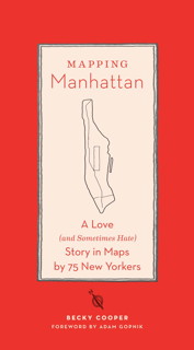
Book cover: Mapping Manhattan A new book collects hand-drawn maps of Manhattan submitted by both anonymous and notable New Yorkers: Becky Cooper’s Mapping Manhattan: A Love (and Sometimes Hate) Story in Maps by 75 New Yorkers.

It started with Manhattan in the summer of 2009 when Becky was still an undergraduate at Harvard University. Inspired by Italo Calvino’s Invisible Cities, as well as her own experience creating a map of New York’s public art, Becky walked the length of Broadway, distributing over a thousand letterpress-printed outlines of the borough to the widest variety of New Yorkers she could find.

The maps she got back have been posted online, and now there’s a book. Fascinating project. Brain Pickings and The New York Times Magazine have profiles (with image galleries). Via io9.