The Library of Congress reports on how its Preservation Research and Testing Division used multispectral imaging to bring out previously illegible place names on a 16th-century portolan chart of the east coast of North America. Initially the PRTD was brought in to confirm that the chart was legit before the Library purchased it (which it did last fall), but the faded iron gall ink in some areas of the map suggested obscured details that further analysis could draw out and place names that could be made legible again. According to the article, this represents the first time the Library has posted an enhanced image of one of their holdings.
Tag: portolan
Estate Sale Map Turns Out to Be Rare 14th-Century Portolan
The Los Angeles Times has the story of a map that turned out to be far older and more valuable than anyone expected. Ann and Gordon Getty paid £56,600 for a portolan chart in 1993, restored it and put it on display in their home. After Ann died in 2020, Alex Clausen of Barry Lawrence Ruderman Antique Maps paid $239,000 for it at the estate sale. The map was dated to 1500-1525, but Clausen suspected it was older and therefore even more valuable. Hundreds of hours of research and lab tests determined a new date: circa 1360, making it the oldest portolan chart in the U.S. and the fourth oldest portolan chart known overall. As for how much more valuable, Ruderman thinks it’s worth a lot more than $239,000: they’re listing it for $7.5 million. They’ve named it the Rex Tholomeus Portolan Chart, after the single human figure appearing on the map, and you can see the listing and read the 49-page catalogue (PDF).
The World in Maps: New Exhibition at Yale’s Beinecke Library
An exhibition at Yale University’s Beinecke Rare Book and Manuscript Library opens this Friday: The World in Maps, 1400-1600.
This exhibition presents many of the most historically significant manuscript maps from the late medieval and early modern period from the Beinecke Library’s vast collection of maps. It is focused on portolan charts—large, colorful charts that showed the shoreline of the Mediterranean, and were used by sailors to navigate from port to port. These maps were crucial to the expansion of European trade in the fiftieth and sixteenth century. Yale University Library has one of the most significant map collections of this period and owns some unique items not found in any other collection. […]
This exhibition presents maps from several different historical groups and demonstrates how maps functioned to place people within a larger world context. While primarily focusing on European maps, it also includes Middle Eastern and Asian world maps to illustrate common elements and also highlight significant differences. In addition, the exhibition presents some map forgeries and how they were determined to be fakes using scientific and historic analysis.
On that last point, yes, the Vinland Map will be a highlight of the exhibition, as will the Aguiar and Beccari portolan charts, the Martellus world map, and the Abenzara map.
The exhibition runs until 8 January 2023. Lectures will be taking place in the fall.
Piri Reis Map Back on Display
The Piri Reis map is back on display at the Topkapı Palace in Istanbul. Like the Tabula Peutingeriana, it’s only taken out for display at intervals to protect it from the elements. Discovered when the palace was being converted into a museum in the 1920s, the map is the western third of a portolan chart drawn on gazelle skin parchment in 1513 by Ottoman admiral Ahmet Muhiddin Piri (“Reis”—admiral—was his title). It was an expansive compilation of ancient and contemporary sources much like the Waldseemüller map, and is fascinating in its own right; in recent years, though, it became one of the “proofs” of a nutty theory involving ancient civilizations and polar shifting. [Tony Campbell]
Previously: The Piri Reis Map of 1513; A Turkish Piri Reis Documentary Is Coming.
First You Make the Maps
First You Make the Maps, a Story Map produced for Lapham’s Quarterly by Elizabeth Della Zazzera, surveys maps and mapmaking for sea navigation from the 15th through the 18th centuries.
From the fifteenth to the eighteenth century, European powers sent voyagers to lands farther and farther away from the continent in an expansionist period we now call the Age of Exploration. These journeys were propelled by religious fervor and fierce colonial sentiment—and an overall desire for new trade routes. They would not have been possible without the rise of modern cartography. While geographically accurate maps had existed before, the Age of Exploration saw the emergence of a sustained tradition of topographic surveying. Maps were being made specifically to guide travelers. Technology progressed quickly through the centuries, helping explorers and traders find their way to new imperial outposts—at least sometimes. On other occasions, hiccups in cartographic reasoning led their users even farther astray.
[Kottke]
GeoLounge Looks at Medieval Maps and Travel Guides
Over at GeoLounge, Caitlin has a brief and basic overview of medieval maps and travel guides, including T-O maps, travel guides for pilgrims, mappae mundi, and portolan charts. As she points out, only the last of these even attempted to be geographically accurate; the others had other purposes.
The Avignon Chart
Though I haven’t seen it, the most recent issue of Maps and History reports on the discovery of a fragment of an early portolan chart in the departmental archives of the Vaucluse. The so-called Avignon Chart (Carte d’Avignon)1 dates to around 1300, making it one of the earlier portolan charts known to exist. If you can read French, the Brussels Map Circle’s website has a lengthy article about the chart by Jacques Mille and Paul Fermon that discusses, among other things, the chart’s provenance and how its approximate age was determined. (I don’t know whether this is the same article that appears in Maps and History.) [Tony Campbell]
A Turkish Piri Reis Documentary Is Coming
A Turkish filmmaker is working on a documentary about the life of Ottoman admiral and mapmaker Piri Reis, whose 1513 portolan chart, a fragment of which was rediscovered in 1929, claimed to draw upon ancient and contemporary sources, including Columbus. According to the Doğan News Agency story, the 75-minute film “will feature dramatic reconstructions starring actor Mehmet Günsur as Piri Reis, Riccardo Scamarcio as Christopher Columbus and actress Deniz Özdoğan. Can Atill will reportedly compose the music for the film.” If you can read Turkish, the website of the filmmaker, Gülsah Çeliker, is here; the movie’s website is here. The documentary is supposed to be finished by the end of the year. [WMS]
Maggiolo Planisphere of 1531 to be Auctioned
A 16th-century portolan chart is being auctioned later this month at TEFAF New York. “The map, which was created by a Genoese cartographer named Vesconte Maggiolo in 1531, is one of the first depictions of America’s eastern seaboard. It’s also the first (extant) map, ever, to show New York harbor,” Bloomberg’s James Tarmy writes. The asking price is $10 million—which would tie it with the Library of Congress’s copy of the Waldseemüller map as the most expensive map ever. The seller, Daniel Crouch Rare Books, has produced a detailed, lavishly illustrated 56-page booklet befitting a map with an eight-figure asking price. [WMS]
International Workshop on Portolan Charts
The program for the First International Workshop on the Origin and Evolution of Portolan Charts, which takes place 5-6 June 2016 in Lisbon, Portugal, is now live. The conference focuses on the history of portolan charts and the analytical techniques used to study them. [via]
More Map Books
Here are some map books that I recently found out about:
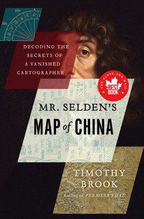
- Mr. Selden’s Map of China: Decoding the Secrets of a Vanished Cartographer by Timothy Brook (Bloomsbury Press/House of Anansi Press/Profile Books, 9/13). A book-length study of the enigmatic Selden Map of China, donated to the Bodleian Library in 1659 and only rediscovered in 2009. (Amazon)
- The Golden Age of Maritime Maps: When Europe Discovered the World by Catherine Hoffman, Hélène Richard and Emmanuelle Vagnon (Firefly Books, 9/13). One of those big, illustrated books of old maps; this one looks at portolan charts. It’s an English translation of L’Âge d’or des cartes marines. (Amazon)
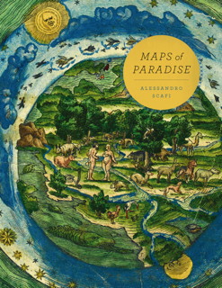
- Maps of Paradise by Alessandro Scafi (University of Chicago Press, 11/13). Explores “the diverse ways in which scholars and mapmakers from the eighth to the twenty-first century rose to the challenge of identifying the location of paradise on a map, despite the certain knowledge that it was beyond human reach.” (Amazon)
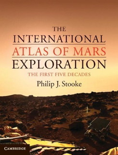
- The International Atlas of Mars Exploration: The First Five Decades, 1953 to 2003 by Philip J. Stooke (Cambridge University Press, 9/12). The first of two volumes (the second will be subtitled Spirit to Curiosity) that maps the extent of exploration by orbiters and landers. (Amazon, author’s page)