Google Maps Updates Will Make It Impossible for Google to Respond to Geofence Warrants

Last week I mentioned forthcoming changes to how Google Maps stores users’ location data. According to the Electronic Frontier Foundation, those changes could spell the end of what are known as geofence warrants, which “require a provider—almost always Google—to search its entire reserve of user location data to identify all users or devices located within a geographic area during a time period specified by law enforcement.” The EFF believes geofence warrants are unconstitutional in the United States. Defaulting to on-device storage, deletion after three months, and encrypted cloud backups means Google can’t access that data: there’s nothing for them to turn over.

“All of this is fantastic news for users, and we are cautiously optimistic that this will effectively mean the end of geofence warrants,” says the EFF. “However, we are not yet prepared to declare total victory. Google’s collection of users’ location data isn’t limited to just the ‘Location History’ data searched in response to geofence warrants; Google collects additional location information as well. It remains to be seen whether law enforcement will find a way to access these other stores of location data on a mass basis in the future.”

Via Daring Fireball (where Gruber notes that Apple has never collected location data, i.e. there’s a reason it’s “almost always Google”).

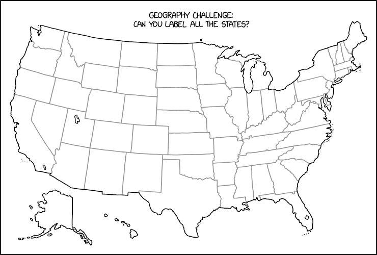
xkcd’s Geography Challenge

An xkcd comic by Randall Munroe called Label the States
Randall Munroe, “Label the States,” xkcd, 15 Dec 2023.

Stare at this map for a while until you figure out what Randall Munroe has done in last Friday’s xkcd. Then scream. (Kottke says: “This is evil.”) It’s not the first time that xkcd has committed mischief and violence on an outline map of the contiguous United States: see, for example this one, or this one. I worry it may not be the last.

Previously: xkcd’s United States Map; The Contiguous 41 States—Wait, What?

Anton Thomas’s Wild World Is Out in the World

Anton Thomas's Wild World, a hand-drawn pictorial map of the world featuring wildlife.
Anton Thomas

Earlier this year Anton Thomas finished his Wild World map—a hand-drawn pictorial map of the natural world on the Natural Earth projection—and prints and posters have been shipping out. I’ve covered Wild World before on The Map Room, but this is news I somehow missed at the time.1 But this week Anton’s project has gotten some fairly significant news coverage: first from The New York Times (paywalled) and then from CBC Radio’s The Current (not).2

Previously: Anton Thomas’s Next Project: Wild World; Anton Thomas’s Wild World: A Progress Report.

Google Maps Updates Offer Users More Control Over Their Data

Forthcoming updates to Google Maps will give users a bit more control over their location data. Location History—off by default—will have the option of being stored on-device rather than on Google’s servers, and auto-delete will default to three months instead of 18. Meanwhile, users will be able to delete activity (“searches, directions, visits, and shares”) related to a specific location—the online maps equivalent of clearing your browser history, I guess. (I can’t help but notice that announcing greater user control over this information highlights the fact that this information is being collected in the first place.)

2023 Holiday Gift Guide

Here’s the 2023 iteration of my annual gift guide. The idea of which is, if you have a map-obsessed person in your life and would like to give them something map-related—or you are a map-obsessed person and would like your broad hints to have something to link to—this guide may give you some ideas.

This is not a list of recommendations: what’s here is mainly what I’ve spotted online, and there’s probably a lot more out there. In most cases I haven’t even seen what’s listed here, much less reviewed it: these are simply things that look like they might be fit for gift giving. (Anyone who tries to parlay this into “recommended by The Map Room” is going to get a very sad look from me.)

Continue reading “2023 Holiday Gift Guide”

3D-Printed Lithophane Globe Ornament

3D lithophane globe ornamentEvery year, for the past few years, John Nelson has released a DIY globe ornament; this year he eschews papercraft and teamed up with Ruben Bruijning to produce a 3D-printed lithophane globe: “A lithophane is a backlit 3D object that glows brighter or dimmer depending on how thick the material is. Areas where the ornament is thin, the light more readily shines through, so it appears light. Thicker areas let less light through, so they appear darker. It’s a 3D negative.” Obviously needs a light put in it (to say nothing of a 3D printer).

Previously: Orthographic Papercraft Ornament; This Year’s Papercraft Globe Ornament; John Nelson’s Cassini Globe Ornament; John Nelson’s Dymaxion Globe Ornaments; DIY Map Ornaments.

Google Maps Sends Drivers into Nevada Desert After Interstate Closure

Last month, after a dust storm shut down Interstate 15 between Las Vegas and Barstow, Google Maps sent drivers off-roading, rerouting them via barely passable desert trails. Some were stuck for hours. Google has since apologized.

Jalopnik describes this as yet another case of blindly following, but I think this is a more specific failure mode. Rerouting due to road closures or traffic jams opens up routes that the algorithm would normally deprecate, and catches more drivers unprepared. It’s one thing when that means a quiet residential street gets an expressway’s worth of traffic, quite another when the second best choice is a dirt track—or a 500-mile detour. When the best answer the algorithm can give you is a bad one, it will still give you that answer.

Previously: Man Dies After Driving Across Collapsed Bridge, Family Sues Google; Google Rerouted Traffic Up Poorly Maintained Mountain Roads During a Blizzard; Google Maps Called Out for Showing ‘Potentially Fatal’ Mountain Routes.

Limited Edition Earthsea Map Print Now Available

Original map of Earthsea by Ursula K. Le Guin
Ursula K. Le Guin

A limited edition print of Ursula K. Le Guin’s map of Earthsea has just been released. “Starting with a high resolution photographic image of Le Guin’s original, the team digitally cleaned or reinforced each line and letter, separating each color in the drawing as a layer, to make the maps as legible as the original and to avoid the artifacts of a typical CMYK process.” The cost is $150 for the black-and-white version and $300 for the colour version, with only 50 and 250 copies of each being printed, respectively. (I suspect you shouldn’t dither too long if you’re interested.) Proceeds go to the Pacific Northwest College of Art and the Freedom to Read Foundation. [Tor.com]