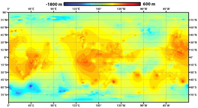
The Cassini team has released a global topographic map of Saturn’s moon Titan. What makes this map interesting is the fact that, due to its thick atmosphere, Titan can only be mapped by radar during Cassini’s close flybys. As a result, only half of its surface has been imaged, and only 11 percent has topography data. For this map, the remainder was, well, extrapolated:
Lorenz’s team used a mathematical process called splining—effectively using smooth, curved surfaces to “join” the areas between grids of existing data. “You can take a spot where there is no data, look how close it is to the nearest data, and use various approaches of averaging and estimating to calculate your best guess,” he said. “If you pick a point, and all the nearby points are high altitude, you’d need a special reason for thinking that point would be lower. We’re mathematically papering over the gaps in our coverage.”
Topo maps of parts of Titan have been released before, but not for the entire moon. See previous posts on The Map Room: Titan in Stereo; Topography of Titan.
