The United Watershed States of America

United Watershed States of America 2

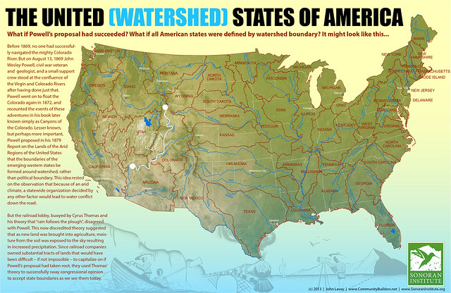
In 1879, surveyor (and future USGS director) John Wesley Powell proposed that the boundaries of future western states be determined by watersheds, in order to avoid water use conflicts. John Lavey takes this proposal to its logical conclusion, imagining a U.S. in which all 50 states follow watershed boundaries. Via io9.

Previously: Fifty Equal States Redux.

Maps of Mercury

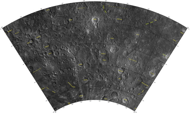
H-12 Michaelangelo

The USGS has released quad maps of the planet Mercury as a set of PDF files: “The 1:5 million-scale series of Mercury maps divides Mercury into 15 quadrangles, H-1 through H-15 (five Mercator, eight Lambert Conformal, and two Polar Stereographic quadrangles). The base mosaic was produced with orbital images by the MESSENGER Team and released by NASA’s Planetary Data System on March 8, 2013. This new global mosaic includes 100% coverage of Mercury’s surface.”

Two Detailed Rail Maps

Northeast Rail Map

A couple of supremely detailed rail maps to bring to your attention, both of which show every line and station of long-distance, regional and commuter rail networks. There’s one for California, which uses a Beck-like, diagrammatic design, and one for the Northeast Corridor (see above), which opts for geographic accuracy. Despite the differences there’s a lot of overlap on the two design teams. Creative Commons licensed, with printed posters available.