I nearly forgot to mention that last Sunday I gave a presentation on the state of OpenStreetMap in Ottawa to the SummerCamp 2011 Mapping Party. It was a small group — five of us, the majority of whom knew more about the subject than I did — and, due to technical snafus with the meeting location, was held in a Bridgehead coffee shop on Bank Street. All the same, my spiel was well received. I made three points in the presentation: that OpenStreetMap was a lot less complete than some make it out to be; that the OSM map of Ottawa needs a lot of work; and here’s what to do about it.
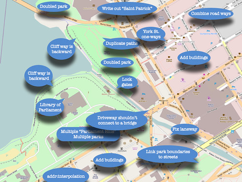
I suppose that I could make the slideshow available if you’re really interested, but my presentations tend to be talks illustrated by slides, rather than read-the-slides, so without me talking it through it’d be kind of confusing. But here’s the penultimate slide, which shows a screencap of OSM’s map of downtown Ottawa, with things that need fixing helpfully labelled.
You’ll be happy to know that many of these things have since been fixed.

