Using Google Maps to Create a Real-World Paracosm

Brendan Koerner’s 12-year-old son has been spending the lockdown planning a summer road trip in great detail using Google Maps. As it turned out, his son was doing something more than, and other than, simply planning a trip: he was using maps to create a paracosm, one based in data and real locations rather than fantasy space.

In the days that followed, I’d often catch my son on Google Maps with pen in hand, jotting down increasingly specific bits of information that he considered essential to his plans: the names of bridges that span the Susquehanna River, the phone numbers for motor inns in Greater Pawtucket, the best things to eat while watching the New Hampshire Fisher Cats. (The stadium’s clam chowder has received lavish online praise.) As I watched him get lost in the pleasure of these tasks, I realized that he was under no illusions about the trip’s actual odds of taking place. He was immersing himself in Google Maps not because he expected we’d be attending a Norwich Sea Unicorns game anytime soon, but so he could build himself a sanctuary—a space where he’s in charge of how an uncertain future will unfold.

Getting lost in maps is an activity I expect a lot of us recognize, and have done ourselves, though the particulars are probably unique to each of us. (Random thought: Is this one reason why fantasy novels come with maps? Are the maps doing more of the work than we thought?)

Atlas Obscura Readers’ Dream Islands: The Results

I mentioned Atlas Obscura’s call for readers to submit maps of their perfect dream island, but I neglected to post a link to the resultsAtlas Obscura: “We received submissions from readers young and old, all full of fun and creative details. Entries included islands full of cats (there were several of those, in fact), political strongholds, simple sandbar paradises, intricate hidden bases, guinea pig sanctuaries, and poetic dreamscapes.”

Atlas Obscura Wants a Map of Your Dream Island

Atlas Obscura is asking readers to draw a map of their perfect dream island and send it in to them. That’s something I can absolutely get behind.

If you could make an island to your exact specifications, what would it look like? What would make it unique—the true island of your individual dreams?

Maybe your island is made entirely of recycled bottles, or only accepts currency featuring Darth Vader. Perhaps your island is set up as a villains’ lair, or populated with magical creatures that don’t exist anywhere else in the world. Is your island an expansive paradise that will take years to explore, or a simple spot of sand surrounded by boundless ocean? Does it have a treehouse? A mansion? Is there a skull-shaped cave? A water park? A hidden base in a volcano? Mischievous monkeys? Pirate ghosts? A lost society of evolved super-beings?

You’ve got until, uh, tomorrow afternoon. Atlas Obscura will publish their favourites on Friday.

Cartographers’ Stories

Daniel Huffman and John Nelson have launched A Cartographer’s Story, a website that collects personal essays from mapmakers.

While our community has a rich culture of sharing project walkthroughs and clever tricks, our colleagues also need to hear about the personal and emotional relationships we have with our maps. We invest ourselves in creating works that are meant to stir the hearts and imaginations of others—and in return our works invest in us. What are your stories? How has mapping moved you or changed you? Did it encourage you through a tough time? Teach you something about yourself? Represent a significant relationship in your life?

Seven stories posted so far; they’re looking for more.

His Favourite Map: Natural Heritage of Texas

Natural Heritage of Texas, 1986. Map, 54.8″×56.4″. Map #10786, Map Collection, Archives and Records Program, Texas General Land Office, Austin, TX.

James Harkins of the Texas General Land Office shares his favourite map: the 1986 Natural Heritage of Texas map, which featured endangered and vulnerable Texas wildlife.

I was three years old when this map was released. When I was at Moore Elementary (home of the fighting Armadillos!) in the late 1980s, and early 1990s, I specifically remembered this map because it was huge! The Natural Heritage Map of Texas is 4-feet by 4-feet, and it hung in the school cafeteria, to the left of the stage where so many school assemblies had occurred. The map is colorful, big and filled with animals. To be honest, at the time, the animals are what drew my attention, but the map always stuck in my mind because it was the first large wall map I had ever seen. More than anything, though, there was an ocelot in my face, and in the face of every other elementary student in the building who walked up to look at this map. At the time, I thought an ocelot was kind of like a mix between a house cat and a lion or a tiger, and a lion or tiger was really cool. I was hooked! I would always look at the ocelot, as well as the other animals, and the map, and think about what it all meant.

[Texas Map Society]

Weekend Read: ‘You Are Here’

Oftentimes in Japan, I had no idea where I was going. The moments when I did felt like a perfect alignment of puzzle pieces that made the in-betweens worth it. I imagined myself like those ancient cartographers, trying to make sense of the jumble of crepes and onigiri, shrines and skyscrapers, neon and origami. I made my own maps, rewriting them over the ones I had hastily constructed on the flight over. I began to understand how mapping a place, even sketchily, can feel like owning a piece of it.

Emma Talkoff writes in the Harvard Crimson’s Fifteen Minutes magazine about her encounters with maps new and old during her time in Japan. [via]

The Only Fantasy World Map You’ll Ever Need

The Only Fantasy World Map You'll Ever Need
The Only Fantasy World Map You’ll Ever Need by Jake Manley isn’t the first map of its kind that I’ve seen (see also the map in Diana Wynne Jones’s Tough Guide to Fantasyland); still, it’s clear that fantasy maps are a proven vehicle to satirize and critique the genre. (And be satirized and critiqued.) [John Scalzi]

Art and Personal Mapmaking

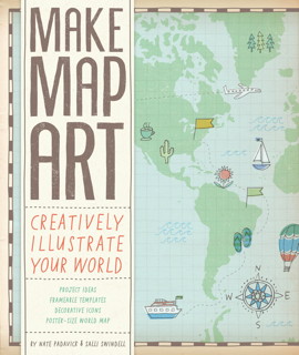
Book cover: Map Art LabBook cover: Make Map Art

Two books (well, one is sort of book-ish) related to map art and personal cartography to tell you about:

  1. Map Art Lab: 52 Exciting Art Explorations in Mapmaking, Imagination, and Travel by Jill K. Berry and Linden McNeilly (Quarry Books, 5/14): “map-related activities set into weekly exercises, beginning with legends and lines, moving through types and styles, and then creating personalized maps that allow you to journey to new worlds.”
  2. Make Map Art: Creatively Illustrate Your World by Nate Padavick and Salli Swindell (Chronicle Books, 2/14), a “creative toolkit” that includes a booklet and 30 pull-out sheets to use as templates for personal mapmaking projects.

Jill Kelly’s previous work, Personal Geographies: Explorations in Mixed-Media Mapmaking, was reviewed here in 2011 [Fuck Yeah Cartography].