Astronomer and lunar cartographer Antonín Rükl, author of the authoritative Atlas of the Moon among other works, died on 12 July in his home in Prague at the age of 83, Sky and Telescope reports.
Tag: Moon
The Chang’E-1 Topographic Atlas of the Moon
 Universe Today has a review of The Chang’E-1 Topographic Atlas of the Moon (Springer, February 2016) a book of lunar maps based on digital elevation model data and stereo imagery from the CNSA’s Chang’e-1 spacecraft. (The first edition was published in Chinese and English in 2012.)
New Moon Maps
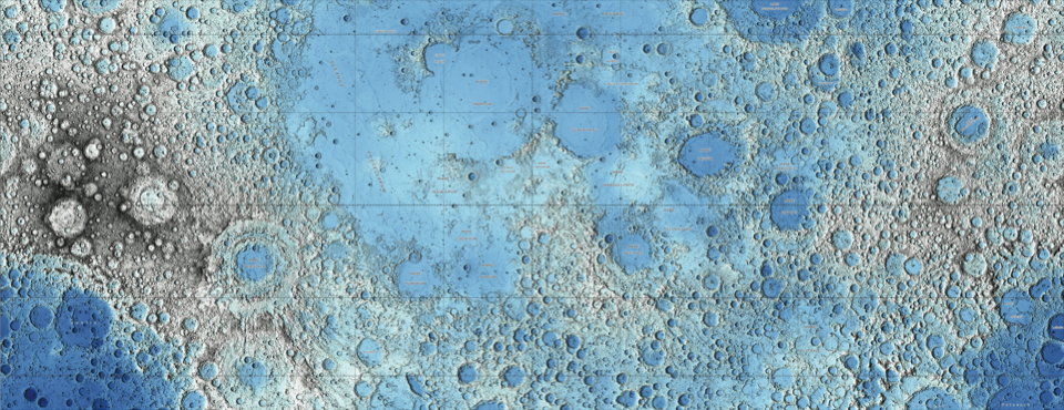
Two stunning maps of the Moon have been released by the USGS, both based on data collected by the Lunar Reconnaissance Orbiter: one an image mosaic assembled from visual imagery, the other (above) a colour-coded topographical map derived from laser altimeter data. Via io9.
Moon and Comet Maps
Maps of planets, moons and other objects in our solar system always get me excited, though truth be told they were among the less popular posts on my old Map Room blog. Here are a couple of rather colourful recent examples:
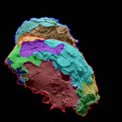
- Above left, a preliminary map of Comet 67P/Churyumov-Gerasimenko, the subject of a visit by the Rosetta mission, that colour-codes several morphologically different regions.
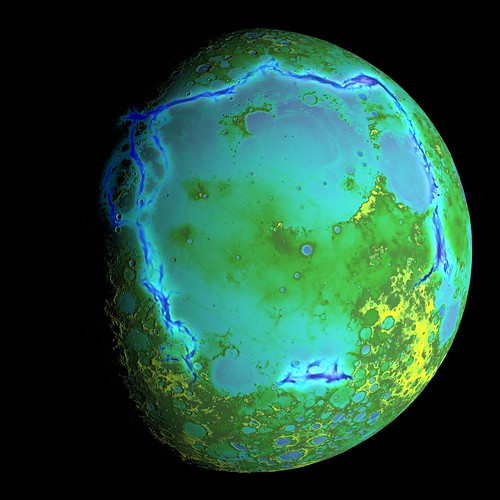
- Above right, a topographical map of the Moon’s surface based on laser altimeter data from the Lunar Reconnaissance Orbiter.
Image credits: ESA/Rosetta/MPS for OSIRIS Team MPS/
Lunar Gravity Map
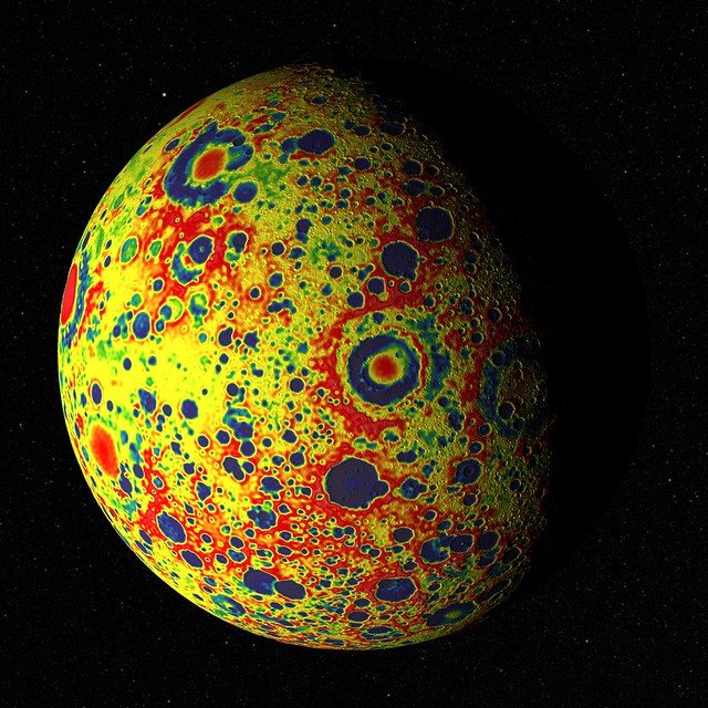
NASA has released a free-air gravity map of the Moon: “If the Moon were a perfectly smooth sphere of uniform density, the gravity map would be a single, featureless color, indicating that the force of gravity at a given elevation was the same everywhere. But like other rocky bodies in the solar system, including Earth, the Moon has both a bumpy surface and a lumpy interior. … The free-air gravity map shows deviations from the mean, the gravity that a cueball Moon would have.” Gravity data comes from the GRAIL mission, with the digital elevation model provided by the Lunar Reconnaissance Orbiter laser altimeter. Image credit: NASA’s Goddard Goddard Space Flight Center Scientific Visualization Studio.
New Moon Globe Released
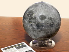 Calling it “the first entirely new globe of the lunar surface in more than 40 years,” Sky and Telescope has announced a new Moon globe based on Lunar Reconnaissance Orbiter imagery. Replogle’s Moon globe has been the standard for decades, but it’s based on 1960s-era charts and, as I said in my review three years ago, doesn’t have a lot of contrast and doesn’t look much like the Moon. Mind you, the new globe costs almost twice as much.
More Moon Maps
Chinese scientists have released a high-resolution map of the Moon based on images from the Chang’e 2 spacecraft; the maps are at a resolution of seven metres (MoonViews, Universe Today). Phil Stooke compares the Chang’e 2 images with those from the Lunar Reconnaissance Orbiter Camera (LROC). Meanwhile, and speaking of the LROC, Jeffrey Ambroziak is making 3D anaglyph maps based on LROC data; he’s launched a Kickstarter campaign to create a 3D digital map of the entire Moon.
A New Lunar Topo Map
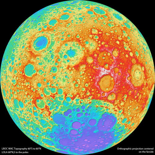
A new topographic map of the Moon from the Lunar Reconnaissance Orbiter: “Today the LROC team releases Version 1 of the Wide Angle Camera (WAC) topographic map of the Moon. This amazing map shows you the ups and downs over nearly the entire Moon, at a scale of 100 meters across the surface, and 20 meters or better vertically.” Late last year lunar topo maps were released that were based on laser altimeter data; presumably the WAC data, based on stereo observations, is better. Image credit: NASA/

