The Only Fantasy World Map You’ll Ever Need by Jake Manley isn’t the first map of its kind that I’ve seen (see also the map in Diana Wynne Jones’s Tough Guide to Fantasyland); still, it’s clear that fantasy maps are a proven vehicle to satirize and critique the genre. (And be satirized and critiqued.) [John Scalzi]
Month: April 2014
Importing CanVec Data into OpenStreetMap
Last February I imported CanVec data into OpenStreetMap for the first time.
CanVec is a dataset produced by the federal Department of Natural Resources. It’s been made available to use in OpenStreetMap: users have to download the data for a given area and import it into the OSM database.
It’s a great resource, but I’ve been giving CanVec the side eye for years, largely because OSM users had been bungling the imports and not cleaning up the mess they made. To some extent it also encouraged a certain amount of laziness from Canadian OSM users: why go to the trouble of tracing imagery or going out with a GPS if you could just download the data from the Natural Resources FTP server?
That said, most of my complaints were from a few years ago; it’s been a while since I’ve seen a CanVec-induced mess in the database (for example, doubled or even tripled roads imported on top of one another). And between existing imports and the improved Bing aerial and satellite imagery coverage, there weren’t many places I was aware of that I could, you know, try a CanVec import for myself.
Except one.
Art and Personal Mapmaking
Two books (well, one is sort of book-ish) related to map art and personal cartography to tell you about:
- Map Art Lab: 52 Exciting Art Explorations in Mapmaking, Imagination, and Travel by Jill K. Berry and Linden McNeilly (Quarry Books, 5/14): “map-related activities set into weekly exercises, beginning with legends and lines, moving through types and styles, and then creating personalized maps that allow you to journey to new worlds.”
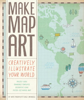
- Make Map Art: Creatively Illustrate Your World by Nate Padavick and Salli Swindell (Chronicle Books, 2/14), a “creative toolkit” that includes a booklet and 30 pull-out sheets to use as templates for personal mapmaking projects.
Jill Kelly’s previous work, Personal Geographies: Explorations in Mixed-Media Mapmaking, was reviewed here in 2011 [Fuck Yeah Cartography].
The Geology of ‘Game of Thrones’

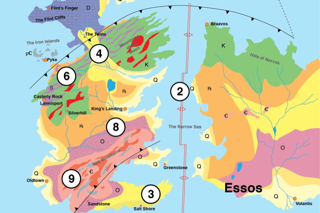
In The Geology of Game of Thrones, a group of geologists has created a geologic map of Westeros and Essos, as well as an invented geologic history of the planet on which George R. R. Martin’s epic takes place. Via io9.
This isn’t the first time a fantasy world has been looked at through a geologic lens. Karen Wynn Fonstad’s Atlas of Middle-earth took a reasonably rigorous look at the landforms of Middle-earth. And Antony Swithin—a geologist in real life under his real name, William Sarjeant—created a geologic map of his invented island of Rockall (see previous entry).
Previously: Review: The Lands of Ice and Fire.


