Switzerland is updating its official map series. The new maps are digitally based and use new fonts, symbols and colours—railways, for example, are now in red. They replace the 1:25,000 series that dates back to the 1950s; all 247 sheets should be replaced by 2019. You can compare the old and new map designs on this interactive map (screencap above). [via]
Tag: topo maps
The Atlantic on Tom Harrison
The Atlantic interviews Tom Harrison, an independent cartographer based in San Rafael, California who produces maps of California parks and wilderness areas for hikers and mountain bikers, about his individualistic mapmaking process. (Tom Harrison Maps at Amazon.) [via]
The Ordnance Survey Maps Mars
The Ordnance Survey has created a map of Mars. “The one-off Ordnance Survey Mars map, created using NASA open data and made to a 1:4,000,000 scale, is made to see if our style of mapping has potential for future Mars missions.” It looks very much like a topographic map of Mars might; the reduced version is a bit more screen-friendly.
Copper Plates Used to Make Topo Maps on Display
The Michigan State University Map Library now has on display three copper plates used to make the 1912 USGS topographic map of the Lansing, Michigan area. “From the 1880s to the 1950s, the U.S. Geological Survey used engraved copper plates in the process of printing topographic and geographic quadrangle maps. Copper alloy engraving plates were inscribed with a mirror image of the points, contour lines, symbols, and text that constitute a topographic map. Each plate was inscribed with details for a single color of ink.” [via]
New Moon Maps
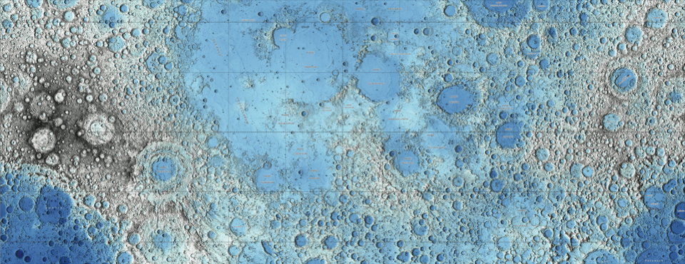
Two stunning maps of the Moon have been released by the USGS, both based on data collected by the Lunar Reconnaissance Orbiter: one an image mosaic assembled from visual imagery, the other (above) a colour-coded topographical map derived from laser altimeter data. Via io9.


