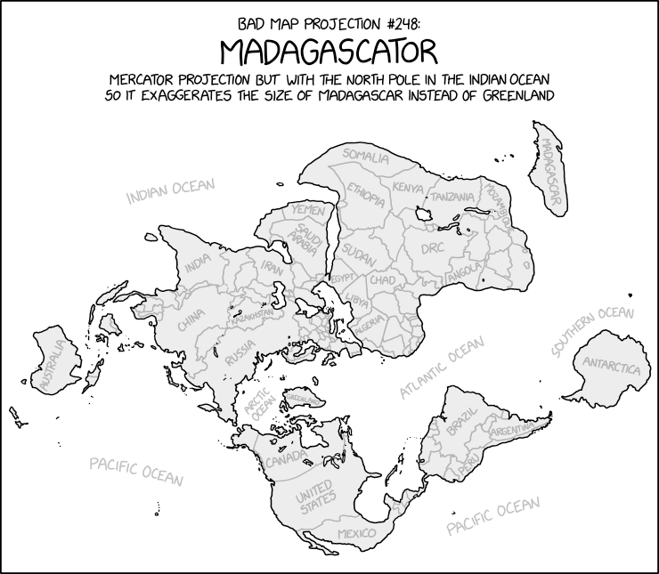
Uncharacteristically for xkcd’s Bad Map Projection series, the Madagascator is actually totally legitimate as a projection. Not that it’s any less mischievous, mind.
Update, 3 May: Turns out there was more to this xkcd cartoon. See Mercator: Extreme.
Randall Munroe’s map projection humour is increasingly on point, as last Friday’s xkcd demonstrates. (The mouseover text is even better: “There are two rules on this ship: Never gaze back into the projection abyss, and never touch the red button labeled DYMAXION.”)
Richard Peter Johnson has been posting quizzes on Reddit where the shapes of countries and U.S. states are flipped, rotated and/or inverted and you’re challenged to identify them. It’s actually harder than you might think—especially when they’re inverted or mirror-flipped—and messes with your perception in the way that, say, upside-down world maps do.
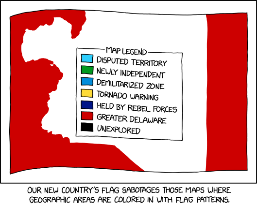
Randall Munroe, “Flag Map Sabotage,” xkcd, 13 Oct 2021.
Maps where countries are coloured in with flag patterns: I’ve seen a lot of them around, especially on Reddit, but I haven’t necessarily liked them; xkcd’s comic from last Wednesday goes one step further in that it offers a way to hack them.
Randall Munroe, “Bad Map Projection: The Greenland Special,” xkcd, 14 July 2021
At some point, xkcd cartoonist Randall Munroe is going to put out a book focusing on his map-related cartoons, isn’t he. The latest in his “Bad Map Projection” series (previously: All South Americas, Time Zones, Liquid Resize) is The Greenland Special, an equal-area projection except for Greenland, which uses Mercator. And I thought he was messing with us before.
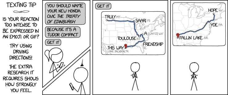
Randall Munroe, “Contiguous 41 States.” xkcd, 4 Dec 2020.
The thing about this xkcd cartoon is that at first glance it’s entirely plausible: Randall has done violence to state boundaries while maintaining the rough overall shape of the lower 48. He’s snipped out seven states without anyone noticing if they don’t look too closely.
A map of Scarfolk has been announced. For those blissfully unaware, Scarfolk is Richard Littler’s fictional, satirical English town locked in a 1970s-era dystopia. Littler has been producing deeply creepy examples of graphic design—public information posters, mainly—purporting to emanate from Scarfolk authorities on his blog and in two books so far. This “road and leisure map for uninvited tourists,” which apparently comes with a postcard and visa, costs £12. As they say in Scarfolk: For more information please reread. [via]
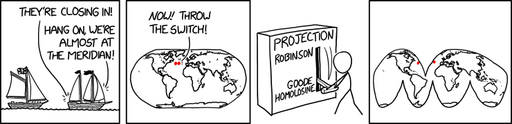
Saturday Morning Breakfast Cereal’s take on the Mercator projection is … not what you’d expect. The punch line is similar to Christopher Rowe’s short story, “Another Word for Map Is Faith”: if you can’t make the map conform to the territory, make the territory conform to the map. Since we’re dealing with the Mercator projection, this requires some … escalation.
Randall Munroe, “Bad Map Projection: South America.” xkcd, 17 Jan 2020.
xkcd is back with another bad map projection: in this one, it’s all South Americas. The alt-text: “The projection does a good job preserving both distance and azimuth, at the cost of really exaggerating how many South Americas there are.”
If you’re not familiar with that poem, here’s the key passage:
He had bought a large map representing the sea, Without the least vestige of land:
And the crew were much pleased when they found it to be A map they could all understand.
“What’s the good of Mercator’s North Poles and Equators, Tropics, Zones, and Meridian Lines?”
So the Bellman would cry and the crew would reply “They are merely conventional signs!
“Other maps are such shapes, with their islands and capes! But we’ve got our brave Captain to thank:”
(So the crew would protest) “that he’s bought us the best— A perfect and absolute blank!”
It’s not like xkcd has a monopoly on comics about maps. Last week, Zach Weinersmith’s Saturday Morning Breakfast Cereal web comic posted a comic about alternative non-spherical Earth theories: everything from a hollow Earth to, well, stranger variations—including a slightly lumpy oblate spheroid Earth, which I frankly find hard to believe in.