New Maps of Ceres and Pluto

Global Map of Pluto

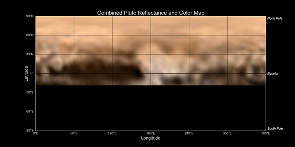
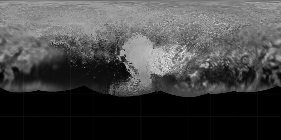
As I predicted, a new global map of Pluto has been released that incorporates the imagery that has been downlinked so far from the New Horizons flyby: with gridlines, without gridlines. If nothing else, the equatorial projection demonstrates how much of Pluto’s surface was not seen during the very brief encounter. From what I understand, imagery downlinks will resume in September and carry on for another year, so this map will almost certainly see many more updates.

Meanwhile, Ceres also has some new maps.

Continue reading “New Maps of Ceres and Pluto”

Three Books on WWII Maps

  1. Great Escapes: The Story of MI9’s Second World War Escape and Evasion Maps by Barbara Bond (Times Books, October 2015): history of the escape maps produced for prisoners of war.
  2. Mapping the Second World War by Peter Chasseaud (Collins, October 2015): a collection of historical maps; follow-up to Chasseaud’s 2013 book Mapping the First World War.
  3. Mapping the Second World War: The Key Battles of the European Theatre from Above by Michael Swift and Michael Sharpe (Conway Maritime Press, November 2014).

Previously: Two Books on WWI Maps.

History of Cartography Project’s Sixth Volume Now Out

History of Cartography Volume 6 (book covers)

The sixth volume of the massive History of Cartography Project, Cartography in the Twentieth Century, is now available. Edited by Mark Monmonier, it takes two physical volumes and nearly two thousand pages to cover mapmaking in the twentieth century—and lists for an eye-popping $500 (U.S.), though it’s a bit cheaper on Amazon.

Volumes one through three are available for free download. Volumes four and five, covering the European Enlightenment and the nineteenth century, respectively, are still in development.

Previously: History of Cartography Project Co-Founder Dies.

Mapcodes

The New Yorker‘s Elements blog has a piece about mapcodes. These are short alphanumeric codes assigned to every location on the planet, with short codes reserved for areas of high population density. It’s meant to be a substitute for latitude and longitude, and aimed at parts of the world where there are no formal addresses (which makes directions somewhat interesting): give someone a mapcode, and you’re giving them a very precise location.

The Peace Tower in Ottawa, for example, has an Ontario mapcode of 09W.YK (mapcodes exist within country and state/provincial contexts).
The main problem, as I see it, is that while the Mapcode Foundation is trying to make mapcodes a standard, it still relies on data tables to produce the code, which is to say that there’s some computational overhead. Whereas something like Universal Transverse Mercator coordinates can be derived from topo maps (which have UTM grids on them).

The Best Map of Pluto Ever (Until Some Time Later This Month)

New Horizons Map of Pluto
NASA-JHUAPL-SWRI

The New Horizons spacecraft’s rendezvous with Pluto is next week, folks, but we’re already getting better views of our favourite dwarf planet than we’ve ever had before. NASA has assembled images taken between June 27 and July 3 into the above map, which despite its relatively low resolution shows some intriguing surface features: the so-called “whale” and “donut.” (Of course, low resolution is relative: this is already much better than the Hubble-based maps of Pluto released in 2005 and 2010.)